
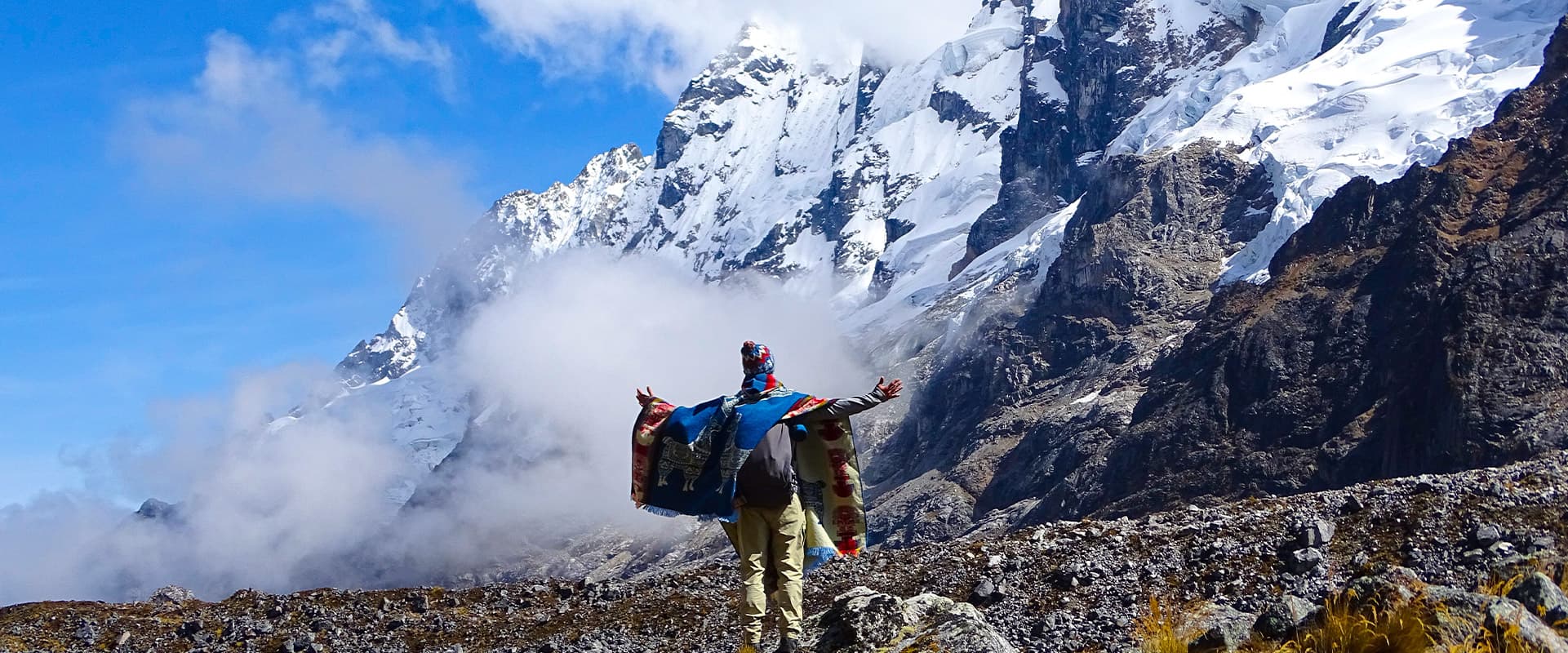
The Salkantay Trek is not a route with just one type of landscape. It is five days of continuous transformation: from the frozen high plateau with glaciers to the subtropical zone with coffee crops, from the silence of the high mountains to the sound of the river at the bottom of the canyon, from the austerity of the puna to the lushness of the lower valleys. Few trekking routes in the world compress that much variety into so little time and with such intensity.
This guide describes the Salkantay route stage by stage, with attention to the specific landscape of each day, the places of interest that appear along the way, and what the eye can expect to find on each stretch. It is not a guide to difficulty or logistics, but rather a visual and geographic journey through the five days that make up one of the most spectacular treks in Peru.
Starting point: Cusco and the road to Soraypampa
The journey does not begin at kilometer 82 of any railway line or at the gate of any archaeological site. It begins in Cusco, very early on the morning of the first day, with a vehicle transfer of approximately three hours southwest of the city along the road that leads to Abancay. The journey itself already has its own scenic value: the route leaves the city, crosses the open high plateau of the surrounding area, and begins to climb toward the valleys that surround the Salkantay massif.
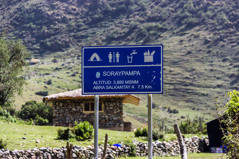
The first arrival point is the village of Mollepata, at about 2,800 meters above sea level, where some itineraries include breakfast before continuing by vehicle along a dirt road that climbs for another hour to the Soraypampa base camp, at 3,900 meters. The change in landscape during that final hour of ascent is the first preview of what is to come: the vegetation gradually disappears, the slopes become barer, and the sky opens up as the altitude leaves the last trees behind.
Soraypampa is an open valley of ichu grasslands with the snowcapped Salkantay visible in the distance from the moment of arrival. On clear days, the first time the snowy summit is seen from base camp is enough to understand why the trek bears that name. The camp is set with the mountain as a backdrop, and that image stays with the group throughout the entire first night.
Day 1: Humantay Lake and the first encounter with the glacier
The first hike of the Salkantay Trek has a destination that for many participants turns out to be the most photogenic of all: Humantay Lake, at 4,200 meters above sea level, in a glacial cirque directly below the north face of Salkantay. The waters of the lake have that intense turquoise color produced by suspended glacial rock flour, and on windless days the surface reflects the snowy summit with a clarity that makes it hard to tell where the mountain ends and where its reflection begins.
The climb from Soraypampa takes between 45 minutes and one hour along a dirt and rock trail that ascends in zigzags up the slope of the glacial cirque. As you go up, the lake gradually appears above the edge of the slope: first the color of the water, then the full extent of the surface, and finally the complete panorama with the glacier in the background. That first moment of seeing the lake from the rim is one of the memories most often recalled by people who have done the route.
The Humantay setting is not just the lake. The rocky walls of the glacial cirque that surround it, covered with lichens and with small meltwater waterfalls falling from the flanks, create a reduced-scale scene within the vast high-mountain landscape. The wildflowers that grow among the rocks at that altitude have a toughness and delicacy that do not seem to match the harsh surroundings around them.
The descent back to Soraypampa closes the day with enough time to rest before nightfall, which at base camp can be significantly cold regardless of the season.
Day 2: Salkantay Pass and the descent into the other side of the world
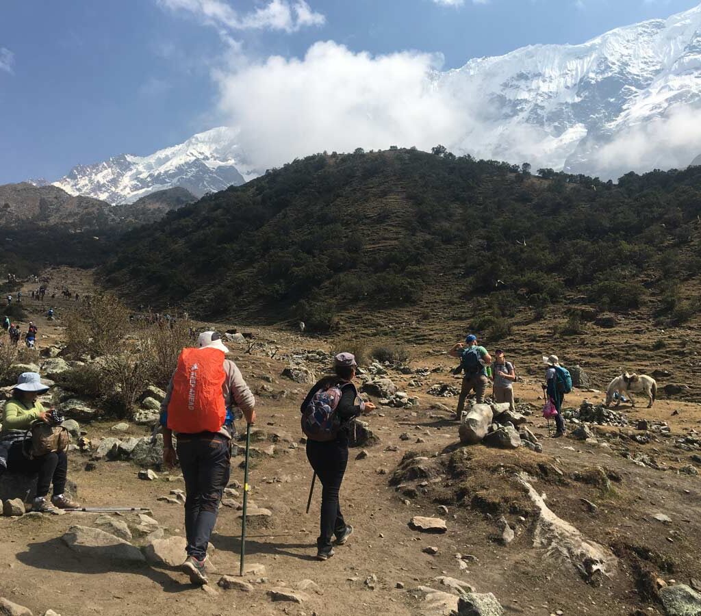
The second day begins in darkness. Departure from the Soraypampa camp takes place before sunrise, with headlamps on and the lowest temperatures of the entire route. The immediate objective is Salkantay Pass, the mountain pass at 4,630 meters that is the highest point of the trek and the place that gives it its name and character.
During the first hour of ascent, with the sky still dark, Salkantay gradually takes shape as a black silhouette against the stars. As light begins to appear on the horizon, the mountain takes on color: first bluish gray, then pinkish white when the first rays touch the glacier. That sunrise over the north face of Salkantay, seen from the trail climbing to the pass, is possibly the most memorable image of the five days.
At Salkantay Pass, the landscape is one of absolute austerity. Rock, ice, wind, and sky. The north glacier of the snowcapped mountain lies less than a kilometer away in a straight line. The glacial moraines on the sides of the pass are deposits of material left behind by the ice over centuries of movement. On clear days, snowcapped peaks can be seen in every direction from the top of the pass: Humantay to the north, Tucarhuay to the east, and the Vilcabamba range stretching westward.
The descent from the pass is where the trek reveals its most transformative character. In just a few hours, the landscape changes radically and continuously. First come the high-altitude grasslands with meltwater streams. Then the first shrubs and rock outcrops covered with moss. Farther down, the first low trees appear. Toward the end of the descent, when the trail reaches the valleys of Chaullay, the vegetation is already completely different from that of the departure camp: ferns, broad-leaf plants, bromeliads, and an atmospheric humidity that contrasts with the dryness of the pass. The temperature has risen by more than ten degrees on the same day.
The second day’s camp is set in this transition environment, with the sound of the river replacing the silence of the high mountains and the sky covered by the first low clouds that at this altitude are already part of the everyday landscape.
Day 3: The coffee valleys and the arrival in the lower tropics
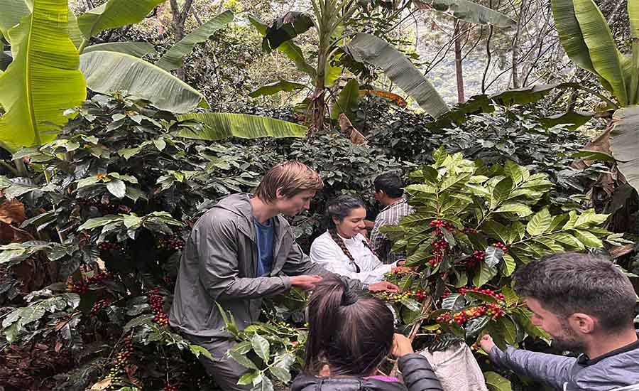
The third day consolidates the transformation that began during the second day’s descent. The trail moves through the valleys of La Playa and Santa Teresa at altitudes ranging between 1,800 and 2,500 meters, crossing one of the most unexpected environments of the entire route for those arriving from the high mountains: coffee plantations.
The coffee plantations in the Santa Teresa area are among the most recognized in the Cusco region for the quality of the beans produced at that intermediate altitude between the highlands and the jungle. The trail passes among coffee plants in full production during much of the third day, with red or green cherries visible among the leaves depending on the season and the smell of damp soil and vegetation filling the air. Alongside coffee appear cacao, cherimoya, passion fruit, and other tropical fruits that can be tasted fresh at the stands in the villages along the way.
The landscape of this third day has a different scale from that of the previous two. These are no longer panoramic views of the high mountains with a horizon stretching for hundreds of kilometers. It is a landscape of proximity: the plants along the sides of the trail, the river that can be heard but not always seen, the canyon walls that in some sections close in enough to reduce the visible sky to a strip. It is a more intimate and more detailed environment than that of the previous days.
Arrival in Santa Teresa at the end of the day coincides with the possibility of visiting the Cocalmayo hot springs, where naturally hot water at around 29 degrees forms pools next to the river. After two days of high mountains and steep descent, that moment is the perfect counterpoint to the accumulated effort.
Day 4: The trail along the tracks and the entrance to the Urubamba canyon
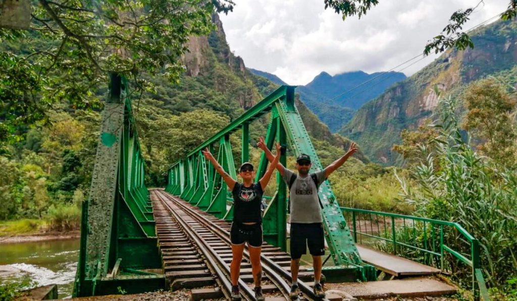
The fourth day is the most contemplative of the route. The trail follows the bank of the Urubamba River and the train tracks toward Aguas Calientes along a stretch of between 10 and 15 kilometers with no significant elevation changes. The landscape is completely different from any of the previous days: the canyon walls enclosing the river are vertical and covered in dense vegetation, the sound of the water is constant, and the passing train, when it appears, adds an unexpectedly industrial element to an environment that until that point had been purely natural.
The stretch along the tracks has its own kind of beauty, more austere and less spectacular than that of the previous days, but one that works as a necessary pause between the effort of the mountains and the excitement of the fifth day. The wooden bridges over the side streams, the small waterfalls falling from the canyon walls directly onto the path, and the groups of butterflies that appear in the sunniest sections of the trail are the details that define this day.
Some itinerary variants include on this day a visit to the Machu Picchu hanging bridge, which stands over the river a short distance from the archaeological site and offers a completely different perspective of the citadel’s surroundings from below. Arrival in Aguas Calientes at the end of the afternoon closes the trekking portion of the route and opens the final day.
Day 5: Machu Picchu from the perspective of someone who arrived on foot
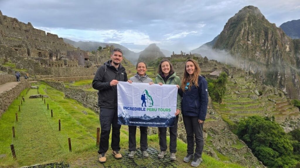
The fifth day is the visit to Machu Picchu. Access from Aguas Calientes is by bus in approximately 25 minutes along the road that climbs in zigzags up the mountainside. From the site entrance, the main circuit of the citadel leads through the agricultural terraces, the Temple of the Sun, the Main Plaza, the Intihuatana, and the residential sectors on a route of two to four hours depending on the time available.
The citadel of Machu Picchu seen from within has a scale that photographs do not accurately convey. The terraces descending the southern slope of the mountain, Huayna Picchu rising above the complex to the north, and the void of the Urubamba Valley hundreds of meters below on every side create a sensation of being literally suspended between mountain and sky that is difficult to describe and can only be understood by being there.
For someone arriving on the fifth day of the Salkantay Trek, that vision has an added layer of meaning. It is not the first time they have seen a photo of Machu Picchu. But it is the first time they see it with a body that has crossed the Salkantay glacier, descended fifteen hundred meters in a single day, and walked along the Urubamba to get here. That accumulation of physical experience makes the visit to the site something qualitatively different from that of someone who rides directly up by bus from Aguas Calientes without having walked at all beforehand.
The return to Cusco is by train from Aguas Calientes that same afternoon, with the landscape of the Sacred Valley passing by the window in the opposite direction from the first day. The full journey is over, but the landscape of Salkantay Pass with the glacier at sunrise, the color of Humantay Lake, and the smell of the coffee plantations on the third day travel back in the luggage in a way that takes up no space but does not disappear either.
Route variations: what changes depending on the itinerary
The basic route described in this guide corresponds to the standard five-day camping version. There are variations that modify some aspects of the journey without changing its essential character.
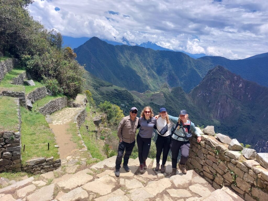
The four-day version compresses the third and fourth days into a single one, with longer days that experienced guides do not recommend because they reduce the time available to enjoy the landscape of the lower valleys. The five-day version with lodging instead of camping replaces tents with accommodations in the villages along the way, with greater nighttime comfort but less immersion in the natural environment. The variant with a visit to Inti Punku adds on the fifth day the hike to the Sun Gate before descending to the main entrance of Machu Picchu, with an extension of about two additional hours that is worth the effort if the group’s physical condition allows it.
In all variants, the second day with the crossing of Salkantay Pass remains the same: it continues to be the heart of the journey and the moment that defines what the trek is in its entirety.
Do you want to experience the Salkantay Trek with guides who know every detail of the route and the field equipment each stage requires? At Incredible Peru Tours, we operate the Salkantay in its different variations and adapt the itinerary to the preferences and conditions of each group.


