
Traveling from Arequipa to Colca is not a simple jump from the city to a viewpoint. In just a few hours, the road climbs from 2,335 meters to highland plains above 4,000 meters, reaches almost 4,910 meters at Patapampa, and then descends into the valley again. Everything changes outside the window: streets, dry terrain, volcanoes, plains, wetlands, vicuñas, and later terraces and villages. This stretch is part of the journey, not time you simply have to endure.
What the route is like
The road leaves Arequipa and heads toward the highlands of Caylloma. Chivay, the usual gateway to the valley, sits at about 3,635 meters. The road does not climb directly from one elevation to the other. Before descending to Chivay, it crosses much higher areas. Looking only at Chivay’s elevation gives you only part of the picture.
Leaving Arequipa
The first few kilometers still follow the dry surroundings of the White City. Houses become more scattered, the road opens into wider spaces, and the volcanoes stop being part of the urban background. The agricultural terraces of Colca have not appeared yet. First comes the climb from the Arequipa valley into the highlands.
Salinas and Aguada Blanca National Reserve
Much of the route enters this reserve, which covers more than 366,000 hectares between Arequipa and Moquegua: vicuñas, tarucas, high altitude birds, lakes, wetlands, and open plains. There is less human development, lower vegetation, and longer distances. The sky takes up more of the view. The volcanoes are no longer just silhouettes behind buildings.
Pampa Cañahuas
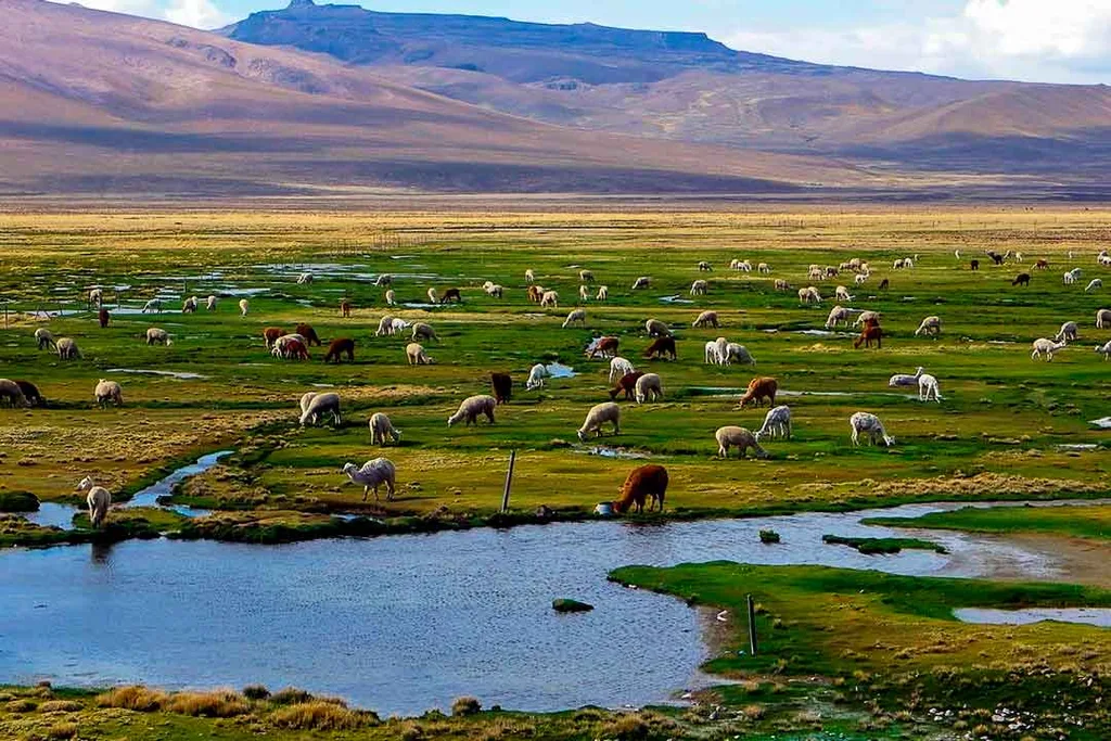
This is where the highland landscape becomes clear. You may see vicuñas. They are wild animals. They are not placed along the roadside, and the distance from which you see them changes every day. The open plains reveal the size of the reserve and how quickly the city has disappeared behind you.
High altitude wetlands
Higher up, water creates wetlands in terrain that looks dry from a distance. They support wildlife and pastoral activity. From the bus you can see camelids, patches of wet ground, and mountains that seem close even when there are still many kilometers to go.
The high altitude comes before Chivay
Anyone who thinks the elevation begins at the town may be surprised. The road rises above 4,000 meters long before reaching Chivay. Someone who slept in Arequipa at 2,335 meters can be more than 2,000 meters higher just a few hours later. Some people get out and walk without a problem. Others feel every incline. At high altitude stops, take your time: there is less oxygen than in the city.
Patapampa
The Patapampa Viewpoint, also known as the Andes Viewpoint, is listed by Mincetur at 4,910 meters. It is one of the highest accessible points on the circuit. The difference from Arequipa is more than 2,500 meters. A clear sky does not change that elevation.
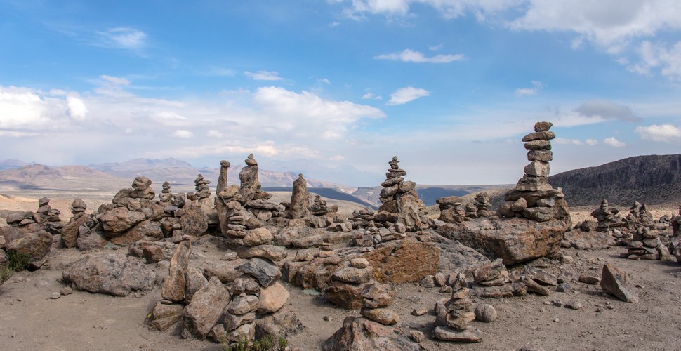
When visibility is good, you can identify Mismi, Chachani, Misti, Sabancaya, Ampato, Ubinas, and Hualca Hualca. There are often apachetas as well. You do not need to stay long. Up to this point, the road has been climbing. Afterward, a different stretch begins.
From Patapampa to Chivay
The road descends more than 1,200 meters. The highland plains give way to cultivated land: fields, roads, and houses. The valley does not appear all at once. You begin to recognize it when crops, terraces, and slopes shaped over centuries return to the landscape.
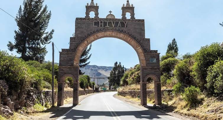
Chivay
At about 3,635 meters, Chivay concentrates services and access to the valley. The sequence is this: Arequipa 2,335 m, Patapampa 4,910 m, Chivay 3,635 m. It is not a continuous climb toward the canyon. It is a high point followed by a descent.
Distance
The official inventory lists about 151 kilometers between the Arequipa bus terminal and Chivay, with a travel time of around three hours by public bus. A tour takes longer because the road itself is part of the visit: Pampa Cañahuas, wildlife, Patapampa. Do not compare a vehicle traveling directly from one point to another with an excursion that makes stops.
Chivay is not the Cruz del Cóndor
Reaching the town does not mean you have reached the most photographed viewpoint. There are still villages, terraces, churches, and other viewpoints ahead. The map may already say Colca Valley, but there are still kilometers to go.
After Chivay
The highland plains stop dominating the landscape. Agricultural terraces cover the slopes, green or dry depending on the month. The road leaves the open plain and begins following the shape of the valley.
From the open valley to the deep canyon
Toward Cabanaconde, the slopes become steeper, the walls grow more abrupt, and the river lies farther below. The horizontal landscape of the highlands comes to an end. The scenery is now measured in depth. In a single day, you travel from high altitude plains to a canyon.
Cruz del Cóndor
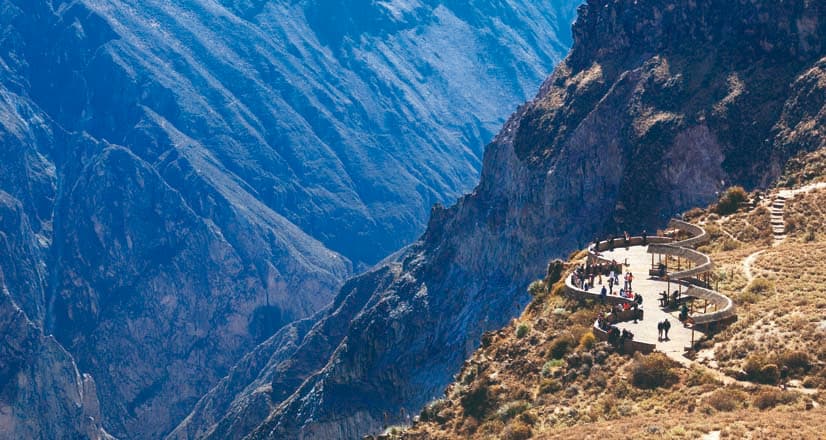
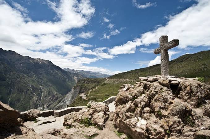
The viewpoint is about 42 kilometers from Chivay and sits at approximately 3,780 meters. You can see the canyon walls and, when conditions are favorable, the condor. The vertical drop to the river exceeds 1,250 meters in this area, according to Mincetur. After Patapampa, the contrast is clear: there, the horizon; here, the depth.
Four elevations
- Arequipa: 2,335 m
- Chivay: 3,635 m
- Patapampa: 4,910 m
- Cruz del Cóndor: 3,780 m
- The order explains the journey: you leave, climb higher than Chivay, and then descend into the valley.
The landscape by section
- Arequipa: city, dry landscape, volcanoes in the background.
- Highlands and reserve: plains, grasslands, wetlands, high altitude wildlife.
- Patapampa: more mineral terrain, mountain range, above 4,000 meters.
- Descent to Chivay: crops, houses, agricultural terraces.
- Valley and canyon: deep terrain leading to the major viewpoints.
That explains more than simply saying there are “a few hours on the road.”
Stay overnight in Colca or return the same day?
This is about the route, not choosing a hotel. Going there and back in one day means many hours sitting in a vehicle and less time at the stops. One night separates the climb from Arequipa from the section toward the viewpoints and removes the rush to make the return trip. If the goal is to understand the landscape and not simply check Cruz del Cóndor off a list, the extra time matters.
Clothing and altitude
Do not pack only for Arequipa’s weather. At Patapampa, close to 4,900 meters, it can be cold even if the morning in the city was mild. Dress in layers. Bring water, sunscreen, and sunglasses: the elevation does not reduce the strength of the sun. At high altitude stops, walk slowly.
Best time to visit
Colca can be visited all year. Mincetur recommends May through November for outdoor activities because this is the drier season. During the rainy season, the valley becomes greener and high altitude viewpoints can be covered by clouds. The road remains the same. The colors do not.
On a journey through southern Peru
On Peru 13 Days, this section takes you directly into the high Andes after the coast and the city. Simply leaving a hotel in Arequipa and opening another room in Chivay leaves out the reserve, wildlife, volcanoes, a pass close to 5,000 meters, and the descent into the valley.
What lies between Arequipa and Colca
More than kilometers. You start at 2,335 meters, enter the highlands, see vicuñas, reach 4,910 meters at Patapampa, and descend toward Chivay, villages, agricultural terraces, and the deep cut of the canyon.
Two common mistakes are thinking that Chivay is the highest point and treating the hours on the road as wasted time. Here, the road is also part of the destination.


