2026 Book your spot for the Inca Trail 2026!

Inicio » salkantay » Page 7

There are mountains you see. And there are mountains you feel. Salkantay belongs to the second category. When it first appears as you round a bend in the trail on the second day of the trek, with its hanging glaciers just a few hundred meters away and its 6,271-meter summit dominating a horizon that leaves room for nothing else, most people seeing it for the first time stop without even meaning to. Not because fatigue demands it, but because the landscape calls for that pause.

Salkantay is not just the second-highest mountain in the Cusco region. For the Quechua-speaking communities that have lived at its feet for centuries, it is an Apu, a sacred mountain with its own personality, will, and power over the land around it. That dual nature as both an extraordinary geographic feature and a revered spiritual being is what makes Salkantay more than just a photogenic backdrop. It is a place with a presence that can only be understood by being there.
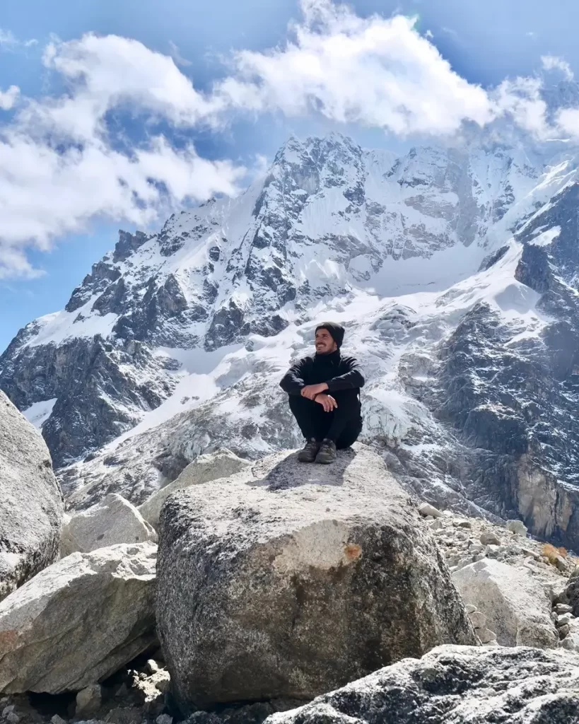
Salkantay Snowy Peak

What Salkantay means and what it represents for andean communities

The name Salkantay comes from Quechua and allows for at least two documented interpretations. The most widespread translates it as “wild mountain” or “untamed mountain,” combining the root salqa, which refers to what is wild, undomesticated, and beyond human control, with the ending that indicates mountain or elevated place. Another interpretation reads it as “the one who rules” or “the sovereign,” referring to the mountain’s dominant role in the geography of the region.

Both translations capture something real about the place. Salkantay is not a gentle or easily accessible mountain in the tourist sense of the word. Its immediate surroundings are among the harshest in the entire Cusco area of influence: winds that change direction without warning, temperatures that can drop dramatically in minutes, active glaciers that occasionally produce icefalls, and terrain that, at the highest pass, concentrates all the risk factors of high Andean mountain travel.

For the communities of Mollepata, Soraypampa, and nearby villages, Salkantay is the tutelary Apu of the area, the guardian that protects the crops, determines the behavior of the weather, and decides the fate of those who work and live in its territory. Every year, during the Corpus Christi period and on other dates in the Andean calendar, offerings to the earth and ritual ceremonies are performed at the mountain’s sacred points as a way of maintaining balance between the human world and the spiritual world represented by the Apu.

The traveler who reaches the Salkantay Pass without knowing that context sees an impressive mountain. The traveler who arrives knowing that for thousands of people that mountain has a name, character, and will sees something completely different.
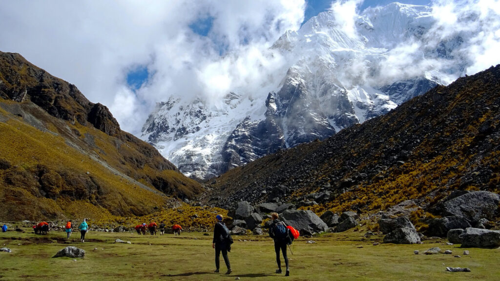
Salkantay Route

Geographic facts: a mountain of great significance

Salkantay reaches 6,271 meters above sea level, making it the second-highest peak in the Cusco region, after Ausangate at 6,384 meters. It is part of the Vilcabamba mountain range, the branch of the Andes that separates the Urubamba Valley from the Amazon basin to the south, and its glacial mass feeds several rivers and lakes in the region, including Humantay Lake, which has become one of the most photographed attractions in the surroundings of Cusco.

The first documented ascent of Salkantay was made in 1952 by a Franco-American expedition led by mountaineer François Chamoux and geographer Hubert Dollfus. Since then, the summit has been reached by teams with technical high-mountain climbing experience, but it is not an accessible objective for the average trekker. Reaching the summit requires glacier equipment, ice-climbing experience, and favorable weather conditions that the area’s climate instability does not easily guarantee.

What is accessible, and truly extraordinary, is the pass that bears its name. The Salkantay Pass, at 4,630 meters above sea level, is the highest point of the trek of the same name and the place from which the mountain can be seen in all its magnitude from the ideal distance. From that pass, Salkantay’s northern glacier is less than a kilometer away in a straight line, and on clear days the contrast between dark rock, bluish ice, and high-mountain sky creates a color combination that no photo filter can improve.

Humantay Lake: the mirror of Salkantay

At around 4,200 meters in altitude, in a glacial cirque at the foot of Salkantay, lies Humantay Lake. Its waters have that intense turquoise color created by suspended glacial rock flour, and on windless days its surface reflects the mountain so perfectly that the lake becomes a flawless mirror of the summit.

The lake is accessible on a day trip from Cusco or as a stop on the first day of the Salkantay Trek. The hike from the Soraypampa base camp to the shore takes between 45 minutes and an hour of moderate uphill walking. It is not technically difficult, but the altitude sets the pace for anyone who has not spent several days acclimatizing in the region. Arriving early in the morning, before the wind disturbs the surface, guarantees the best conditions for photographing the mountain’s reflection in the water.

For local communities, Humantay Lake is not just a tourist attraction but a place of ritual significance. The water flowing down from the glacier is considered purifying, and the lake, as a point of contact between the Apu and human territory, plays a role in the offering ceremonies carried out by paqos, the Andean priests, at the sacred sites around Salkantay.
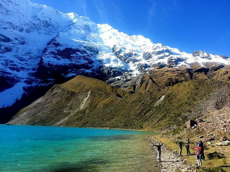
Humantay Lake
Humantay Lake

The Salkantay Trek: experiencing the mountain from the trail

The trek that takes the name of the snowy peak is the five-day route that begins in Mollepata or Soraypampa, crosses the Salkantay Pass on the second day, and descends through the Santa Teresa Valley to Aguas Calientes. It is the route that brings the traveler closest to the glacier for the longest time, and it is also the one that best reveals Salkantay’s dual nature: the absolute cold of the high mountains at the pass and the subtropical warmth of the valley floor just a few hours later.

The second day of the trek, with a nighttime or pre-dawn departure from base camp to cross the pass before wind and clouds close it in, is the moment of greatest physical proximity to the snowy peak. In that stretch, with the headlamp still on and the sky just beginning to brighten, Salkantay appears gradually: first as a dark silhouette against the sky, then as a mass of rock and ice that grows as the trail approaches the pass, and finally as a presence that fills the entire horizon from the top of the pass.

That moment of crossing the pass with the mountain literally towering overhead is what people who have completed the Salkantay Trek mention most often when describing the experience. Not arriving at Machu Picchu, not descending into the subtropical valley, not the Santa Teresa hot springs at the end of the second day. The moment when Salkantay fills the field of vision from the pass that bears its name is what stays with them.
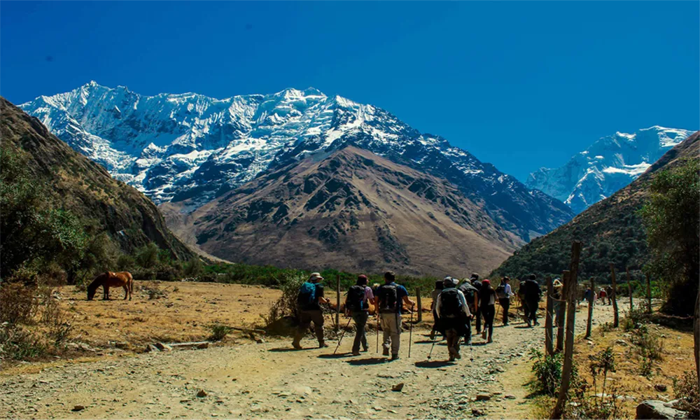
Salkantay Trek
Salkantay Trek

Salkantay compared to the Inca Trail: what each one offers

The comparison between the Salkantay Trek and the Inca Trail is the most common one among travelers looking to reach Machu Picchu on foot and having to choose between the two best-known routes in the region. There is already a specific article on this website that compares them in detail, but in the context of Salkantay as a mountain, it is worth summarizing the central point of that difference.

The Inca Trail is primarily a historical and archaeological experience that takes place in an extraordinary natural setting. The Salkantay Trek is primarily a high-mountain nature experience that ends at an archaeological site. That order of priorities defines everything else: the type of landscape, the traveler profile each route attracts, and the memory each one leaves behind.

For those who come to Peru with Salkantay on their list, the mountain is the destination. Machu Picchu is the reward at the end of the road, but the core of the experience is the 4,630-meter pass, the glacier at almost touching distance, and Humantay Lake reflecting the summit at sunrise. That is what the Inca Trail, for all its historical greatness, cannot offer.

How to reach the Salkantay area from Cusco

The most common starting point for accessing the Salkantay area is the town of Mollepata, about 100 kilometers west of Cusco along the highway heading toward Abancay. From Cusco, the trip by private transportation or shared bus takes between two and a half and three hours, depending on road conditions. From Mollepata, you continue by vehicle to the Soraypampa base camp, at around 3,900 meters above sea level, where the hiking section toward Humantay Lake and the second-day pass begins.

The one-day excursion to Humantay Lake leaves Cusco very early in the morning with a tour agency, arrives in Soraypampa around 8:00 or 9:00 a.m., and allows enough time to hike up to the lake, spend an hour there, and return before sunset. It is the most accessible option for those who want to see Salkantay up close without committing to the full five-day trek.

For the full trek, departure from Cusco is also very early on the first day, and the return from Aguas Calientes is coordinated by train and ground transportation on the fifth day. All intermediate logistics, including campsites, meals, guide, and porters, are managed through the operating agency.

When to go: the mountain in every season

The dry season, from May to October, offers the best conditions for seeing Salkantay in all its clarity. The clear skies of June and July are the most favorable for photographing the summit and crossing the pass with full visibility. Nighttime temperatures at base camp can drop several degrees below freezing even during these months, so proper thermal gear is essential.

The rainy season, from November to March, brings frequent clouds that can cover the summit for days. However, the vegetation in the lower valleys reaches a lushness during those months that the dry season does not produce, and the contrast between the snow-covered mountain and the green valleys is visually more intense. Humantay Lake, fed by seasonal snowmelt, has more water and a richer color during the rainy months than during the rest of the year.

The Salkantay Trek does not have a monthly closure like the Inca Trail in February. It can be done year-round, adjusting expectations for visibility and pass conditions depending on the season.

Do you want to experience Salkantay from the trail with the right preparation and support? At Incredible Peru Tours, we operate the Salkantay Trek in all its variations with guides specialized in the route, full camping equipment, and the flexibility to adapt the pace to the conditions of each group.
Inicio » salkantay » Page 7

In 2008, National Geographic Traveler magazine included the Salkantay Trek on its list of the twenty-five most highly rated treks in the world. It wasn’t a courtesy mention or an inclusion based on proximity to Machu Picchu. It was the recognition of a route with its own identity, with a variety of landscapes and ecosystems that few routes on the planet pack into five days, and with a level of on-the-ground experience that has since grown steadily in reputation among travelers from around the world.

Today the Salkantay Trek is the most popular alternative to the Classic Inca Trail for those who want to reach Machu Picchu on foot without the limited permits of the historic trek. But reducing it to its role as an “alternative” means missing the most interesting part of what it actually is. This guide explains what the Salkantay Trek is in its entirety, where its name comes from, how it was developed as a tourist route, what its main characteristics are, and why those who complete it tend to remember it as something very different from what they expected.

Salkantay Trekking

Where the name comes from and what it means for those who trek it

The trek’s name comes directly from the Salkantay snowcapped peak, the second highest mountain in the Cusco department at 6,271 meters above sea level. In Quechua, salqa refers to the wild, to what belongs to the territory beyond human control, and the full name is commonly translated as “untamed mountain” or “the sovereign.” For the Quechua-speaking communities in the surrounding valleys, Salkantay is an Apu, a sacred mountain with power over the weather, the crops, and the well-being of those who live at its base.

The trek takes that name not only because it passes alongside the snowcapped peak but because the pass that bears its name, the Salkantay Pass at 4,630 meters, is the heart of the route. Crossing that pass with the mountain literally overhead, with glaciers just a few hundred meters away and the high-altitude wind hitting you head-on, is the experience that defines the route and the one that most people who have completed it remember most vividly years later.

History of the Salkantay Trek as a tourist route

The route known today as the Salkantay Trek was not designed by any official agency or inaugurated on a specific date. It took shape gradually during the 1980s and 1990s, when growing restrictions on access to the Inca Trail and the sustained increase in international interest in trekking in the Peruvian Andes led local guides and operators to explore alternative routes that would also reach Machu Picchu.

The trails that make up the trek existed long before tourism arrived in the area. They are herding and communication paths between communities that local populations had used for generations to move between the Urubamba and Apurimac valleys and the Santa Teresa area. What tour operators did was connect those sections into a coherent multi-day route, add camping spots, establish the Salkantay Pass as the central element of the journey, and design the logistics needed for groups of travelers from different parts of the world to complete the route with support.

The inclusion on National Geographic Traveler’s list in 2008 was the turning point that made the Salkantay Trek an internationally recognized destination. Since then, demand has grown steadily and the number of operators offering this route in their catalog has multiplied. Today it is the second most requested trek in the Cusco region, behind only the Classic Inca Trail.

Trekking on the Salkantay route

How many days it takes and what the route looks like

The standard version of the Salkantay Trek lasts five days and covers between 70 and 75 kilometers depending on the specific variant chosen by the operator. There is also a four-day version that compresses some stages, although the most complete and least demanding experience per day is the five-day option.

The route departs from the town of Mollepata or directly from the Soraypampa base camp, which is reached by vehicle from Cusco in a drive of approximately three hours. From Soraypampa, the first day is an acclimatization hike with the option of climbing up to Humantay Lake, the glacial lake at 4,200 meters whose turquoise waters reflect the snowcapped peak on windless days. It is an optional stop, but one that the vast majority of groups include because of the sheer magnitude of the scenery.

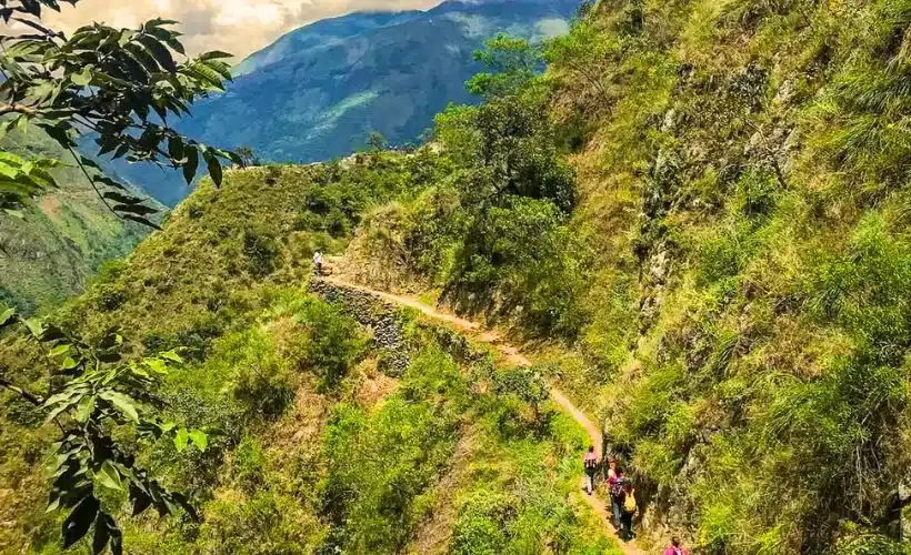
The second day is the most demanding and the most spectacular of the entire route. It begins before dawn with a several-hour hike up to the Salkantay Pass at 4,630 meters, with the snowcapped peak growing progressively on the horizon as the trail gains elevation. Crossing the pass is the climactic moment of the entire trek. From there, the descent toward the Chaullay campsite begins the transition from high glacial mountain terrain to the subtropical vegetation of the lower valleys, one of the most dramatic ecosystem shifts you can experience on foot in such a short time.

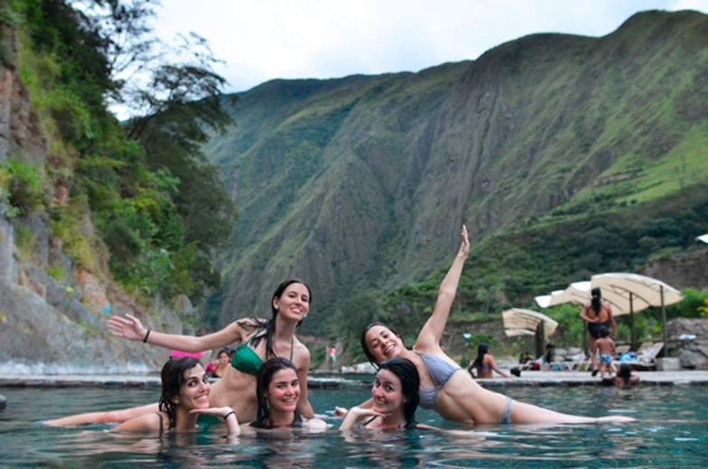
The third and fourth days continue the descent through the coffee, cacao, and tropical fruit growing areas of the Santa Teresa valley, with the temperature rising gradually and the vegetation becoming denser and more lush. The Santa Teresa section includes the chance to relax in the Cocalmayo hot springs at the end of the day, one of the most appreciated moments of the entire route after days of physical effort. The fourth day ends at the hydroelectric station or in Aguas Calientes depending on the variant.

The fifth day is the visit to Machu Picchu, with access by bus from Aguas Calientes or on foot from the hydroelectric station if the itinerary includes it. The return to Cusco is by train from Aguas Calientes that same afternoon.

The ecosystems along the route: why everything changes in five days

One of the most talked-about features of the Salkantay Trek is the variety of ecosystems it crosses in such a short time. This is not a route that stays in one type of landscape for several days: it is a progressive descent from high glacial mountain terrain to the subtropical cloud forest zone, involving radical changes in temperature, vegetation, wildlife, and climate with each passing day.

The first and second days take place in the puna zone, the high Andean mountain ecosystem with ichu grasslands, glacial lakes, condors at the highest points, and temperatures that can drop several degrees below freezing on camp nights. It is an open, stark landscape of a scale that flattens the observer’s sense of perspective.

After crossing the Salkantay Pass, the landscape begins to change noticeably with every hour of descent. First come the high-altitude shrubs, then the ferns, then taller trees, and finally the dense vegetation of the cloud forest with orchids, bromeliads, and a humidity that contrasts radically with the dryness of the pass. By the third day, when the trail reaches the coffee and tropical fruit growing valleys, the transformation is so complete that it is hard to believe the same path that runs through there crossed a glacier above 4,600 meters less than 24 hours earlier.

That vertical transition over just a few days is what makes the Salkantay a biologically extraordinary route, comparable in ecosystem variety to journeys that on other continents would require weeks of travel.

Real difficulty: what the body faces on each day

The Salkantay Trek is generally classified as a high-difficulty trek, a category that deserves some nuance. The factor that most defines that classification is the altitude on the second day, with the pass at 4,630 meters as the highest point. For someone arriving without prior acclimatization, that section can be extremely demanding. For someone who has spent two or three previous days in Cusco at 3,400 meters, the same section is tough but manageable at a proper pace.

The total distance of the route, between 70 and 75 kilometers over five days, is not in itself what takes the biggest toll. What tires you out the most on the Salkantay are the hours of downhill hiking on the second and third days, with steep descents over uneven terrain that test the knees and quads in a way that the uphill sections do not. Arriving at the Chaullay campsite at the end of the second day with fresh legs depends largely on having used trekking poles from the moment you leave the pass and on having descended with the short, controlled steps that the slope demands.

Prior acclimatization of at least two nights in Cusco is the basic recommendation for any participant profile, no exceptions. For people over 55 or with a history of altitude sensitivity, three nights in the city before starting the route is the most prudent option.

What a standard Salkantay Trek package includes

Packages from authorized agencies for the Salkantay Trek typically include transportation from Cusco to the starting point and the return from Aguas Calientes, a guide for all days of the trek, porters or muleteers with mules to carry camping gear and food, tents and sleeping pads, all meals during the route, and the entrance ticket to Machu Picchu on the last day. Some agencies also include the entrance fee to Humantay Lake and the visit to the Santa Teresa hot springs as part of the base package.

What the standard package typically does not include is a personal sleeping bag, which can be rented from the agency or brought by the trekker, personal expenses in the towns along the way, tips for the support team, and the return train from Aguas Calientes, which in some packages is billed separately.

Cocalmayo hot springs

Why National Geographic included it among the best in the world

The reason behind that 2008 mention is not hard to understand when you break down the characteristics of the route. Few treks in the world combine a mountain pass above 4,600 meters next to an active glacier, a complete transition between ecosystems spanning from the puna to the cloud forest, a visit to one of the most important archaeological sites on the planet at the end of the route, and the possibility of doing it all in five days without the need for technical mountaineering equipment.

That combination of relative accessibility with real spectacle is what sets the Salkantay apart from other high-mountain treks that are equally impressive but require technical experience or exceptional physical fitness. The Salkantay is extraordinary and within reach of a wide range of people if they prepare properly. That is not common among the world’s most highly rated mountain routes, and it is exactly what has made it what it is today.

Want to do the Salkantay Trek with all the logistics taken care of and guides who know every kilometer of the route? At Incredible Peru Tours we operate the Salkantay in its four- and five-day versions with full field equipment, a specialized cooking team, and the level of support that a route of this caliber deserves.

Partners

Partners and Agreements

Backed by the world's best tourism organizations

Dircetur
Fodor's
Lonely Planet
PromPerú
TripAdvisor