
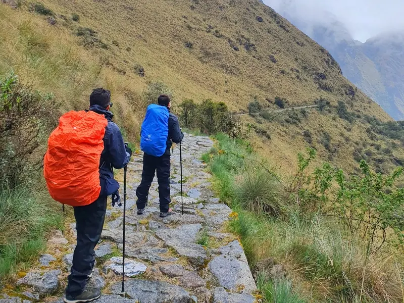
Before the modern states of South America existed, before there were paved highways or railway lines crossing the Andes, one Empire had built by hand the most extensive road network the American continent has ever known. Thirty thousand kilometers of stone trails, suspension bridges, rest stations, and route markers connected southern Colombia to central Chile and northwestern Argentina, passing through the heart of the Peruvian and Bolivian Andes.
That network was called Qhapaq Ñan. And the section that thousands of travelers walk each year toward Machu Picchu is just one of its fragments, the most famous and the best preserved, but still only a small part of something whose full scale is still difficult to fully grasp. This guide tells the complete story of that extraordinary achievement: what it was, what it was used for, how it was built, and what remains of it today.
What Qhapaq Ñan means and how to pronounce it
Qhapaq Ñan is pronounced approximately “ha-pak nyan” in standard Quechua, although pronunciation varies slightly across the Andean region. It literally means “road of the powerful” or “main road,” where qhapaq refers to nobility, greatness, and power, and ñan simply means road or route. Some academic texts translate it as “Great Inca Road” or “Royal Inca Road,” although neither version fully captures the weight of the original Quechua term.
The name did not refer to a single road, but to the entire road network of the Tahuantinsuyo, the Inca Empire. It included the two great longitudinal axes that ran across the continent from north to south, the hundreds of transverse branches that connected those axes to one another, and all the secondary routes that reached the most remote communities in imperial territory. In practice, it was the nervous system of the Inca state: without the Qhapaq Ñan, the Empire could not function.
The true extent of the network: a number that is hard to visualize
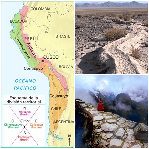
When UNESCO declared Qhapaq Ñan a World Heritage Site in 2014, it recorded a total extension of approximately 30,000 kilometers of roads. To give a sense of that scale, the circumference of the Earth at the equator is about 40,000 kilometers. The Inca road network was equivalent to nearly three-quarters of that distance, built without machinery, without wheeled transport, and without draft animals in the mountain sections, using only human labor organized through the mit’a system.
That World Heritage declaration involved six countries simultaneously: Peru, Bolivia, Ecuador, Colombia, Argentina, and Chile. It was the first multinational inscription in UNESCO history in South America, a recognition that Qhapaq Ñan does not belong to any one modern state in particular, but to the civilization that built it and to the descendants who share it across borders that came later.
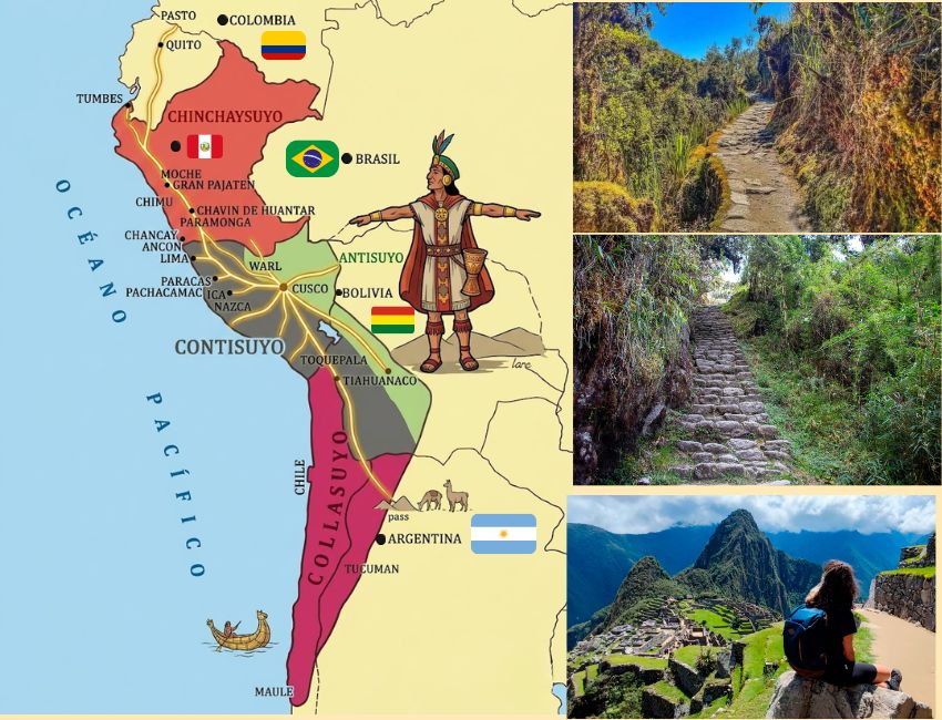
The network had two main axes. The highland road followed the backbone of the Andes from southern Colombia to northwestern Argentina, crossing elevations above 4,000 meters at several points along its route. The coastal road followed the Pacific shoreline from Ecuador to central Chile, crossing deserts, coastal valleys, and areas with climates completely different from those of the highlands. These two axes were connected by dozens of transverse routes that descended from the mountains to the sea or climbed from the coast to the altiplano, creating a web of connections that covered virtually the entire territory of the Empire.
Why the Incas built such an extensive network
The Qhapaq Ñan was not built for the pleasure of walking or for free trade among citizens. It was built to sustain a state with some of the most demanding functions any government can have: moving armies long distances in a short time, distributing resources among regions with complementary production, sending and receiving information from the farthest edges of the territory as quickly as possible, and maintaining administrative control over millions of people who spoke different languages and had their own cultural traditions.
To fulfill all those functions at the same time, the Tahuantinsuyo needed a transportation and communication system that worked with a reliability the Andean landscape itself seemed designed to prevent. The Andes are a mountain range with some of the deepest canyons on the planet, glaciers, coastal deserts, tropical jungle, and frozen high plateau, all within relatively close geographic distances. Building roads that worked in all those environments at the same time was one of the most ambitious engineering enterprises of the ancient world.
The result was an infrastructure that allowed the imperial army to move at a rate of 30 to 40 kilometers per day, that allowed chasqui messengers to carry news from Quito to Cusco in approximately five days, and that allowed state administrators to control the flow of goods, people, and information with an efficiency that would surprise any modern logistics manager.
The engineering behind the roads: how they were built
Inca engineers did not solve the problem of the Andean landscape in just one way. Each environment received a specific solution, developed with the materials available in that area and adapted to the climatic and topographic conditions of each region.
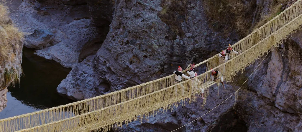
In the highlands, the stone roads are the best preserved and the best known. Hillside sections were built by cutting into bedrock or stacking stones until a firm platform was achieved. River crossings were solved with suspension bridges made of braided plant fiber, mainly agave and ichu grass, which could support the weight of full cargo columns and were renewed every year through communal labor. The bridge at Quehue, over the Apurímac River canyon in Cusco, is still rebuilt every year by the local community using techniques identical to those of the imperial period, and it is the only living example of that tradition that remains active today.
On the desert coast, where stone was not the dominant material, roads were marked by adobe walls along the sides of the route to keep the wind from erasing the trail in the sand. In some sections, the walls reached several meters in height and created corridors that channeled both the passage of people and the direction of the wind. In the low jungle, the problem was not wind but mud: there, raised platforms of wood and compacted earth were built to allow people to walk over flooded ground without sinking.
Every certain number of kilometers, roughly equivalent to a day’s march, the road reached a tambo. These installations were the stations of the system: food storage facilities, lodging for officials and armies, relay points for the chasquis, and small administrative centers that recorded the movement of people and goods across the territory. The most important tambos eventually became population centers that today are cities or towns in the six countries that share the Qhapaq Ñan.
The chasqui system: communication at running speed
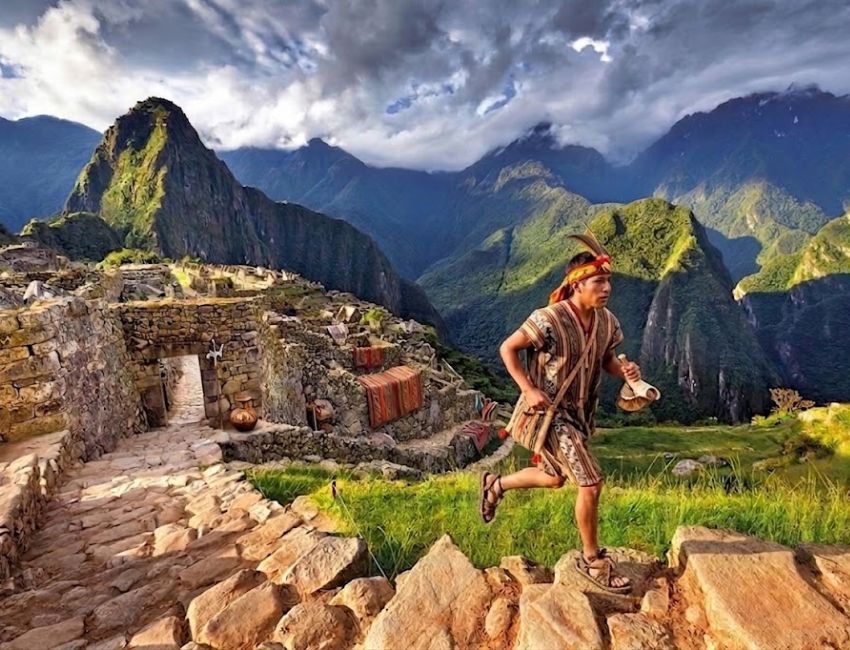
The Qhapaq Ñan was also the infrastructure on which one of the most remarkable communication systems of the ancient world operated. The chasquis were young messengers selected from childhood and trained specifically to run long distances at high altitude, transmit messages from memory with accuracy, and deliver physical objects without damage. They were stationed at relay posts separated by only a few kilometers along the entire network, and they passed the message from runner to runner in an unbroken chain that could cover the Empire in a matter of days.
Messages could be oral, memorized and recited from chasqui to chasqui with the precision of someone trained to retain information word for word. They could also be physical, in the form of quipus: knots tied in cords of different colors and sizes that specialists in this gestural writing system could read as records of numerical, administrative, or narrative data. The quipu was the Empire’s record-keeping system, and the Qhapaq Ñan was the system through which those records traveled.
The speed of the chasqui system has been the subject of historical calculations that produce figures that are hard to believe. According to colonial sources that documented how the system functioned shortly after the conquest, a message could travel the approximately 2,000 kilometers between Cusco and Quito in five days. For comparison, a commercial caravan took between forty and sixty days to cover the same distance.
The Spanish conquest and the fate of the road network
When Francisco Pizarro and the Spanish conquistadors arrived in the Andes in 1532, one of the first things the chroniclers of the expedition described with astonishment was the quality of the roads. Pedro Cieza de León, the chronicler who best described the Qhapaq Ñan in the 16th century, wrote that in his opinion those roads surpassed in construction any Roman works he had seen in Europe.
The irony of the conquest is that the Inca roads themselves helped make possible the defeat of the Empire that had built them. The Spanish armies moved along the Qhapaq Ñan with a speed that would not have been possible without that infrastructure. The territory Pizarro needed to control would have been practically inaccessible without the network the Incas had built over two centuries of expansion.
With the fall of the Tahuantinsuyo, the system that kept the roads alive also disappeared. The mit’a that organized construction and maintenance work, the tambos that supplied travelers, the chasquis who carried messages, and the administrators who coordinated the whole system stopped functioning within a few decades. Without maintenance, the most fragile sections were swallowed by vegetation, eroded by rain, or simply forgotten because the new colonial routes followed different alignments designed for different purposes.
What survived did so largely thanks to isolation. The sections of the Inca Trail that remain in the best condition are those left outside the colonial and republican routes, in mountain areas that later development had no reason to alter. The section toward Machu Picchu is the best-known example, but there are fragments of the Qhapaq Ñan in similar condition across the six countries that share this heritage.
Qhapaq Ñan today: living heritage in six countries
The UNESCO declaration in 2014 was the starting point for a process of inventory, restoration, and tourism development that is still underway in all six countries involved. Peru has the greatest number of documented kilometers and the largest volume of associated infrastructure, but Ecuador, Bolivia, Colombia, Argentina, and Chile also have sections of remarkable historical and scenic interest that are beginning to be incorporated into cultural and adventure tourism circuits.
In Peru, beyond the section toward Machu Picchu, there are fragments of the Qhapaq Ñan open to visitors in regions such as Cajamarca, Huánuco, Ayacucho, and Puno. Some of these sections pass through Andean communities that have lived beside the road for generations and that in some cases still use it as an everyday route between villages. Community-based tourism organized around those sections offers a way to experience the Qhapaq Ñan in a very different context from the trek to Machu Picchu: slower, closer to local communities, and with an anthropological dimension that the main tourist circuit cannot offer.
Walking any section of the Qhapaq Ñan means stepping onto a work that has no equivalent in the pre-Columbian world. Not because of its length or its age, but because of what it represents: the determination of a state to connect an impossible territory using the only material available, which was human labor organized on a scale that still amazes those who study it. That is what you step on when you walk the Inca Trail to Machu Picchu. And knowing that changes the way every stone feels under your feet.
Do you want to explore the most emblematic section of the Qhapaq Ñan with guides specialized in Inca history who can provide context for every mile of the journey? At Incredible Peru Tours, we organize the Classic Inca Trail, the Short Inca Trail, and private service with the historical and cultural approach this heritage deserves.


