
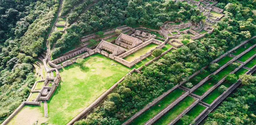
Choquequirao is one of the most impressive Inca archaeological sites in the Cusco region, and also one of the least visited because of how demanding it is to reach. Unlike Machu Picchu, there is no train or road that takes you directly to the entrance of the citadel. To get there, you need to combine ground transportation with several hours of hiking, turning the journey into a true trekking experience. In this guide, you will find every section of the route, approximate travel times, and the recommendations you need before setting out.
Starting Point: From Cusco to Cachora
The journey begins in Cusco, with the town of Cachora, in the Apurímac region, as the first destination. Cachora is the most commonly used access point for starting the hike to Choquequirao because the main trail begins from there.
The drive takes around four hours. The route follows the highway connecting Cusco with Abancay and then turns toward Cachora along a secondary road. You can complete this section with prearranged tourist transportation, a private transfer, or by combining public buses to the Ramal de Cachora turnoff and then taking a shared taxi to the town. If you travel with a tour operator, transportation is usually included and will take you directly to Cachora or to the Capuliyoc viewpoint, located a few miles farther along the route, where many groups begin the hike to save time.
Cachora is located at approximately 9,514 feet (2,900 meters) above sea level and is a good place to spend the first night if you arrive late, as it offers basic accommodations and services where you can stock up on supplies before starting the trek.

The Hike from Cachora to Choquequirao
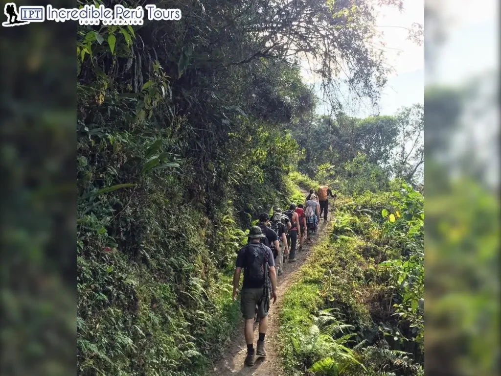
This is where the most demanding part of the journey begins. The full hike to the citadel is usually completed over two days, covering approximately 19 miles (30 kilometers) and combining steep descents with challenging climbs.
From Cachora or the Capuliyoc viewpoint, the trail descends toward the bottom of the Apurímac River canyon. This descent is long and continuously loses elevation, so it requires extra care with your knees and proper hiking footwear. At the bottom of the canyon is the Playa Rosalina area, near the river, where many groups camp for the first night.
The following day, the climb toward Choquequirao begins. This is the toughest ascent of the entire route because you gain a significant amount of elevation over just a few miles, often under the intense canyon sun. The trail passes through Santa Rosa and Marampata. Marampata offers accommodations and campsites where you can rest, and from there you can already enjoy your first views of the citadel. From Marampata, a final section leads to the archaeological complex, located at approximately 10,007 feet (3,050 meters) above sea level.
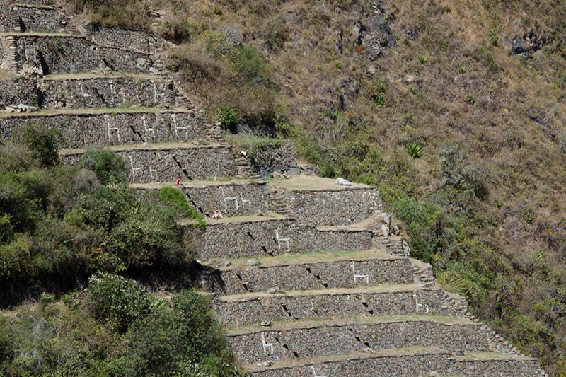
Choquequirao stretches across terraces on the mountainside, featuring agricultural terraces, plazas, ceremonial structures, and the famous terraces decorated with llama figures made from white stone. Exploring the site at a relaxed pace takes several hours, so it is best to set aside a good portion of the day for your visit before beginning the return journey along the same route.
How Long Does the Entire Trip Take?
The classic round-trip trek is organized as a four-day, three-night journey. This includes transportation from Cusco, the hike to the archaeological site, the visit to the citadel, and the return trip. There are also longer versions that continue from Choquequirao toward Machu Picchu along multi-day routes designed for travelers looking for a longer and more physically demanding adventure.
Recommendations Before You Go
Acclimatization is essential. It is recommended to spend at least two days in Cusco or the Sacred Valley before beginning the hike so your body can adjust to the altitude and handle the physical demands of the canyon more comfortably.
The best time to hike this route is from April through October, during the dry season, when the trail is generally in better condition and there is less risk of rain making the route difficult. The rainy months, from November through March, make the terrain more challenging and are generally not the most recommended time to visit.
When it comes to gear, prioritize a good pair of broken-in hiking boots, layered clothing for the heat of the canyon and the cold at night, sun protection, a hat, trekking poles for the descents, and enough water. Booking a guided service makes the logistics much easier because it usually includes transportation, meals, campsites, and pack animals to carry heavier luggage, something you will definitely appreciate during the steep climbs.
The difficulty level is high. You do not need technical mountaineering experience, but you should be in good physical condition because the steep elevation changes throughout the canyon can challenge even experienced hikers.
If you prefer not to organize transportation, campsites, and the trekking route on your own, you can choose a 5-Day Choquequirao and Machu Picchu Tour that includes a guide, transportation from Cusco to Cachora, meals, and campsites throughout the entire trek.
Frequently Asked Questions
Can you reach Choquequirao by car or train?
No. There is no road or train line that reaches the citadel. The closest vehicle access points are Cachora or the Capuliyoc viewpoint, and from there the only way to reach Choquequirao is on foot.
How many days do you need to visit Choquequirao?
The classic trek takes four days and three nights, including the hike in, the visit to the archaeological site, and the return journey. There are shorter but extremely demanding options, as well as longer treks that connect Choquequirao with Machu Picchu.
How difficult is the Choquequirao trek?
It is considered a highly challenging trek because of the steep elevation changes involved in descending into and climbing out of the Apurímac Canyon. It does not require technical mountaineering skills, but good physical fitness and proper acclimatization are essential.
What is the best time of year to visit?
The dry season, from April through October, offers the best trail conditions. Between November and March, rainfall makes the trail more difficult and increases the risk of landslides along the route.
Do I need a guide to reach Choquequirao?
A guide is not required, but booking a guided service makes the logistics of transportation, campsites, meals, and luggage much easier to manage. It also provides additional support and security along a remote route with limited cell service and few facilities.
What is the elevation of Choquequirao?
The archaeological complex is located at approximately 10,007 feet (3,050 meters) above sea level, while the trail descends to around 4,921 feet (1,500 meters) at the bottom of the Apurímac Canyon. This dramatic elevation change explains why the climbs are so physically demanding.


