
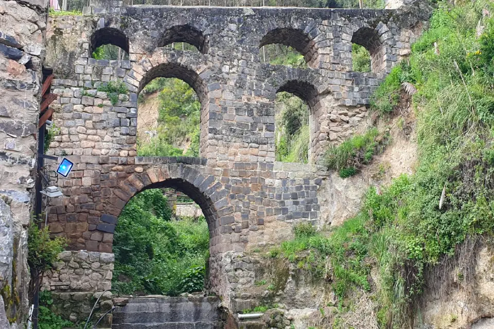
The Sapantiana Aqueduct is a colonial hydraulic structure built between the 17th and 18th centuries in the city of Cusco. It is located in the ravine of the same name, between the San Blas and San Cristóbal neighborhoods, about a 15-minute walk from the Plaza de Armas. Admission is free.
Its stacked stone arches, surrounded by vegetation and the sound of flowing water, make it one of the most peaceful and photogenic spots in the historic center. In this guide, you’ll learn about its history, what to see during your visit, and the easiest route to get there.
History of the Sapantiana Aqueduct
During the colonial period, Cusco needed a constant water supply for different parts of the city. To address this need, the Jesuit order and the city council promoted the construction of this aqueduct, which carried water above the Puqru River at the bottom of the ravine.
A Bridge Between Two Eras
The aqueduct takes its name from the Sapantiana huaca, an ancient Inca sacred site located in the same area. Researchers believe that some of the stones used in the colonial structure were reused from nearby Inca buildings, a common practice at the time.
For this reason, as you explore Sapantiana, you can see how the Inca tradition of water management, which made use of the ravine’s canals and springs, blends with the arched architecture brought from Europe.
What to See at the Sapantiana Aqueduct
Although it is a small site, there are several details worth taking the time to appreciate.
The Stone Arches
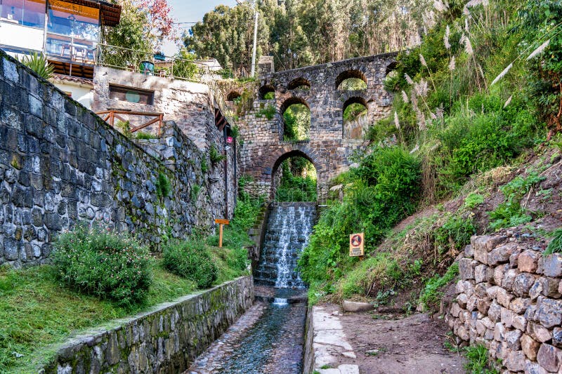
Its main attraction is the wall of arches arranged on several levels, rising above the ravine like a giant stone staircase. Its design is reminiscent of Roman aqueducts, and it is one of the few structures of this type still preserved in Cusco.
The Water and Vegetation
The stream running through the ravine, the small waterfalls, and the vegetation growing between the stones create a cool and peaceful atmosphere, very different from the bustle of the nearby streets. It’s a good place to take a break while exploring the city.
Views of the Neighborhood
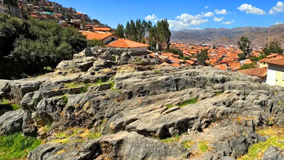
From the stairways surrounding the aqueduct, you can admire the tiled rooftops and traditional houses of San Blas and San Cristóbal. In the afternoon, the warm light falling on the stone creates one of the best scenes for photography.
How to Get to the Sapantiana Aqueduct
The easiest way to get there is on foot from the historic center. The route includes some uphill sections and stairs, so take your time.
From the Plaza de Armas
- Leave the Plaza de Armas via Triunfo Street, next to the Cathedral.
- Continue along Choquechaca Street, a quiet street lined with cafés and handicraft shops.
- At the end of Choquechaca Street, you’ll find a set of stairs leading down into the ravine and directly to the aqueduct.
The distance is approximately 900 meters (0.6 miles), and the walk takes about 15 minutes.
From San Cristóbal
If you’re in the upper part of the city, near the San Cristóbal viewpoint, you can walk down Siete Borreguitos Street, one of the most picturesque streets in Cusco, which connects to the Sapantiana ravine.

Practical Information for Your Visit
- Admission: Free. No tourist ticket is required.
- Visit duration: Between 20 and 30 minutes, or a little longer if you stop to take photos.
- Best time to visit: During the day, especially in the morning or mid-afternoon, when the lighting is good.
- Footwear: Comfortable sneakers with good traction, as the stone steps can be wet.
What to Visit Near Sapantiana
The aqueduct is located in an ideal area for planning a walking tour through traditional Cusco.
- The Twelve-Angled Stone, on Hatun Rumiyoq Street, just a few minutes from the route.
- The San Blas neighborhood, with its small square, colonial church, and artisan workshops.
- The San Cristóbal viewpoint, offering one of the best views of the Plaza de Armas.
- The Santo Domingo Convent in Cusco, built over the Inca temple of Qorikancha, where you can continue exploring the blend of Inca and colonial heritage.
If you’re interested in hydraulic engineering, you can also visit the Tipón Archaeological Park, where the Incas built agricultural terraces and canals that still carry water today. And if you prefer to explore the city’s main attractions with a guide, you can join a Half-Day Cusco City Tour.
Frequently Asked Questions About the Sapantiana Aqueduct
How Much Does It Cost to Visit the Sapantiana Aqueduct?
Nothing. It is an open-air site, and admission is free.
Where Is the Sapantiana Aqueduct Located?
It is located in the Sapantiana ravine, at the foot of the hill where Sacsayhuamán stands, between the San Blas and San Cristóbal neighborhoods, about a 15-minute walk from the Plaza de Armas.
Who Built the Sapantiana Aqueduct?
Its construction was promoted by the Jesuit order and the Cusco city council between the 17th and 18th centuries to supply water to the city.
Is the Sapantiana Aqueduct an Inca Structure?
No. It is a colonial structure, although it was built at a site associated with an ancient Inca huaca and probably reused stones from nearby Inca buildings.
How Much Time Do You Need to Visit?
About 20 to 30 minutes at the aqueduct. If you combine your visit with San Blas and the San Cristóbal viewpoint, allow approximately two hours for the walk.


