2026 Book your spot for the Inca Trail 2026!

Inicio » Cusco » Page 6

Humantay Lake and Rainbow Mountain are two of the most sought after high altitude landscapes near Cusco. One features turquoise waters at the foot of a snow covered mountain, while the other displays mineral bands that color an entire hillside. They are located in different areas of the region, but both can be visited on a well organized two day trip. Here you will learn what each destination is, what to expect from the hikes, how to prepare for the altitude, and why visiting them together makes better use of your time in Cusco.

What Is Humantay Lake?

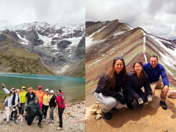
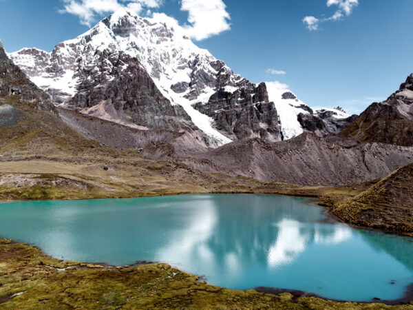
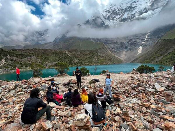
Humantay Lake is a glacial lake located at 4,300 meters above sea level, at the foot of Humantay Mountain in the Vilcabamba Mountain Range. Its turquoise waters come from glacial melt, and the intensity of the color changes depending on the light and the time of year. From the shore, you will have direct views of Humantay Mountain and, farther in the distance, Salkantay Mountain, which rises to 6,271 meters above sea level and is the highest peak in the area.

The starting point of the hike is Soraypampa, at 3,900 meters above sea level. The climb to the lake takes approximately one hour and thirty minutes along a trail with a steady incline, and the return descent takes about one hour. It is not a long distance, but the altitude makes it challenging, so it is best to hike slowly and take breaks.

Humantay Lake
Humantay Lake

What Is Rainbow Mountain?

Rainbow Mountain, also known as Vinicunca, is a geological formation whose colors come from the mineral composition of the ground. Clays, sulfides, and iron oxides create bands that range from red to green and yellow across the hillside. From the summit, you can enjoy views of Ausangate Mountain, and along the route it is common to see llamas, alpacas, and birds that are native to the high altitude ecosystem.

On the route that combines both destinations, access to the mountain is through the Phulawasipata area. From there, the hike to the viewpoint takes approximately one hour and thirty minutes, and the descent takes about the same amount of time. As with Humantay Lake, the main challenge is not the distance but the altitude, which reaches approximately 5,000 meters above sea level.

Rainbow Mountain
Rainbow Mountain

Differences Between Humantay Lake and Rainbow Mountain

Although both are high altitude hikes near Cusco, they offer different experiences. This comparison will help you understand what to expect from each destination before your trip:

FeatureHumantay LakeRainbow Mountain
Main landscapeTurquoise glacial lake at the foot of a snow covered mountainHillside with mineral bands in several colors
Elevation of the highest point4,300 meters above sea levelApproximately 5,000 meters above sea level
Starting pointSoraypampa, at 3,900 meters above sea levelPhulawasipata
Uphill hiking timeApproximately 1 hour and 30 minutesApproximately 1 hour and 30 minutes
DifficultyModerate to challenging because of the altitudeModerate to challenging because of the altitude
Main attractionGlacial waters and views of Salkantay MountainMineral colors and views of Ausangate Mountain

Why Visit Humantay Lake and Rainbow Mountain on the Same Trip?

These two destinations are located in different directions from Cusco, and visiting them separately means two very early mornings and two full days of transportation. Combining them on a two day trip allows you to make better use of the travel time and, most importantly, gain elevation more gradually. The first day at Humantay Lake serves as acclimatization before climbing Rainbow Mountain the following day.

Another advantage is the overnight rest between the two hikes. Instead of returning to Cusco after visiting Humantay Lake, the route includes one night in the Panoramic Wooden Geodesic Domes in Soraypampa. This avoids additional hours on the road and, when the weather is clear, offers the opportunity to see a night sky with very little light pollution. This arrangement is difficult to recreate independently without losing time and comfort.

To complete this trip with transportation, accommodations, and a guide already coordinated, the 2 Day Humantay Lake and Rainbow Mountain Trek from Incredible Peru Tours organizes the entire route with a single reservation, including pickup from your hotel in Cusco.

Geodesic domes
One Night in the Domes After the Humantay Lake Tour

How to Prepare for the Altitude

Both Humantay Lake and Rainbow Mountain are located above 4,000 meters above sea level, and the altitude has a greater impact than the distance. Spending at least two or three days in Cusco before the excursion helps your body adjust, although it does not completely eliminate the risk of altitude sickness. During the hikes, it is best to move slowly, take short breaks, and breathe calmly instead of trying to keep up with other people.

Dressing in layers is the best strategy because the mornings are very cold and the midday sun is intense. Bring a warm wind resistant jacket, a hat, gloves, sunscreen, sunglasses, and enough water. During the rainy season, from November through March, add a waterproof jacket and footwear with good traction because the trails can be slippery.

Clothing for high altitude conditions
Clothing for High Altitude Conditions

Best Time to Visit

The dry season, approximately from April through October, usually offers clearer skies and firmer trails. These conditions improve visibility at both the lake and the colorful mineral bands. However, mornings can be very cold, and wind is common in the high altitude areas.

During the rainy season, from November through March, there is a greater chance of fog, rain, or snow. These conditions can reduce visibility of the colors and make the journey slower. If you travel during these months, it is best to keep your itinerary flexible because the weather can affect travel times.

Dry Season

Book Your Two Day Trip

Visiting Humantay Lake and Rainbow Mountain on the same trip is one of the most efficient ways to make the most of your days in Cusco, as long as the logistics are properly arranged. With transportation, accommodations in Soraypampa, meals, and a guide already organized, you can focus entirely on the hikes and the scenery. You can check date availability and book directly with Incredible Peru Tours to secure your space, especially during the high season, when demand is greater.

Frequently Asked Questions

Can Humantay Lake and Rainbow Mountain be visited on the same day?

It is not recommended. They are located in different areas of the Cusco region, and each one requires its own early departure and transportation. The usual option is to visit them over two days, with an overnight stay in Soraypampa, which also helps with acclimatization.

How difficult are the hikes?

Both hikes range from moderate to challenging, not because of the distance but because of the altitude. The climb to Humantay Lake and the climb to Rainbow Mountain each take approximately one hour and thirty minutes. With proper acclimatization and a slow pace, most travelers complete them without difficulty.

What is the elevation of each destination?

Humantay Lake is located at 4,300 meters above sea level, and Rainbow Mountain reaches approximately 5,000 meters above sea level. The starting point for the Humantay Lake hike in Soraypampa is located at 3,900 meters above sea level.

Do I need to acclimate before the trip?

Yes. It is recommended that you spend at least two or three days in Cusco before the excursion to reduce the risk of altitude sickness. The two day itinerary also helps because the first day at Humantay Lake prepares your body for the higher elevation on the second day.

What should I bring?

Bring warm clothing in layers, a wind resistant jacket, a hat, gloves, sunscreen, sunglasses, and water. During the rainy season, also bring a waterproof jacket and footwear with good traction.

Inicio » Cusco » Page 6

The difficulty of the Red Valley hike is considered moderate to challenging. The main difficulty is not only the distance, but also the altitude of more than 5,000 meters above sea level, the lower oxygen level, the slopes, and the accumulated fatigue after visiting Rainbow Mountain.

The perceived level of effort varies according to previous acclimatization, physical condition, weather, and personal pace. A person who is well adapted to Cusco may complete the route with controlled breaks, while a traveler who has just arrived from a low-altitude city may find the hike much more demanding.

How difficult is the Red Valley hike?

The route to the Red Valley should not be assessed only by the number of minutes spent walking. It takes place in a high-mountain environment where breathing requires more effort, even when moving slowly or walking along a seemingly short section.

The early-morning cold, wind, ascents and descents, uneven ground, and fatigue from the previous visit to Vinicunca can make the route more demanding than expected. Therefore, it should be planned as part of a full day of physical activity and not as an effortless additional walk.

Difficulty level of the route

The Red Valley hike is normally classified as moderate to challenging. A person with good physical condition and acclimatization can complete the section without requiring technical mountaineering experience, provided that they maintain a slow and steady pace.

This assessment is not the same for every traveler. People with low levels of physical activity, respiratory difficulties, knee discomfort, or limited adaptation to altitude may find it challenging, even if the trail does not add a great distance.

Why altitude increases the difficulty

Walking above 5,000 meters above sea level means that less oxygen is available than in Cusco and, even more so, than in cities located close to sea level. This can cause the body to become tired more quickly and breathing to accelerate even on a gentle slope.

It is common to need frequent breaks to catch your breath. Stopping for a few minutes, breathing calmly, and drinking water can help you continue more comfortably. Trying to maintain the same pace as another member of the group is a common mistake.

Terrain difficulty

The route is a natural mountain trail, not a paved path. It may include slopes, sections of compacted soil, loose stones, and uneven areas that require attention while walking, especially during the descent.

Depending on the weather, the terrain may have mud, puddles, or slippery surfaces. Footwear with good grip reduces the risk of slipping and allows you to place your feet more securely on uneven sections.

Red Valley Trek
Red Valley Trek

Distance and duration of the hike

The distance and duration of the route may vary according to the access point, the route selected by the operator, trail conditions, and the group’s pace. Not all travelers arrive at the same starting point or complete exactly the same circuit.

Rather than focusing only on the number of minutes, it is advisable to save energy for the return. Breaks to breathe, take photographs, or wait for the group are also part of the actual duration of the excursion.

Hiking time from Vinicunca

From Rainbow Mountain to the Red Valley viewpoint, the section usually takes approximately 20 to 30 minutes. This estimate assumes continuous progress, but it may increase if the traveler needs to stop because of the altitude.

The time also varies according to trail conditions. On days with wind, rain, or snow, moving safely may require a slower pace and greater caution on inclined sections.

Return time

The return may take around 40 minutes or longer, depending on the route used, terrain conditions, and the breaks taken. Although some sections are downhill, they are not always easy because of loose stones and accumulated fatigue.

It is advisable not to calculate the return as though it were automatic or effortless. After spending several hours away from Cusco, fatigue may affect balance, concentration, and walking speed.

Accumulated effort during the excursion

The difficulty should be assessed by considering the entire day. The Red Valley is normally visited after the ascent to Vinicunca, so the body has already made a considerable effort before beginning this additional section.

Those who decide to add it should assess how they feel when they reach Rainbow Mountain. If there is severe exhaustion, a strong headache, or shortness of breath that does not improve with rest, it is preferable to prioritize safety and not continue.

Red Valley
Red Valley

Red Valley altitude

The route through the Red Valley takes place at an altitude of more than 5,000 meters above sea level. This is the factor that most strongly affects physical effort, since the body receives less oxygen with each breath.

Even active travelers may feel slower than usual. Preparation does not mean walking quickly, but arriving properly acclimatized, recognizing personal limits, and giving the body time to adapt to the pace of the route.

Elevation of the Red Valley viewpoint

The Red Valley viewpoint is located at approximately 5,200 meters above sea level, although the figure may vary slightly depending on the exact point along the route and the measurement used. It is higher than the usual elevation of the main Vinicunca viewpoint.

At this altitude, the availability of oxygen is clearly lower than in the city of Cusco, which is located at approximately 3,400 meters above sea level. For this reason, a short hike may feel more demanding than the distance shown on a map would suggest.

Effects of walking at high altitude

Some travelers may experience significant fatigue, headaches, dizziness, nausea, or shortness of breath. These symptoms may be related to altitude and should be taken seriously, especially if they increase during the route.

When experiencing any discomfort, it is advisable to stop, inform the guide, and rest. If the symptoms worsen, the traveler should not continue or force the body to reach the viewpoint. The safest decision may be to begin the return accompanied by another person.

Red Valley Altitude
Red Valley Altitude

Is the Red Valley or Vinicunca more difficult?

For many people, the main ascent to Vinicunca represents the greatest effort because of the slope and altitude. However, the Red Valley may feel equally or more difficult for some travelers because it is completed after fatigue has already accumulated.

The section toward the Red Valley is usually shorter, but it should not generally be considered easy. The answer depends on how each person reacted during the ascent to Rainbow Mountain, their acclimatization, and the conditions on the day.

Difficulty of the ascent to Vinicunca

The ascent to Vinicunca usually contains the most demanding part of the excursion. Its slopes, thinner air, and the duration of the hike require the body to work continuously until reaching the viewpoint.

It is common for travelers to move slowly and take short breaks. Maintaining your own pace, without trying to follow those who walk faster, helps manage energy more effectively for the rest of the day.

Difficulty of the section toward the Red Valley

The trail toward the Red Valley extends the hike and adds further effort after Vinicunca. It may include inclined and uneven areas, making leg fatigue and the lower availability of oxygen more noticeable.

One advantage is that this route normally offers views of a wider landscape with reddish tones and, on many days, fewer visitors than the main viewpoint. The decision to add it should be based on the energy available and the guide’s instructions.

Is previous hiking experience necessary?

It is not necessary to be an experienced mountaineer to visit the Red Valley. Even so, it is recommended to have suitable physical condition, good acclimatization, and the ability to walk for several hours in a high-altitude environment.

Previous experience helps travelers understand their own pace and use footwear or trekking poles correctly, but it does not replace the body’s adaptation to altitude. An active person who is not acclimatized may feel worse than someone who is less physically trained but prepared with enough time.

Recommended physical condition

It is advisable to be capable of completing long walks and climbing slopes without experiencing significant physical problems. Before the trip, walking, performing moderate cardiovascular exercise, and strengthening the legs may be useful, always according to each person’s condition.

Running or intense sports training is not required. The most useful preparation is having basic endurance, stability when walking on uneven surfaces, and the ability to stop without frustration when the body requires it.

Recommended experience

Having completed previous hikes, especially in high-altitude areas, can make the experience easier. It helps travelers recognize signs of fatigue, manage their water intake, and maintain a cautious pace on slopes.

However, a previous high-altitude hike does not guarantee that discomfort will not occur. The body’s response to environments above 5,000 meters above sea level may vary between trips, so it remains necessary to acclimatize and pay attention to any symptoms.

Importance of acclimatization

Acclimatization is one of the most important factors for completing the route safely and comfortably. Spending a few days in Cusco allows the body to begin adapting before facing an excursion at a much higher altitude.

Arriving in Cusco and visiting Vinicunca or the Red Valley the following day may increase the likelihood of feeling unwell. There is no method that completely eliminates the risk, but gradual adaptation reduces the physical demands for many travelers.

How many days to acclimatize in Cusco

It is recommended to remain in Cusco for at least one or two days before taking the excursion. During the first few hours, it is preferable to rest, stay hydrated, and avoid intense physical activity, as well as very heavy meals or excessive alcohol consumption.

A practical alternative is to begin with relaxed visits within Cusco or less demanding routes. This allows the traveler to observe how their body responds before planning a hike above 5,000 meters above sea level.

How to know if you are properly acclimatized

A positive sign is feeling comfortable while taking simple walks around Cusco, climbing stairs at a moderate pace, and resting without severe headaches, dizziness, or unusual shortness of breath. This does not guarantee complete adaptation, but it provides a useful reference.

If altitude-related symptoms persist or increase in the city, it is not advisable to assume that they will improve during the excursion. In that case, it is recommended to change the plan and consult a healthcare professional if there are concerns about physical condition.

Acclimatizing in Cusco several days before the trek

Preparation for the Red Valley hike

Proper preparation can reduce the perceived difficulty and help travelers walk more safely. The goal is not to eliminate the effort caused by altitude, but to manage it through practical decisions before and during the route.

The most common mistakes are starting too quickly, carrying insufficient warm clothing, not drinking enough water, and wearing shoes without adequate grip. Preparing the equipment the night before prevents problems during an excursion that usually begins early in the morning from Cusco.

Walking slowly and taking breaks

It is advisable to maintain a steady, short, and controlled pace. Walking quickly at the beginning may cause early exhaustion, so it is better to save energy for the slopes and the return journey.

Breaks are not a sign of inability. Stopping for a few minutes when necessary helps restore breathing and allows travelers to continue more safely. It is not advisable to compete with other visitors or attempt to arrive first.

Hydration and food

Carrying water helps compensate for some of the dehydration that may occur because of the cold, wind, and physical effort. It is preferable to drink small sips regularly instead of waiting until you feel very thirsty.

It is also useful to carry light foods that provide energy, such as fruit, nuts, or simple energy bars. Before walking, it is advisable to avoid excessively heavy meals, since they may increase discomfort if altitude-related nausea occurs.

Suitable clothing and footwear

Hiking shoes with good grip and firm soles are recommended. The footwear should have been worn previously to avoid blisters or discomfort during a route where changing shoes is not normally a practical option.

Clothing should include warm layers, wind protection, and a waterproof garment. The weather can change quickly, so setting out with only one light layer or without rain protection may make the route more difficult.

Trekking poles

Trekking poles can provide stability on slopes and sections with rocks or loose soil. They also help distribute some of the effort between the legs and arms, especially during descents.

To be useful, they should be adjusted to a comfortable height and used without blocking the path of other visitors. They do not replace a cautious pace or suitable footwear, but they can provide greater security for people with limited stability.

Suitable clothing for trekking

Who should avoid this hike?

Not everyone responds to altitude in the same way. Before including the Red Valley in an itinerary, it is advisable to consider personal health, acclimatization level, and the actual ability to walk in a demanding environment.

The decision should be individual and responsible. If there is a medical history or uncertainty about how the body may respond to altitude, a professional assessment before the trip is the most prudent option.

  • People with medical conditions
  • Children and older adults
  • Travelers without acclimatization

How does the difficulty change according to the weather?

The weather can change quickly in this area and considerably alter trail conditions. A manageable route on a dry morning may become slower and more slippery if rain, fog, or hail appears.

Before setting out, it is advisable to check the forecast as a reference and prepare clothing for different conditions. Even so, the actual mountain weather may be different, so the guide’s safety instructions should always take priority.

Difficulty during the dry season

During the dry season, conditions are generally better for walking, with less mud and greater visibility on many days. This may make it easier to progress along the trail, although it does not reduce the effects of altitude.

Mornings may have very low temperatures and strong winds. Therefore, the absence of rain does not mean that travelers can set out with insufficient clothing or without protection for the hands, head, and face.

Difficulty during the rainy season

During the rainy season, mud, puddles, and wet surfaces may make the terrain slippery. Rain may also increase the sensation of cold and cause progress to become slower.

Fog, hail, or snow may reduce visibility and change the excursion plan. Under these conditions, it is even more important to wear suitable footwear, waterproof clothing, and accept route changes if the guide considers them necessary.

Snow-covered Red Valley

Tips for visiting Vinicunca and the Red Valley

Visiting Vinicunca and the Red Valley with transportation and a guide makes it easier to organize the schedule, route, and return to Cusco. One organized alternative is the Rainbow Mountain + Red Valley Tour, which combines both attractions in an excursion from Cusco.

Before booking, it is advisable to confirm what the service includes, the pickup point, the time available at each location, and the expected conditions for the day. It is also useful to ask how the return is handled if a traveler is unable to continue walking.

Follow the guide’s instructions

The guide understands the group’s usual pace, changes in the weather, and the general conditions of the route. Following their instructions regarding breaks, routes, and schedules helps prevent delays or unsafe decisions.

It is also necessary to respect the return times. Remaining too long at a viewpoint may affect the group’s logistics and increase exposure to cold or changing weather conditions during the afternoon.

Do not continue when experiencing severe symptoms

If severe symptoms appear, such as a strong headache, significant dizziness, shortness of breath that does not improve with rest, vomiting, or extreme weakness, the traveler should immediately inform the guide. The discomfort should not be minimized because of a desire to complete the hike.

Forcing the body may worsen the situation and make the return more difficult. The priority is to descend or return by following the safety instructions, even if this means not reaching the Red Valley.

Frequently asked questions

These answers help travelers assess whether the route is suitable for their physical preparation and the time available during a visit to Cusco.

Conditions may vary because of the weather, the route used, and each person’s response to altitude, so the figures should be considered approximate references.

Is the Red Valley hike difficult?

It is considered a moderate to challenging hike, mainly because of the altitude above 5,000 meters above sea level and the accumulated effort after visiting Vinicunca.

The additional distance is not very long, but the lower oxygen level, slopes, and natural terrain may increase the feeling of fatigue.

How long do you walk to reach the Red Valley?

From Rainbow Mountain to the Red Valley viewpoint, the section usually takes approximately 20 to 30 minutes.

The time may vary according to the traveler’s pace, the necessary breaks, trail conditions, and the weather on the day.

Can I visit the Red Valley without experience?

Yes, it is possible for healthy, properly acclimatized travelers with suitable physical condition to walk for several hours and climb slopes.

Technical experience is not required, but travelers should move calmly, use appropriate equipment, and respect their body’s limits at high altitude.

Can you reach the Red Valley on horseback?

The availability and extent of horse services may vary according to the date, local community, weather, and route conditions. It is advisable to confirm this with the operator in advance.

Even when the service is available, it will probably be necessary to walk along certain sections. It should not be assumed that the horse reaches every viewpoint or area of the Red Valley.

What happens if I cannot complete the hike?

The body should not be forced to complete the route. The correct action is to inform the guide as soon as excessive fatigue or altitude-related symptoms appear.

The return should be completed by following the safety instructions and the group’s plan. Prioritizing health is more appropriate than attempting to reach a specific point on the trail.

Is it worth adding the Red Valley to the route?

It may be worthwhile for travelers who are properly acclimatized, have enough energy, and are interested in seeing broader reddish landscapes that are generally less crowded.

If the ascent to Vinicunca has already been very demanding or there are altitude-related symptoms, it is preferable not to add this section. The visit should be adapted to the traveler’s actual condition on the day.

Inicio » Cusco » Page 6

Visiting Vinicunca and the Red Valley on the same day is possible and allows you to experience two very different landscapes in a single hike. Vinicunca, also known as Rainbow Mountain, stands out for its multicolored stripes and receives a larger number of visitors. The Red Valley, by contrast, features much more extensive reddish slopes and is usually quieter. Both are located near Ausangate, and their trails can be connected.

The decision depends mainly on your available time, acclimatization, and physical condition. The combined route requires more effort than visiting Vinicunca alone, but it adds expansive views and a different descent from the usual route.

Main differences between Rainbow Mountain and the Red Valley

The main difference lies in the type of landscape. Vinicunca draws attention to a mountain with mineral bands in several colors, while the Red Valley offers views of a succession of hills, ravines, and slopes dominated by red tones.

Visitor numbers, the route, and the overall experience also differ. Both destinations are at high altitude, above 5,000 meters above sea level, so they should be assessed not only for their views but also for the effort required by each route.

Differences in the landscape

Rainbow Mountain features stripes in reddish, yellow, ochre, green, and gray tones. These variations are caused by the mineral composition of the ground and are seen mainly from the Vinicunca viewpoint.

The Red Valley has a different appearance: mountains and slopes in red tones predominate, with brown and pink areas depending on the daylight. It is not a single mountain, but an extensive landscape that unfolds as you walk along the trail.

Differences in popularity

Vinicunca is one of Cusco’s best-known attractions and usually draws groups of visitors from the early morning hours. Its international recognition leads many people to include it even in short itineraries.

The Red Valley receives fewer travelers because a significant number of those who reach Vinicunca return along the main route. Therefore, when continuing toward this area, it is common to encounter fewer people on the trail.

Differences in the experience

A visit to Vinicunca is usually more crowded, especially at the main viewpoint. It is a suitable route for those who want to see the colorful mountain that frequently appears in photographs and Cusco travel guides.

The Red Valley offers a hike with open views and a greater sense of space. The route may feel quieter, although not necessarily easier, because accumulated fatigue and altitude still affect each traveler’s pace.

Location of Vinicunca and the Red Valley

Vinicunca and the Red Valley are in the Cusco region, near snow-capped Ausangate, in the southeastern part of the department. They are reached by mountain roads from the city of Cusco and, depending on the starting point, the overland journey may take several hours.

The trails for both attractions are close to each other. For this reason, many excursions first hike to Vinicunca and then continue along an alternative route that descends toward or connects with the Red Valley.

Where Rainbow Mountain is located

Rainbow Mountain is located near the Ausangate mountain range in Cusco. The most commonly used access route begins in the city of Cusco and heads toward communities in Canchis Province, where the hike to the viewpoint starts.

From Cusco, the road journey usually begins before dawn to make the most of the day. The exact starting point may vary depending on the chosen route, road conditions, and the arrangements for each visit.

Where the Red Valley is located

The Red Valley is located near Vinicunca, in a high-mountain area close to Ausangate. It is normally visited as an extension of the main hike, after reaching the Rainbow Mountain viewpoint.

Access depends on whether the trail has been opened by the local communities and on weather conditions. Before setting out, it is advisable to confirm whether the combined route is available, especially during months with rain or snowfall.

Comparison of the hikes

The hike to Vinicunca is usually shorter than the route that also includes the Red Valley. However, both take place at high altitude, where even moderate distances may require more time than expected.

The slope, ground conditions, weather, and acclimatization affect the actual difficulty. A person who walks easily at lower elevations may need frequent breaks in this part of Cusco.

Duration of the hike to Rainbow Mountain

The hike to the Rainbow Mountain viewpoint usually takes about 1.5 to 2.5 hours each way. The time depends on the access point, the traveler’s pace, and the presence of mud, snow, or wind.

Including the ascent, time at the viewpoint, and the return, many people estimate between 3 and 5 hours for the walking portion of the activity. It is not advisable to plan it at a rushed pace, since the lower oxygen level can affect physical exertion.

Duration of the hike to the Red Valley

After visiting Vinicunca, going to the Red Valley can add approximately 1.5 to 3 hours to the total route. The time varies according to the exit route, stops for photographs, and the point where the transportation is waiting.

On some route variations, the Red Valley serves as a descent route; on others, it requires walking an additional section before descending. Ask about the exact route before booking or beginning the excursion.

Which hike is more difficult

Visiting only Vinicunca can feel demanding because of the continuous climb to the viewpoint and its altitude. The effort increases in the final sections, where some travelers move slowly because of the cold and thinner air.

The route that includes the Red Valley is usually more demanding overall because it lengthens the day and adds further elevation changes. Even so, the difficulty is not the same for everyone: it depends on acclimatization, physical condition, weather, and previous experience hiking at high altitude.

Map of Rainbow Mountain + Red Valley

Altitude and climate at both destinations

Both destinations are located at high altitude and have variable weather. You may set out under clear skies and encounter wind, fog, rain, or snow during the hike, even on the same day.

The best preparation includes spending at least two or three days in Cusco before the excursion, drinking water frequently, avoiding alcohol the night before, and wearing layered clothing. The cold is usually more intense early in the morning and when the wind picks up.

Elevation of Rainbow Mountain

The Rainbow Mountain viewpoint is located at approximately 5,036 meters above sea level. This altitude can make breathing shorter, increase the pulse, and make the ascent feel slower than expected.

Walking slowly, taking brief breaks, and not competing with the pace of other visitors helps manage the effort more effectively. If severe altitude sickness symptoms appear, such as a strong headache, dizziness, or persistent shortness of breath, the prudent course is to descend and seek assistance.

Rainbow Mountain

Elevation of the Red Valley

The route through the Red Valley runs at approximately 4,900 to 5,100 meters above sea level, depending on the trail used. Because of its proximity to Vinicunca, exposure to altitude is similar and should be treated with the same caution.

It is advisable to walk slowly, protect yourself from the sun, and stay hydrated, even when it is cold. A common mistake is to continue simply because the route appears to be mostly downhill; accumulated fatigue may be strongly felt at the end of the day.

Red Valley

Which one has fewer visitors

The Red Valley usually has fewer visitors than Vinicunca. Many people reach the Rainbow Mountain viewpoint, take photographs, and return along the same trail without continuing to the second attraction.

Visitor numbers may vary depending on the season, day of the week, weather, and arrival time. Traveling early helps avoid some groups, although it does not guarantee empty trails during the dry season.

Tourist numbers at Vinicunca

Vinicunca attracts a larger number of visitors because of its international recognition and the wide range of day trips available from Cusco. The main viewpoint can become crowded during peak group arrival times.

To have more space, it helps to arrive early and avoid staying only at the central photography spot. It is also advisable to be patient and respect marked trails, without climbing into restricted areas in search of a different photograph.

Tourist numbers in the Red Valley

The Red Valley normally receives fewer travelers because it requires additional time and is not always included in basic tour programs. This makes it possible to walk through several sections with less noise and fewer people nearby.

Even so, it should not be assumed that it will be empty. On high-demand dates or when several excursions use the same route, groups may coincide at panoramic viewpoints and community access points.

Which one offers better scenery

There is no single answer because each place offers a different type of landscape. Vinicunca is a good choice for those who prioritize colorful bands on one particular mountain; the Red Valley is more suitable for those who prefer expansive panoramas and trails among reddish formations.

Light and weather have a strong influence on both. In fog, rain, or snow, the colors may appear less defined, while under clear skies the shades and views of nearby mountains are generally easier to appreciate.

Rainbow Mountain landscape

Vinicunca’s main attraction is its mineral stripes, visible from the viewpoint located opposite the mountain. From this point, you can also see peaks, open slopes, and the high-altitude terrain of the Ausangate area.

For photography, using a wide-angle lens and allowing time to wait for changes in the light or gaps between groups usually works best. The actual colors may vary depending on soil moisture, cloud cover, and the time of the visit.

Red Valley landscape

The Red Valley stands out for its extensive reddish formations, with trails that cross slopes and ravines. The scale of the landscape is best appreciated during the hike, not only from a single viewpoint.

Some sections offer views of Ausangate and other nearby mountains. It is an interesting option for those who enjoy photographing trail lines, ground textures, and expansive panoramas without focusing solely on one mountain.

Can Vinicunca and the Red Valley be visited on the same day?

Yes, Vinicunca and the Red Valley can be visited on the same day if access is available, there is enough time, and the traveler is well acclimatized and in suitable physical condition. The day usually begins before dawn in Cusco and ends in the afternoon or evening because of the transfers and the duration of the hike.

Travelers who prefer to have transportation, the route order, and the return journey arranged can consider this Rainbow Mountain + Red Valley Tour as an organized alternative for visiting both attractions from Cusco. Before confirming, check what is included, the pickup point, admission fees, and whether the route is open for the selected date.

Combined route from Vinicunca

The combined route usually begins with the ascent to the Vinicunca viewpoint. After spending a few minutes at Rainbow Mountain, the hike continues along a trail toward the reddish sections of the valley and, depending on the program, ends at a different exit point.

This additional section may take between 1.5 and 3 hours. The exact route varies according to the community, trail conditions, and the location of the return vehicle, so it is advisable to confirm it before departure.

Admission prices

Vinicunca and the Red Valley may have separate admission fees administered by local communities. The amounts and payment arrangements may change, so it is not advisable to assume that one ticket automatically covers both places.

Check prices before the trip and carry cash in Peruvian soles as a backup, since card or digital-wallet payments are not always available in rural areas. When booking an excursion, check whether admission fees are included or paid directly at the entrance.

Which one to choose according to traveler type

The choice depends on the available time, adaptation to altitude, and the type of landscape you are seeking. Vinicunca is the most direct option for a first visit, while the Red Valley adds a broader and less crowded route.

You can also combine both if you have already spent several days in Cusco, feel physically well, and are prepared for a long day. It is not advisable to decide based only on photographs: weather and physical effort should carry equal weight in the planning.

For a first visit to Cusco

For a first visit to Cusco, Vinicunca is usually the most representative alternative for those who want to see the region’s most famous colorful mountain. Its route is more widely known, and there are more transportation and excursion options available.

Ideally, schedule it after acclimatizing in Cusco or the Sacred Valley. Avoid doing this hike on the same day you arrive by plane, since the change in altitude can make the physical effort more difficult.

For those seeking fewer visitors

The Red Valley is usually a suitable alternative for travelers who prefer trails with fewer groups and more open views. The lower number of visitors is due to the fact that many people return after reaching Vinicunca.

This option requires allowing additional time and preserving enough energy for the second section. It is preferable to choose it when you are not in a hurry to return to Cusco and feel comfortable walking for several hours at high altitude.

For photography enthusiasts

Vinicunca offers a highly recognizable composition: the mountain with colorful bands opposite the main viewpoint. It is useful for those seeking a clear image of the destination and wanting to photograph contrasts among mineral tones.

The Red Valley offers more variety for panoramic photographs, trails, slopes, and views toward Ausangate. When carrying a camera or phone, protect the equipment from dust, cold, and possible rain, and bring a portable charger because low temperatures reduce battery life.

For travelers with limited time

When time is limited, you can visit only Vinicunca and return along the main route. This alternative reduces the duration of the hike, although the transfer from Cusco will still occupy a considerable part of the day.

The combined route may be feasible if your itinerary and physical condition allow it. It is not advisable to shorten rest periods or quicken your pace to include both places, because the altitude can turn a rushed day into an uncomfortable experience.

Red Valley
Red Valley

Best time to visit both places

The dry season, usually from April to October, generally offers better visibility and less slippery trails. The rainy season, generally from November to March, may produce landscapes with more moisture, but it also brings more changes in the weather.

At any time of year, check the forecast shortly before setting out and bring waterproof clothing, a hat, gloves, sunscreen, and footwear with good traction. Weather in this area can change quickly and affect both the views and safety on the trail.

Visiting during the dry season

During the dry season, skies are usually clearer and conditions are better for hiking. This improves the visibility of Vinicunca’s colors and the formations of the Red Valley, especially during the early hours of the day.

Mornings can be very cold, and the wind may intensify in the higher areas. Bring thermal layers that you can remove or put on during the hike, because physical exertion and sun exposure change how the temperature feels.

Visiting during the rainy season

During the rainy season, there may be mud, fog, rain, snow, and reduced visibility of the colors. Trails may be more slippery, and some routes or access points may be changed for safety reasons.

When traveling during these months, wear waterproof trekking shoes or footwear with good traction, a rain jacket, and protection for your backpack. Keep your itinerary flexible, since an excursion may require changes depending on the day’s conditions.

Frequently asked questions

These answers help address common questions before organizing a visit to Vinicunca, the Red Valley, or both destinations in a single day.

Access conditions, fees, and weather may change, so it is always advisable to confirm operational information shortly before traveling.

Which is better, Rainbow Mountain or the Red Valley?

Vinicunca is better known and is usually the first choice for those who want to see the mountain with colorful stripes. The Red Valley offers a broader landscape of reddish slopes and normally a hike with fewer visitors. The best option depends on whether you prioritize one specific view or a panoramic route.

Which one is more difficult?

Vinicunca requires an ascent to more than 5,000 meters above sea level, so it can be tiring. Visiting the Red Valley afterward involves a longer hike and more time exposed to high altitude. The difficulty varies according to each person’s acclimatization, the weather, and physical condition.

Which one has fewer tourists?

The Red Valley usually has fewer tourists because many travelers return after reaching the Vinicunca viewpoint. However, visitor numbers vary according to the season, day of the week, and the routes used by groups. During the dry season, both places may receive more visitors.

Is it necessary to pay two admission fees?

Fees may be charged separately because the access points are administered by local communities. Do not assume that admission to Vinicunca automatically includes the Red Valley. Check the current cost and payment conditions before beginning the excursion.

Can both places be visited without a tour?

Yes, it is possible to do so without a tour, but it requires arranging transportation from Cusco, knowing the starting point, following the correct route, and coordinating the return. You must also confirm access availability and carry cash for admission fees. For many travelers, the logistics are simpler with an organized excursion.

Inicio » Cusco » Page 6

The Red Valley of Cusco is in the province of Canchis, south of the city of Cusco, near Rainbow Mountain or Vinicunca. You can get there on an organized excursion with transportation and a guide, or on your own by combining public transportation, local vehicles, and a high-altitude hike. The second option takes more coordination, especially to secure the return from the access area.

Where is the Red Valley of Cusco?

The Red Valley is in the Cusco region, in a high-mountain setting close to the Pitumarca and Cusipata routes. Its landscape is defined by slopes and formations in reddish tones, produced by the mineral composition of the soil.

This destination sits within the area near the Vilcanota mountain range, home as well to the Ausangate snowcap and Rainbow Mountain. Given how close they are, many travelers visit the Red Valley as an extension of the hike to Vinicunca.

Location and altitude of the Red Valley

The exact location of the Red Valley of Cusco can vary with the entry point chosen and the route the local communities have opened. Generally, it lies in a high area of Canchis, near the tourist access points for Rainbow Mountain and sectors connected to Pitumarca.

The route usually runs between roughly 4,800 and 5,200 m (15,748 to 17,060 ft). That elevation can raise the physical effort considerably, even when the walking distance looks short. The lack of oxygen, the cold, and the wind make the pace slower than in the city of Cusco.

Distance between Cusco and the Red Valley

From the city of Cusco, the road distance to the Red Valley access points usually falls between 100 and 140 kilometers (62 to 87 miles), depending on whether you travel via Cusipata, Pitumarca, or another entry point. The trip includes paved highways and local roads that may have unpaved stretches.

The drive usually takes three to four hours before the hike begins. This is a reference time and can change with traffic leaving Cusco, roadwork, rain, snow, road conditions, and the specific point where the walk starts.

Map of Rainbow Mountain + Red Valley-1 Day

How to get to the Red Valley from Cusco

The two main ways to reach the Red Valley from Cusco are booking a one-day excursion or making the trip on your own. A tour handles the transportation and scheduling, while independent travel offers more freedom but requires planning connections and the return.

Either way, it’s best to leave early. The route crosses high areas and the weather can shift during the day, so arriving with time to spare lets you hike without rushing and head back before conditions worsen.

Getting there with an organized tour

An organized tour is usually the simplest way to visit the Red Valley, since it normally includes transportation from Cusco, scheduling, a guide, and assistance during the hike. It also saves you from hunting for local vehicles in areas where service doesn’t always run on fixed schedules.

Before booking, confirm whether the itinerary covers the detour to the Red Valley, the local entrance fees, meals, and the time set aside for the hike. You can look at this Red Valley tour from Incredible Peru Tours if you want an organized departure that combines Rainbow Mountain with the Red Valley route in a single day.

The agency can also help you confirm route availability, pickup points, the difficulty level, and the services included before you book.

Getting to the Red Valley on your own

On your own, you can leave Cusco toward Cusipata or Pitumarca, depending on which route is available and which access point you plan to use. There’s public transportation from the city to these districts, though schedules and frequency can vary, especially very early in the morning.

Once you arrive, you’ll need to hire local transportation to the trailhead or to the closest permitted point. Before leaving Cusco, arrange the return with the driver or check whether vehicles will be available late in the afternoon. One of the most common mistakes is arriving without a return plan, when there’s already little transportation left in the area.

Getting there from Rainbow Mountain

The Red Valley can be visited from Rainbow Mountain as an extension of the Vinicunca trail. After reaching the main viewpoint, some routes continue toward a detour leading to a less crowded landscape dominated by reddish tones.

This access may require an additional fee managed locally and extra hiking time. Before taking the detour, check whether it’s open, ask about the current cost, and gauge your energy for the return, since the elevation stays above 4,800 m (15,748 ft).

Red Valley
Red Valley

What is the hike to the Red Valley like?

The hike to the Red Valley follows open mountain trails, with slopes, stretches of loose dirt, and views toward rock formations and slopes in mineral colors. Much of the route has no shade, so the sun can feel strong even when the air temperature is low.

Distance isn’t the only factor that defines the effort. Walking at high altitude can bring on quick fatigue, shortness of breath, headaches, or nausea in people who haven’t acclimatized properly.

Distance and length of the hike

The distance and duration of the hike depend on the route chosen. Visited as an extension of Vinicunca, the detour to the Red Valley can add roughly one to three hours to the total route, counting the way out, rest stops, and the return.

On routes with alternative access points, the times can differ. The weather, the trail’s condition, the starting point, and the traveler’s pace all have a direct effect. Treat these times as a reference and don’t plan the day with too tight a margin.

Difficulty level

The main challenge of the hike is the altitude. Someone in good physical shape may feel they’re moving slowly because of the reduced oxygen, especially on the slopes and the sections near the viewpoints.

The early-morning cold, the wind, the grades, and sudden weather changes all play a part too. This isn’t a route to attempt without prior acclimatization in Cusco. If intense altitude sickness symptoms appear, stop, tell your guide or companion, and descend if necessary.

Red Valley hike
Red Valley hike

How much does it cost to visit the Red Valley?

The cost of visiting the Red Valley can include transportation from Cusco, the local entrance fee, meals, a guide, horse rental at some access points, and, if you combine the routes, entry to Rainbow Mountain. The final budget depends on whether you travel with an agency or independently.

Shared excursions tend to simplify expenses into a single payment, though you should review which services are included. On your own, the cost can vary more because local transportation and entrance fees are negotiated or paid separately.

Entrance fee and additional expenses

It’s not advisable to publish a fixed entrance price without recent verification, since rates can change and some are managed by local communities. Before traveling, check the current cost of access to the Red Valley and, if applicable, entry to Vinicunca.

Beyond the entrance fee, budget for local transportation, water, snacks, restrooms, and a possible ride back. Carry cash in soles as your main form of payment in the area. Card payments and online transfers aren’t guaranteed given the limited coverage.

Best time to visit the Red Valley

The best time to visit the Red Valley depends on whether you prioritize drier trails and better visibility or accept more variable conditions in exchange for landscapes with more vegetation. In Cusco, the dry season generally runs from about May to October and the rainy season from November to March.

In any month, check the forecast the day before and ask about access conditions. In high-mountain areas there can be wind, frost, or snowfall outside the usual periods.

Visiting during the dry season

The dry season usually offers better hiking conditions because rain is less likely and trails tend to be firmer. Clear morning skies are also more common, which helps for taking in the scenery.

On the downside, mornings can be very cold and visitor numbers rise in the peak months. Leaving early, bringing thermal clothing, and protecting yourself from the sun help you handle the temperature swings.

Visiting during the rainy season

During the rainy season you may find mud, fog, rainfall, snow, and rapid changes in access conditions. This can cut visibility and make some sections of trail more slippery.

If you travel in these months, wear waterproof footwear with good traction and bring a water-resistant jacket. Keep your itinerary flexible too, since some routes may have temporary restrictions for safety reasons.

Red Valley with snow

What to bring to the Red Valley

For a visit to the Red Valley, bring gear for cold, sun, wind, and possible rain all in the same day. The temperature difference between the departure from Cusco, the morning on the mountain, and the return can be considerable.

A small, comfortable backpack lets you carry what you need without adding too much weight. Don’t count on shops or restaurants along the way, since available services are limited and not always open.

Recommended clothing and footwear

Dress in layers: a thermal garment, a warm mid layer, and a waterproof or windproof jacket. This combination lets you adapt to temperature swings without hiking in too much insulation once the effort picks up.

Footwear should have good traction and preferably be water resistant. Also bring a hat, gloves, and a scarf or neck gaiter to protect against the cold and wind. Trekking poles can help you keep your balance on slopes or uneven ground.

Water, food, and sun protection

Bring enough water for the whole hike and snacks that are easy to eat, such as dried fruit, cereal bars, chocolate, or nuts. At high altitude it’s better to sip water steadily than to wait until you’re very thirsty.

Pack sunscreen, sunglasses, and lip balm, since radiation is high in this area. Also carry cash, personal documents, and a power bank if you plan to use your phone for photos or communication.

Preparing for the altitude

It’s advisable to acclimatize at least one or two days in Cusco before doing the hike. During that time, avoid demanding activities, drink fluids, eat lightly, and don’t drink alcohol in excess.

On the route, walk slowly and keep a steady pace. If you feel a severe headache, dizziness, shortness of breath that doesn’t improve with rest, vomiting, or confusion, tell your guide or companion right away. Don’t push the climb just to reach a particular point.

Can you visit the Red Valley and Vinicunca on the same day?

Yes, the Red Valley and Vinicunca can be combined in a one-day excursion as long as access is available, the weather allows it, and you’re in adequate physical shape. This is one of the most common ways to see both landscapes on a single trip from Cusco.

The day tends to be long because it includes several hours of transportation, hiking at altitude, and the return to the city. That makes it a better fit for travelers who have already spent a few days acclimatizing in Cusco.

Combined route via Rainbow Mountain

The combined route normally starts with the hike to the Rainbow Mountain viewpoint. From there, you take a trail or detour leading toward the Red Valley before returning to the meeting point with the transportation.

The additional stretch can take one to three hours more, depending on the itinerary, the trail’s condition, and the group’s pace. Before taking the detour, check with the guide or local staff whether the trail is open and whether there’s an additional access fee.

Red Valley route with Rainbow Mountain

Frequently asked questions about the Red Valley of Cusco

These are the most common questions before organizing a visit to the Red Valley from Cusco. Access conditions, rates, and times can change, so it’s always worth confirming the information close to your travel date.

How long does it take to get there from Cusco?

The drive from Cusco to the access points usually takes three to four hours. Then you add the hike, which can last several hours depending on the route chosen. The total time changes with the weather, traffic, the starting point, and each traveler’s pace.

Can you visit the Red Valley without a tour?

Yes, you can visit the Red Valley without a tour, but it requires arranging transportation both ways. You’ll need to verify which access is available, hire local transportation, and know the hiking route. It’s a more flexible option, though with a higher risk of logistical surprises.

What is the altitude of the Red Valley?

The Red Valley route runs at roughly 4,800 to 5,200 m (15,748 to 17,060 ft), depending on the trail and the viewpoint you visit. For that reason, acclimatize in Cusco beforehand. The altitude can affect even travelers in good physical shape.

Is the hike difficult?

The hike can be moderate or demanding depending on your fitness, your experience at altitude, and the weather. The slopes and uneven terrain play a part, but the biggest challenge is usually the reduced oxygen. Walking slowly and resting when needed helps you complete the route more comfortably.

Are there restrooms, restaurants, and cell signal?

Services are limited and concentrated at a few access points or parking areas. There may be basic restrooms and small food stands, but don’t rely on them. Cell signal can be unstable or nonexistent along several stretches, so it’s better to arrange your return in advance.

Inicio » Cusco » Page 6

The main differences between Rainbow Mountain and the Red Valley come down to the scenery and the number of visitors. Vinicunca is known for its mineral bands in several colors and draws bigger crowds, while the Red Valley shows far more extensive reddish slopes and tends to be quieter. The two places are close to each other and, if the routes are open, can be visited on the same day.

The choice depends on what you’re after. Rainbow Mountain is usually the priority for a first visit to Cusco, while the Red Valley makes a good extension for travelers who want to walk a bit more and take in an open setting dominated by red tones.

Main differences between Rainbow Mountain and the Red Valley

Vinicunca and the Red Valley are in the same high-mountain area, near the Ausangate snowcap, but they offer different routes and views. Rainbow Mountain centers on a viewpoint facing a formation with color bands, while the Red Valley is walked through a wide area of reddish hills and ravines.

Both destinations require prior adjustment to the altitude. The route to the Red Valley is normally added after reaching Vinicunca, so it demands more time and energy. This comparison helps you decide whether to do only the main hike or include both landscapes.

AspectRainbow MountainRed Valley
SceneryMineral bands in several tones.Slopes, mountains, and ravines in reddish tones.
LocationVinicunca area, near Ausangate.Near Vinicunca, connected by trails depending on the open route.
Approximate altitudeAround 5,000 m (16,404 ft).Around 5,000 m (16,404 ft), varying along the route.
DifficultyModerate to demanding because of the altitude and the final climb.Demanding when added to Vinicunca, given the total accumulated distance.
Hiking timeVaries with the access point and pace; usually several hours round trip.Can add roughly 1 to 2 hours.
VisitorsGenerally busier.Usually less visited.

Differences in scenery

Rainbow Mountain features bands in reddish, ochre, yellow, green, and grayish tones. These variations come from the mineral composition of its geological layers and are seen from the main viewpoint, though how vivid they look changes with the light, the fog, and the time of year.

The Red Valley doesn’t center on a single mountain with defined bands. Its appeal lies in the breadth of the landscape: slopes, paths, and rock formations tinted by red minerals. The feeling is more expansive because you move through the valley and can see the terrain from different angles.

Differences in popularity

Vinicunca is one of Cusco’s best-known attractions and shows up frequently in one-day itineraries. Because of that international recognition, departures tend to bring large groups, especially during the dry season and at the usual arrival hours at the viewpoint.

The Red Valley gets fewer travelers because many people end their visit once they reach Rainbow Mountain and head back to the starting point. Those who continue usually do so on a tour that includes this extension or after arranging the route themselves.

Differences in the experience

The Vinicunca visit tends to be busier and is focused on reaching the viewpoint, resting a few minutes, taking photos, and starting back. It suits travelers who want to see the most widely shared rainbow mountain, though they should expect busier moments at the panoramic point.

The Red Valley lets you extend the hike through a wider setting and, under normal conditions, with fewer groups around. The route can feel more unhurried, but it means continuing to walk at high altitude. It isn’t an option to take lightly if you’re still feeling fatigue or discomfort from the elevation.

Location of Vinicunca and the Red Valley

Both destinations are in the Cusco region, in the area around the Ausangate snowcap. The most used routes start from rural sectors of the provinces of Canchis and Quispicanchi, depending on the access chosen and the operating conditions set by the local communities.

The Vinicunca and Red Valley trails can connect, though the available route may change due to rain, maintenance, community decisions, or safety. Before setting out, confirm where the hike will start and whether the passage toward the Red Valley is open.

Where Rainbow Mountain is

Rainbow Mountain, also called Vinicunca, is southeast of the city of Cusco, in a high area close to Ausangate. The most common access is via the Cusipata route, though there are also entry points linked to Pitumarca and other sectors depending on the excursion you book.

From Cusco, the drive to the trailhead usually takes several hours and normally starts before dawn. The hike to the viewpoint follows. The total time for the day depends on traffic, weather, the access point, and the group’s speed.

Where the Red Valley is

The Red Valley sits near Vinicunca, within the same high-mountain area. On most common routes it isn’t reached from a completely separate access point, but rather as an extension or a detour after the main hike.

The trail can continue from near the Vinicunca viewpoint toward areas of reddish slopes and descend on a different route. Since the connection depends on which paths are open, it’s advisable to verify the local logistics before planning a combined route.

Map of Rainbow Mountain + Red Valley

Comparing the hikes

The hike to Rainbow Mountain takes effort because of the altitude, even when the distance looks manageable. On the most used access points, the route combines relatively gentle sections with a final climb that can feel intense given the thinner air.

Visiting the Red Valley adds distance and more time exposed to cold, wind, and altitude. It doesn’t always have a climb as pronounced as the final stretch to Vinicunca, but you do it once your body has already put in the effort. That’s why the combined route calls for an honest assessment of your fitness.

Length of the hike to Rainbow Mountain

The hike to Vinicunca usually takes 1 to 2 hours each way on the most common access points. In total, the walk can last 3 to 4 hours, counting breaks and time at the viewpoint. These times are for reference and shouldn’t be treated as a fixed schedule.

The duration changes with the access point, the traveler’s pace, acclimatization, and weather conditions. With rain, snow, or mud, progress can be slower. A common mistake is trying to match other people’s pace; the safest approach is a steady step and calm breathing.

Length of the hike to the Red Valley

After seeing Vinicunca, the visit to the Red Valley can add roughly 1 to 2 hours of walking. The time depends on the stretch covered, which trail is open, and whether the route ends at a different pickup point from the original access.

You should also factor in time for photos, rest, and regrouping if you’re on an excursion. To avoid problems, confirm before setting out how long the additional route really takes and where the transportation will be at the end.

Which hike is harder

For many people, the final climb to Rainbow Mountain is the toughest stretch because of its grade and its position near 5,000 m (16,404 ft). Still, the difficulty isn’t the same for everyone: acclimatization, age, health, rest, and previous experience walking at altitude all play a part.

The Red Valley can feel more demanding when added to Vinicunca, because it increases the day’s total distance. Someone who reaches the viewpoint already tired may find it hard to continue, even though the trail afterward doesn’t have the same grade throughout. If there’s a severe headache, nausea, or unusual shortness of breath, it’s better to head back.

After visiting Rainbow Mountain, heading toward the Red Valley

Altitude and weather at both destinations

Vinicunca and the Red Valley sit at high altitude, above many other tourist destinations in Cusco. The cold can be felt from early on and the wind usually picks up in open sections. On top of that, the weather can shift quickly between sun, clouds, drizzle, hail, or snow.

For many travelers, the altitude matters more than the distance. Spending at least two or three days in Cusco before this excursion helps with adjustment, though it doesn’t completely remove the risk of altitude sickness. Bringing water, layered warm clothing, sunscreen, and waterproof gear is a practical measure year-round.

Altitude of Rainbow Mountain

The Rainbow Mountain viewpoint sits at roughly 5,000 m (16,404 ft). Some local references cite figures close to 5,036 m (16,522 ft), but the exact height can vary with where it’s measured and which access is used.

At this elevation, walking fast can bring on exhaustion, rapid breathing, and headaches. The advice is to move slowly, take short pauses when needed, and avoid sudden exertion. Don’t run up for a photo or to keep up with a faster group.

Altitude of the Red Valley

The Red Valley route also runs close to 5,000 m (16,404 ft), though the elevation shifts slightly along the trail. That means fatigue can persist even when the path seems to descend or flatten out.

Walking slowly is a useful way to conserve energy and watch for any warning signs. Before continuing from Vinicunca toward the valley, take stock of how your body is responding. If you’re not up to it that day, turning back after seeing the main mountain is a reasonable choice.

Which one has fewer visitors

The Red Valley usually has fewer visitors than Rainbow Mountain. Most travelers make Vinicunca their main goal and don’t always have the time, energy, or an organized route to continue on to the valley.

The number of people can change with the season, the day of the week, the weather, and the hour of arrival. Leaving early doesn’t guarantee having the place to yourself, but it can help spread out your timing before several groups converge at the most popular points.

Visitor volume at Vinicunca

Vinicunca tends to draw more visitors thanks to its international recognition and the wide range of excursions from Cusco. In the dry season, the viewpoint can hold several groups at once, especially in the middle of the morning.

For a smoother visit, it helps to pick an operator that manages clear timing and doesn’t rely on excessively long stops along the way. Realistic expectations help too: it’s a heavily visited attraction and photos without other people can be hard to get during peak hours.

Rainbow Mountain with tourists

Visitor volume at the Red Valley

The Red Valley normally receives fewer travelers because many visitors head back after seeing Vinicunca. That means you can find trails with more space and panoramic points that are less occupied, especially when access is part of a well-coordinated route.

Even so, don’t assume it will be empty. Some tours include both destinations and numbers can rise on high-demand dates. Trail conditions and community decisions can also change which areas receive visitors on a given day.

Red Valley with a tourist

Which one has better scenery

There’s no single answer about which offers better scenery. Vinicunca is preferred by travelers who want to see mineral bands concentrated on one specific mountain, while the Red Valley appeals to those who value wide panoramas and dominant red tones.

If time and fitness allow, seeing both gives you a fuller picture of this part of Cusco. Daylight has a big effect on photos, so the colors can look different on a clear morning, a cloudy afternoon, or a foggy day.

Scenery at Rainbow Mountain

The Vinicunca landscape is recognized for the mineral bands crossing the mountainside. From the main viewpoint you see the formation head-on, along with peaks, high plains, and mountains surrounding the route.

Photos usually focus on the colored mountain, but the wider setting is worth taking in as well. On clear days the contrasts in the terrain stand out better. On cloudy days the tones can look softer, though the landscape stays interesting for its geological shapes.

Scenery at Rainbow Mountain

Scenery at the Red Valley

The Red Valley stands out for extensive reddish formations covering slopes and ravines. Unlike Vinicunca, it doesn’t concentrate attention on a single viewpoint; the appeal unfolds along the route, with perspectives shifting as the trail moves forward.

Its panoramic paths let you photograph open terrain and, at certain points, views toward Ausangate. It’s a route especially suited to those who prefer wide compositions, trail lines, and contrasts between the red mountains, the sky, and areas of sparse vegetation.

Scenery at the Red Valley

Can you visit Vinicunca and the Red Valley on the same day?

Yes, you can visit Vinicunca and the Red Valley on the same day if access is available, the itinerary has enough time, and you’re in adequate physical shape. The combined route usually starts with reaching the Rainbow Mountain viewpoint and then continues on toward the valley.

A good option is booking a Rainbow Mountain plus Red Valley 1-day tour, since it organizes the transportation, the schedule, the entrance fees, and the route through both attractions in a single day.

Before choosing this option, keep in mind the day starts early and can end late in Cusco. You’ll also need to confirm the entrance fees, the transportation pickup point, and the return route. If you need help arranging these details, Incredible Peru Tours can check route availability and organize the logistics.

Combined route from Vinicunca

The combined route continues from near Vinicunca toward the Red Valley along high-mountain trails. Depending on the circuit that’s open, it can include a descent toward the reddish slopes and finish at a different point from where the main hike began.

As a reference, adding the Red Valley can take 1 to 2 hours more, not counting breaks or route changes due to weather. It’s worth asking whether the transportation waits at the valley’s end point, since returning the same way can add considerably to your walking time.

Entrance fee prices

Entrance fees for Vinicunca and the Red Valley may be charged separately, since the rates are usually managed by local communities. The amounts change over time and can vary with the access chosen, so don’t assume a single ticket covers both places.

Before your trip, check the current price, the accepted payment method, and whether you need cash in soles. Also ask whether the tour includes the entrance fees or whether they’re paid directly on the route. Confirming this avoids delays at the checkpoint.

Best time to visit both places

The dry season, generally between April and October, usually offers better visibility and trails with less mud. That said, mornings can be very cold and wind remains common in the higher sections.

During the rainy season, roughly between November and March, the landscape can show more moisture and some green tones, but there’s a greater chance of fog, rain, snow, and slippery paths. Your choice should factor in your tolerance for variable weather and how flexible your itinerary is.

Visiting during the dry season

The dry season usually brings clearer skies, which helps visibility of the Vinicunca bands and the Red Valley slopes. Trails are normally firmer than in rainy months, though that doesn’t remove the effort the altitude demands.

Early hours can see very low temperatures. Bringing thermal layers, gloves, a hat, and a windproof jacket helps you hike more comfortably. The sun can be intense at midday, so you also need sunscreen, sunglasses, and a hat.

Visiting during the rainy season

In the rainy season you may encounter mud, fog, rain, hail, or snow. These conditions can reduce the visibility of the colors and make the route take longer. In bad weather, some routes may be modified or restricted for safety.

If you travel in these months, bring footwear with a good sole, a poncho or waterproof jacket, and a dry change of clothes for the return. It’s also wise to avoid overly tight itineraries, since weather can delay transportation and disrupt the normal flow of the excursion.

Frequently asked questions

These answers cover common questions before choosing between Vinicunca and the Red Valley. Access conditions, rates, and weather can change, so it’s always worth confirming the details shortly before your trip.

Which is better, Rainbow Mountain or the Red Valley?

Vinicunca is better known and holds the mineral-band landscape many travelers want to see. The Red Valley offers a wider view, with reddish slopes and fewer people on most days. If you have the time and are well adjusted to the altitude, you can combine both; if not, Vinicunca is usually the first choice.

Which is harder?

The final climb to Vinicunca can feel more intense because of the grade and the altitude. The Red Valley asks more of you when visited after Vinicunca, since it adds distance and walking time. Difficulty depends on acclimatization, health, weather, and each person’s pace.

Which has fewer tourists?

The Red Valley usually gets fewer tourists because many people head back after reaching the Vinicunca viewpoint. Even so, numbers change with the season, the weather, and the tours on offer. During dry months and on high-demand dates, this route can also see more groups.

Do you have to pay two entrance fees?

The fees for Vinicunca and the Red Valley may be charged independently, since they’re managed locally. Don’t assume one ticket includes the second route. Check the current price, the payment method, and which services your excursion includes before leaving Cusco.

Can you visit both places without a tour?

Yes, you can visit them without a tour, but it requires arranging transportation from Cusco, knowing the starting point, confirming the trails, and coordinating the return. This option takes more planning, especially if the route ends at a different access point. You should also plan for cash, adequate warm clothing, and a time margin for possible weather changes.

Inicio » Cusco » Page 6

If you’re torn between Vinicunca, Palcoyo, or Pallay Punchu, the choice comes down to your fitness, the time you have, and the scenery you want to see. Vinicunca is the best-known option and the one sought out by travelers who want to visit the most famous rainbow mountain near Cusco. Palcoyo tends to be preferred by those looking for a generally shorter hike. Pallay Punchu offers a different setting, with sharp peaks and typically fewer visitors.

All three routes take place at high altitude, so none should be thought of as a city walk or an effort-free outing. Before deciding, weigh your acclimatization days in Cusco, the expected weather, the condition of the road access, and your previous experience on high-altitude trails.

Differences between Vinicunca, Palcoyo, and Pallay Punchu

Vinicunca, Palcoyo, and Pallay Punchu are all in rural areas of the Cusco region, but their routes, landscapes, and physical demands aren’t the same. Vinicunca lies toward the Cusipata area and is known for its main mountain with mineral bands. Palcoyo lets you see several colorful ridges along with a stone forest. Pallay Punchu is in a more remote area, near the province of Canas, and features a sharper mountain silhouette.

Broadly speaking, Vinicunca draws more visitors; Palcoyo normally involves a shorter hike; and Pallay Punchu can require more care on steep ground. Travel and hiking times vary with the departure point, the route chosen, and daily conditions.

DestinationType of sceneryTypical hikeGeneral difficultyVisitor volume
VinicuncaOne main mountain with colored bandsShort in distance, demanding due to altitudeModerate to demandingHigh
PalcoyoSeveral colorful mountains and a stone forestGenerally shorter and more gradualModerateMedium
Pallay PunchuSharp peaks with colored bandsVariable, with possible steep sectionsModerate to demandingLow to medium

This comparison is a general guide. How difficult a route feels varies a lot between travelers, especially above 4,000 m (13,123 ft), where the pace tends to slow even on stretches of just a few kilometers.

Vinicunca, or Rainbow Mountain

Vinicunca, also called Rainbow Mountain, is the best-known colored mountain near Cusco. Its most sought-after view shows a broad slope with bands of reddish, ochre, yellow, and greenish tones, visible from the main viewpoint when the weather allows good visibility.

Its popularity makes it a fitting choice for travelers who want to see the spot most widely shared in photos and one-day circuits from Cusco. On the downside, it tends to receive large groups, especially in the dry season and during the middle of the morning.

Vinicunca, or Rainbow Mountain

Palcoyo and its colored mountains

Palcoyo lets you take in several colorful formations spread across a wide landscape, rather than focusing the visit on a single main mountain. The route can also include a stone forest, made up of tall rocks eroded by the high-altitude climate.

Many travelers consider Palcoyo a less demanding alternative to Vinicunca, since vehicle access can get closer to the viewpoint. Even so, the route runs at considerable elevation, and cold, wind, or a lack of acclimatization can add to the effort.

Palcoyo and its colored mountains

Pallay Punchu and its mountain scenery

Pallay Punchu stands out for its pointed formations and color bands that follow the mountain’s irregular shape. From certain angles, its natural lines call to mind the folds and patterns of a traditional textile from the southern highlands.

Its location and lower tourist profile make it a less visited alternative than Vinicunca. The route can be demanding because of the altitude, the slopes, and the variable condition of the trail, which makes it a good fit for travelers willing to walk at a calmer pace and adapt to a less standardized route.

Pallay Punchu
Pallay Punchu

Comparing the hikes

The hikes to these three mountains differ by more than just walking time. Altitude, elevation gain, ground surface, wind, and each person’s pace matter more than a distance printed on an itinerary. A short stretch can feel intense if you tackle it without acclimatizing.

Vinicunca usually involves a steady climb toward a high viewpoint. Palcoyo tends to offer a more gradual approach with less time on foot. Pallay Punchu can combine short sections with steeper grades. Times depend on the access point, personal pace, and weather conditions.

AspectVinicuncaPalcoyoPallay Punchu
Approximate hiking timeShort in distance, but slow because of the altitudeThe shortest of the threeVariable depending on available access
Reference maximum altitudeAround 5,000 m (16,404 ft)Above 4,800 m (15,748 ft)Similar to Palcoyo, depending on the section
Type of climbSteady toward a high viewpointGradual approachShort stretches with steep grades
Elevation gainPronounced and sustainedModerate and gradualIrregular, with short demanding climbs
Ground surfaceMaintained path with dirt sectionsWide, stable trailDirt and rock, slippery when wet
Physical demandHigh, especially without acclimatizationMedium, suitable for more travelersMedium to high depending on the open section
Vehicle accessUp to the trailheadClose to the viewpointsDepends on road conditions
Main recommendationSlow pace, hydration, and breaksSet aside time for the viewpointsConfirm in advance which section is open

Which one is least difficult

Comparing Vinicunca, Palcoyo, and Pallay Punchu, Palcoyo is usually considered the least physically demanding option thanks to its typically shorter hike and more gradual elevation gain. That said, all three destinations sit at high altitude and can cause fatigue, headaches, or shortness of breath without proper acclimatization.

Actual difficulty should be judged on four factors: altitude, distance, grade, and trail conditions. Someone with good endurance may find a route manageable, while another traveler with little altitude experience may need more time even on the most accessible one.

Best option for an easier hike

Palcoyo is usually the better choice for travelers looking for a less demanding hike. Transportation can drop visitors relatively close to the panoramic points, and the main route tends to have less intense elevation gain than the other options.

Even so, it isn’t free of challenges. Morning cold, wind gusts, and the altitude can affect any traveler. It’s a good idea to make the visit after spending at least a few days in Cusco and to avoid unnecessary exertion before the excursion.

Best option for experienced travelers

Pallay Punchu can suit people used to high-altitude hikes, uneven terrain, and steeper routes. Its less direct access and the chance of dirt or rock sections make advance planning more important.

Experienced travelers should take the same precautions as on any high-altitude route. Being in good shape doesn’t remove the risk of altitude sickness. If strong symptoms appear, such as a severe headache, nausea, or dizziness, it’s better to stop and descend with the group’s support.

Difficulty of Vinicunca

The distance to Vinicunca can look manageable on an itinerary, but the altitude raises the physical effort considerably. The trail usually includes a sustained climb, and many visitors feel each stretch takes more energy as they get closer to the viewpoint.

Vinicunca can be a good option for travelers with prior preparation and acclimatization days in Cusco. Don’t visit on your first day after arriving, and don’t treat it as a quick hike. Bringing water, light snacks, and clothing for temperature swings helps you handle the route better.

Which one has the best scenery

There’s no single answer about which has the best scenery, because each mountain presents a different formation. Vinicunca focuses attention on one main colored mountain. Palcoyo offers a wider view, with several colorful slopes and rock formations. Pallay Punchu stands out for its pronounced ridges.

To choose, think about the kind of photography and scenery you prefer. If you want the most recognizable image of the rainbow mountain, Vinicunca is the usual reference. If you’d rather have varied settings on a short hike, Palcoyo may fit better. If you’re drawn to sharper relief and an area with fewer groups, Pallay Punchu can be a good alternative.

Scenery at Vinicunca

Vinicunca features one main mountain with bands of different tones, visible from an elevated viewpoint. The landscape usually takes in open slopes, nearby mountains, and a broad valley view when clouds aren’t covering the area.

How the colors appear changes with the hour, the light, and the moisture in the ground. After rain or in fog, the tones can look less defined. So don’t expect the landscape to look exactly like edited photos or shots taken in exceptional conditions.

Scenery at Vinicunca

Scenery at Palcoyo

At Palcoyo you can see several colored mountains in one area, along with sweeping Cusco highland landscapes and rock formations. That variety lets you spread the visit across different panoramic points instead of concentrating on a single photo from one viewpoint.

The stone forest adds another draw for anyone who enjoys short walks and photographing rock features. Wind tends to be strong in open sections, so secure hats, scarves, and light items before walking toward more exposed areas.

Scenery at Palcoyo
Scenery at Palcoyo

Scenery at Pallay Punchu

Pallay Punchu is notable for its steep peaks and natural bands running across the slopes. The irregular shape of the terrain creates different perspectives depending on where you stand, with color lines separated by the mountain’s ridges and folds.

Its scenery can be especially appealing for anyone after compositions with depth, slopes, and less uniform geological shapes. Visibility still depends on the weather, so leave early and check the forecast before setting out on a long route from Cusco.

Scenery at Pallay Punchu

Which one gets the fewest visitors

AspectVinicuncaPalcoyoPallay Punchu
Visitor volumeHigh, the most visited of the threeMedium, growing over the past few yearsLow, the least crowded alternative
Main reasonInternational exposure and daily tour departuresGrowing popularity as an alternative to VinicuncaLess tourist recognition and a longer distance
Busiest hoursBetween mid-morning and early afternoonWhen the full-day circuits arriveNo clear peak, since departures are infrequent
Departure frequencyDaily, with a wide range of agenciesRegular, with fewer operatorsLimited, few scheduled tours
Upside of the crowd levelEasy to find services and organized departuresGroups spread out if you arrive earlyA calmer hike with fewer groups
DownsideWaiting, less room for photos, and a pace set by the groupsSeveral vans arriving at once on high-demand datesRequires planning transportation, food, and safety
Services available on the routePlentifulModerateScarce, don’t count on shops or reliable signal
Tip for avoiding crowdsLeave as early as possibleArrive before the full-day circuitsConfirm access and logistics in advance

Which to choose based on traveler type

The best rainbow mountain for your trip doesn’t come down only to which one looks most familiar online. Choose based on your level of preparation, the days you have in Cusco, your interest in photography, and the kind of hike you want.

A realistic decision lowers the chance of canceling due to altitude sickness or rushing through an excursion. If your itinerary includes several active days, it’s better to place these routes after you’ve rested and visited lower-elevation areas.

For a first visit to Cusco

Vinicunca is a good pick for anyone on a first visit to Cusco who wants to see the most famous and representative rainbow mountain in the tour circuits. It’s easy to fit into a travel program if you already have a few acclimatization days behind you.

The main drawback is the number of visitors and the effort the altitude demands. If you choose Vinicunca, don’t schedule another demanding physical activity for that afternoon. It also helps to carry cash for small expenses that may come up on the road or at the access points.

For families and travelers with lower fitness levels

Palcoyo is generally a more accessible option for families, active older adults, and travelers with lower fitness levels. Its hike tends to be shorter, and the scenery lets you enjoy several viewpoints without a long climb.

Take that recommendation with care, because Palcoyo also sits at high altitude. Young children and people with heart conditions, respiratory issues, or a history of altitude sickness should check with a health professional beforehand and assess whether the excursion is right for them.

For those seeking adventure and fewer tourists

Pallay Punchu can be a fitting alternative for travelers who prefer less visited places and routes that ask for more preparation. Its slopes, longer access, and smaller crowds make the outing feel different from the more common circuits.

Before you go, confirm how the transfer works, how many hours on the road the excursion involves, and which services will be available. If you need to arrange private transportation, a route adapted to your itinerary, or verification of access conditions, the Incredible Peru Tours team can help with that logistics.

For photography enthusiasts

Vinicunca offers a direct view of the main mountain and a panoramic viewpoint many travelers recognize. Palcoyo lets you photograph several colored slopes, open landscapes, and the stone forest. Pallay Punchu delivers compositions with defined peaks, diagonal lines, and more abrupt relief.

For better photos, aim for a morning with a stable forecast and arrive with enough time to wait out changes in light. Bring batteries protected from the cold and a rain cover, and don’t count on drones, since restrictions and flight conditions can vary by location and local authority.

Best time to visit these mountains

The dry season usually offers better conditions for hiking and taking in the scenery at Vinicunca, Palcoyo, and Pallay Punchu. In Cusco, this period generally runs from about April to October, with more stable days and less frequent rain, though mornings can be very cold.

Mountain weather shifts quickly even in dry months. You can get strong wind, clouds, hail, or drizzle within a single day. Checking the forecast the night before and the morning of departure is a useful step, but it doesn’t replace bringing clothing for changing conditions.

Visiting during the dry season

During the dry season there’s usually less rain and a better chance of firm trails. Mornings are cold, especially before leaving Cusco, but clear skies can improve visibility of the color bands and the open landscapes.

It’s also the period with the most visitors. Booking ahead, leaving early, and bringing sun protection are all advisable. At high altitude, radiation can be intense even when temperatures stay low.

Dry season

Visiting during the rainy season

In the rainy season you may run into mud, clouds, fog, and reduced visibility, especially after heavy rainfall. Access roads can take longer and some sections of trail may be slippery.

Traveling in these months doesn’t rule out the visit, but it calls for flexibility. Bring a waterproof jacket, a backpack cover, footwear with good traction, and extra time in your itinerary. If heavy rain is forecast or access poses risks, put safety first.

Rainy season

Tips before choosing your destination

Before deciding between Vinicunca, Palcoyo, or Pallay Punchu, look at the total length of the excursion, not just the hiking time. Many departures involve several hours on the road from Cusco, a very early start, and a return in the afternoon or evening.

It’s also worth confirming what’s included: transportation, meals, guide, entrance fees, trekking poles, and assistance along the route. Costs can vary with the service, the season, and the type of transportation, so check the current details before booking.

  • Assess your fitness
  • Acclimatize before the excursion
  • Check the condition of the route
  • Bring suitable clothing and footwear

Frequently asked questions

These answers will help you choose among the three rainbow mountains based on the hike, the scenery, and the usual number of visitors. Conditions can change with weather, season, and the state of the access roads.

Which is better, Vinicunca or Palcoyo?

Vinicunca is better for travelers who want to see the best-known rainbow mountain near Cusco and don’t mind sharing the route with more groups. Palcoyo is usually preferable if you’re after a generally shorter hike, several colored mountains, and a less crowded setting.

The decision depends on your acclimatization and how much effort you want to put in. Both sit at high altitude, so plan the visit after spending a few days in Cusco.

Which is harder, Vinicunca or Pallay Punchu?

Vinicunca can feel demanding because of the elevation and the climb to the viewpoint. Pallay Punchu can be tougher for some people due to the slopes, the terrain, and access logistics that can vary.

There’s no single answer for every traveler. Difficulty changes with the starting point, the weather, the trail’s condition, and your experience walking at elevation.

Which has the fewest tourists?

Pallay Punchu and Palcoyo usually get fewer visitors than Vinicunca. Pallay Punchu typically sees lower numbers because of its location and the smaller number of regular departures from Cusco.

The number of people varies with the date, holidays, and the season. To lower the chance of running into large groups, leave early and avoid peak demand periods.

Can you visit all three mountains?

Yes, you can see Vinicunca, Palcoyo, and Pallay Punchu on separate days if you have enough time. Trying to visit more than one in a single day isn’t advisable given the distances, the altitude, and the accumulated effort.

Leave rest days between the more demanding routes and make sure you’re well acclimatized. Planning across several days lets you adjust the order of the visits based on the weather and how your body responds to the elevation.

Which is the best option for beginners?

Palcoyo is usually considered the most accessible alternative for beginners because of its generally shorter and less steep hike. Even so, it takes preparation, since it happens at high altitude and can bring cold, wind, or uneven terrain.

For a first high-altitude hike, go slowly, wear the right clothing, and don’t schedule the visit right after arriving in Cusco. If you don’t feel well along the way, tell the guide or the group and avoid forcing the climb.

Partners

Partners and Agreements

Backed by the world's best tourism organizations

Dircetur
Fodor's
Lonely Planet
PromPerú
TripAdvisor