
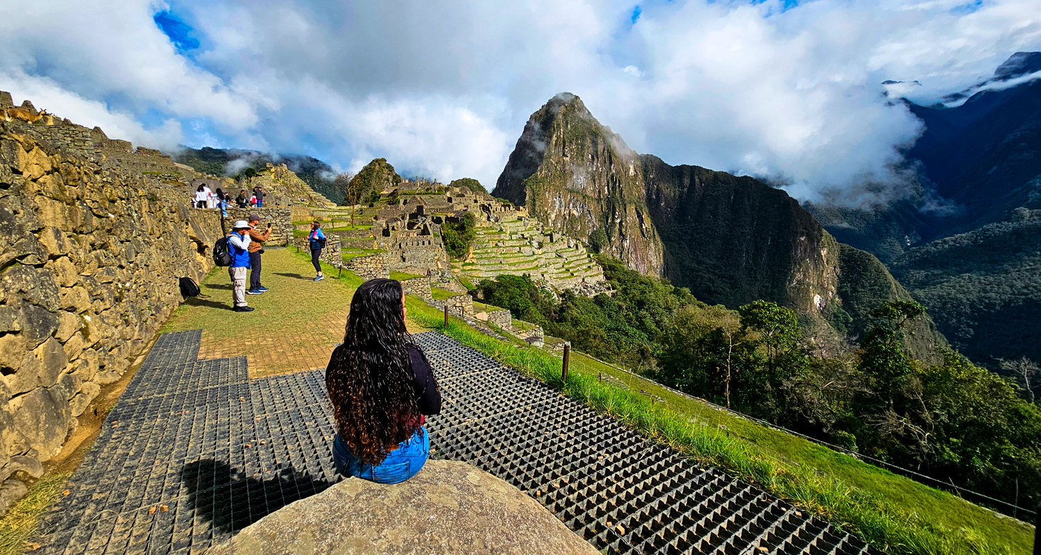
The Classic Inca Trail is not a flat path. Its route climbs and descends across three mountain passes in four days, each with its own altitude, landscape, and level of physical difficulty. Understanding what each pass involves before starting the trek allows you to prepare more precisely and get more out of the experience on the trail. This article describes the three passes with real data: verified altitudes, terrain characteristics, ascent times, and what travelers find at each summit.
What is a mountain pass on the Inca Trail?
A mountain pass, also called an abra in Quechua and in Andean Spanish, is the highest point of a stage before the descent begins into the next valley. On the Inca Trail, the three passes mark the transitions between the four stages of the route and serve as both geographic and emotional landmarks for groups on the move.
The three passes are crossed in chronological order: Warmiwañusca on the second day, Runkurakay on the morning of the third day, and Phuyupatamarca on the afternoon of the third day. Each one has a distinct character in terms of scenery, effort, and archaeological context.
First section: Warmiwañusca (4,215 meters)
The name and its meaning
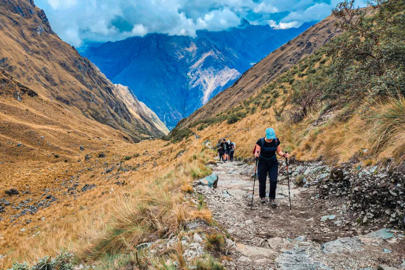
Warmiwañusca means “Dead Woman’s Pass” in Quechua. The name refers to the profile formed by the mountain ridge when viewed from the Cusichaca Valley: a silhouette that local residents have historically interpreted as the figure of a reclining woman. It is the highest pass on the route and the one that demands the greatest physical effort of the four-day trek.
Location and route context
Warmiwañusca is crossed on the second day of the Classic Inca Trail. The day begins at the Wayllabamba campsite, located at 3,000 meters above sea level at the confluence of the Llulluchayoc and Cusichaca rivers. From that point, the ascent to the top of the pass covers approximately 1,200 meters of elevation gain in a stretch that takes between four and six hours depending on the group’s pace and level of acclimatization.
The ascent
The section from Wayllabamba to the summit of Warmiwañusca is the most demanding on the Inca Trail. The trail climbs steadily without any meaningful stretches of flat ground for rest. Above 3,600 meters, the vegetation changes from cloud forest to open puna grasslands, which eliminates shade and exposes the group to wind and direct solar radiation.
The final section, the last 400 meters of elevation gain before the summit, is steep, with uneven stone steps and muddy areas at any time of year. This is the point where altitude sickness has the greatest impact on those who have not acclimatized properly: oxygen availability at 4,215 meters is approximately 40% lower than at sea level.
The ascent from Wayllabamba usually takes anywhere from three hours for groups in good physical condition to five hours for groups moving at a more relaxed pace. There is no correct pace: the goal is to reach the summit, not to get there quickly.
The summit
From the summit of Warmiwañusca, on clear days, you can see the snow-capped Salkantay to the south (6,271 meters, the highest peak in the massif) and the snow-capped Huayanay to the north. The view toward the Pacaymayo Valley, which opens immediately on the other side of the pass, contrasts with the ascent landscape: while the uphill side is open and windy, the downhill side is covered by dense cloud forest with lush vegetation.
It is common for groups to make an extended stop at the summit to catch their breath, take photos, and celebrate the highest point of the trek together. Guides often mark this moment with an explanation of the meaning of the pass and the Andean cosmological context of the apus surrounding the summit.
The descent toward Pacaymayo
The descent from Warmiwañusca to the Pacaymayo campsite (3,600 meters) takes between an hour and a half and two and a half hours. The trail drops along moss-covered stone steps and stretches of damp earth. Trekking poles are especially useful on this section: the knees absorb a considerable amount of impact on long descents like this.
By the time the group reaches the Pacaymayo campsite, it has completed the most difficult segment of the Inca Trail. The scenery from camp, surrounded by cloud forest with orchids and tree ferns, is one of the most memorable on the route.
Second section: Runkurakay (3,998 meters)
The name and its archaeological context
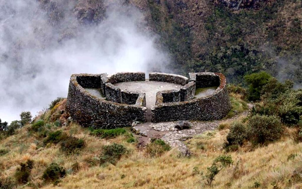
Runkurakay is not just the name of the pass: it is also the name of the archaeological site located just before the summit. The word in Quechua can be translated as “round basket” or “egg,” referring to the oval shape of the main structure. The complex is one of the tambos on the Inca Trail, control and rest stations distributed along the road network of the Tahuantinsuyo.
Location and route context
Runkurakay is crossed on the morning of the third day. The day begins at the Pacaymayo campsite, and the ascent to the pass is considerably less demanding than Warmiwañusca: the elevation gain is approximately 400 meters over a stretch of about an hour and a half to two hours.
The ascent and the archaeological site
The trail from Pacaymayo climbs through cloud forest vegetation with wild orchids and bromeliads. Before reaching the pass, the trail goes through the archaeological site of Runkurakay itself, a well-preserved group of semicircular stone structures built without mortar.
The Runkurakay tambo functioned as a control and rest point for the chasquis, the messengers of the Inca Empire who traveled the Tahuantinsuyo road network. The oval layout of the main structures is unusual in Inca architecture, where rectangular enclosures are more common. Some archaeologists suggest that the circular shape may have been linked to the site’s lookout function, since it visually dominates both the Pacaymayo Valley and the access to the next section.
The summit
At 3,998 meters, the Runkurakay pass is the lowest of the three. From the top, there is a view of Yanacocha Lake, a dark-colored body of water surrounded by puna grasslands at 3,800 meters above sea level. On clear days, the snow-capped Salkantay is also visible to the south, although from a different angle than from Warmiwañusca.
Runkurakay is the pass that receives the least attention in travel accounts of the Inca Trail, probably because it falls between the emotional impact of Warmiwañusca the previous day and the archaeological density of the third day. Still, its context as an active tambo of the Tahuantinsuyo makes it the richest of the three in historical terms.
The descent toward Sayacmarca
From the summit of Runkurakay, the descent leads to the archaeological site of Sayacmarca in approximately 45 minutes. Sayacmarca, which can be interpreted as “inaccessible town” or “dominant place,” is built on a rocky ridge with 270-degree views over the valley. Its enclosures, stairways, and water channel systems are in remarkable condition and represent one of the most archaeologically dense points of the third day.
Third section: Phuyupatamarca (3,650 meters)
The name and its meaning
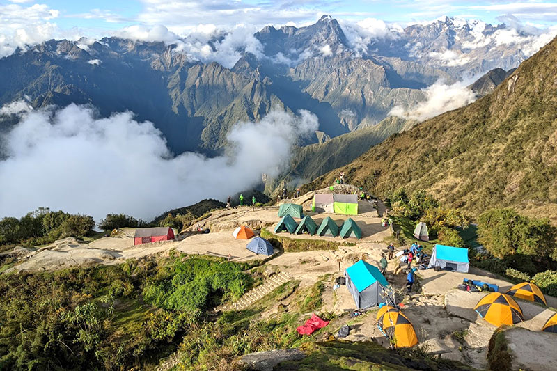
Phuyupatamarca means “town above the clouds” or “place in the height of the clouds” in Quechua. The name describes the experience of reaching this pass at any time of year with remarkable accuracy: clouds rising from the Urubamba Canyon often wrap around the summit and the archaeological site of the same name located just below the pass.
Location and route context
Phuyupatamarca is crossed on the afternoon of the third day, after visiting Sayacmarca and continuing along one of the best-preserved sections of the original Inca Trail paving. The climb from the descent of Runkurakay to this third pass is moderate and technically the least demanding of the three: the elevation gain is approximately 200 meters, and the trail partly follows the original Inca stonework in very good condition.
The ascent and the archaeological site
Before reaching the pass, the trail crosses a transition zone between the puna grasslands and the beginning of the upper cloud forest. The presence of orchids increases noticeably on this section, with species blooming among the mosses and ferns covering the rocks along the path.
The archaeological site of Phuyupatamarca, located just below the pass on the slope facing the Urubamba Canyon, is one of the most impressive hydraulic complexes on the Inca Trail. It has six ceremonial water fountains that still function today, fed by a channel system that captures water from the mountain springs and distributes it in steps among the structures. The sound of running water moving through the stone buildings is one of the sensory details most remembered by visitors to the site.
The summit and the view over the Urubamba Canyon
From the Phuyupatamarca pass at 3,650 meters, when weather conditions allow, it is possible to see both the snow-capped Salkantay to the south and the deep canyon of the Urubamba River to the west, with the high jungle spreading across the lower slopes. On completely clear days, some groups have reported being able to see the citadel of Machu Picchu from this point, although the canyon clouds make that uncommon.
This is the pass from which the ecosystem change that defines the Inca Trail can be seen most clearly: the transition from high-altitude grasslands to the high jungle begins visually from the summit.
The descent toward Wiñaywayna
The descent from Phuyupatamarca to the Wiñaywayna campsite (2,650 meters) is the longest and technically most demanding descent on the entire route. It covers approximately 1,000 meters of elevation loss along moss-covered Inca stone steps, with stretches of vegetation so dense that the trail remains in shadow even at midday.
The descent takes between an hour and a half and two and a half hours. This is the section where the most knee injuries occur on the entire Inca Trail, especially in groups that do not use trekking poles. The constant humidity of the cloud forest makes the steps slippery year-round, regardless of the season.
Upon reaching Wiñaywayna, the group finds the final campsite of the route and the archaeological site of the same name: cascading agricultural terraces along the hillside, residential structures, and another series of ceremonial water fountains that complete the hydraulic sequence that began at Phuyupatamarca.
Comparison of the three passes
| Feature | Warmiwañusca | Runkurakay | Phuyupatamarca |
|---|---|---|---|
| Altitude | 4,215 m | 3,998 m | 3,650 m |
| Day of the trek | Day 2 | Day 3 (morning) | Day 3 (afternoon) |
| Elevation gain from the previous campsite | ~1,200 m | ~400 m | ~200 m |
| Approximate ascent time | 3 to 5 hours | 1.5 to 2 hours | 1 to 1.5 hours |
| Associated archaeological site | None at the summit | Runkurakay tambo | Ceremonial fountains of Phuyupatamarca |
| Ascent difficulty | High | Moderate | Low to moderate |
| Descent difficulty | Moderate | Low | High (moss-covered steps) |
| Ecosystem at the summit | Open puna grasslands | Puna with lake | Puna-cloud forest transition |
How to prepare physically for the three passes
Acclimatization in Cusco beforehand
All three passes rise above 3,600 meters, and the highest reaches 4,215 meters. The human body needs between 48 and 72 hours to begin physiological adaptation to altitude: increased breathing rate, greater red blood cell production, and adjustment of the blood’s acid-base balance. Arriving in Cusco with at least two full days before starting the trek is the minimum recommended.
During those acclimatization days, moderate walks around Cusco (the San Blas neighborhood, Sacsayhuamán, Qenqo) at between 3,400 and 3,600 meters prepare the cardiovascular system for the effort of the second day without creating accumulated fatigue.
Training before the trip
The Inca Trail does not require the fitness level of a mountaineer, but it does require a functional aerobic base. People who arrive with no prior training usually complete the route, but with a significantly higher level of discomfort, especially on the ascent to Warmiwañusca.
Recommended activities in the two months before the trip:
- Hikes with at least 400 meters of elevation gain, twice a week
- Stair workouts with a backpack weighing 5 to 7 kilograms
- Sustained aerobic cardio for 45 to 60 minutes, three times a week
- Specific quadriceps and calf training for the descents
Altitude medication
Acetazolamide (Diamox) is the reference medication for preventing acute mountain sickness. It works by stimulating breathing and speeding up the adaptation process to altitude. It is started 24 hours before ascent and continued during the first days of exposure. It requires a medical prescription and can cause mild side effects such as increased urination and a tingling sensation in the hands and feet. Consulting a doctor before the trip is essential.
Weather conditions at the passes
Warmiwañusca in the dry season (May to October)
The wind at the summit can be intense, especially between June and August. Temperatures at the pass range from 2 °C to 8 °C during the day, with a significantly lower wind chill. Skies are usually clear in the early morning hours and become cloudier toward midday. An early departure from Wayllabamba (between 6:00 and 7:00 a.m.) maximizes the chances of a clear summit.
Warmiwañusca in the rainy season (November to April)
Rain can appear at any time. The ascent becomes more slippery, and wind with rain at the summit lowers the apparent temperature significantly. A waterproof jacket stops being optional and becomes essential gear from the very start of the climb.
Runkurakay and Phuyupatamarca
Both passes are exposed to fog rising from the Urubamba Canyon during the afternoon. The best visibility conditions at these two passes occur in the early hours of the third day. The pace on the third day is usually more relaxed than on the second, which allows more time to enjoy the archaeological sites along the way.
The passes of the Inca Trail of the Tahuantinsuyo
The three passes are not geographical obstacles that the trail crosses out of necessity. Their route responds to a logic of deliberate design: Inca engineers chose to cross these specific ridgelines to connect the Cusco highlands with the Urubamba high jungle fringe in the most efficient way possible, taking advantage of points where the terrain allowed passage without requiring extreme engineering works.
The fact that the trail climbs to 4,215 meters when it could have followed lower-altitude routes suggests that the alignment may also have had a ceremonial function. Mountain passes are spaces of transition in Andean cosmology: the point where the upper world (hanan pacha) and the lower world (ukhu pacha) meet the present world (kay pacha). Crossing a pass was not just a logistical necessity, but an act with ritual significance.
The archaeological sites located at the passes or immediately before them, such as the Runkurakay tambo and the fountains of Phuyupatamarca, reinforce that interpretation: they are spaces for pausing, offering, and reorganizing before continuing to the next section of the sacred road.
Frequently asked questions about the three passes of the Inca Trail
Which of the three passes is the most difficult? Warmiwañusca, without a doubt. It is the highest (4,215 meters), the one with the greatest elevation gain from the previous campsite (approximately 1,200 meters), and the one crossed at the point of greatest accumulated fatigue on the route, at the beginning of the second day when acclimatization is still incomplete. The other two passes are considerably less demanding on the ascent.
Is it possible to cross all three passes in one day? Not within the standard four-day itinerary. Warmiwañusca is crossed on the second day, and Runkurakay and Phuyupatamarca on the third. Technically, a group in extremely strong physical condition could compress the trek into fewer days, but the standard permit covers four days with designated campsites and does not allow itineraries outside that structure.
What happens if someone cannot make it over Warmiwañusca? Guides have established protocols for these situations. The first option is an extended rest with hydration and ibuprofen for altitude headache. If the person cannot continue, the descent back to Wayllabamba is the only way out: there is no direct ground medical evacuation from the summit of the pass. In serious cases, the guide team can coordinate an assisted descent and the return to Cusco from the Wayllabamba community.
Can you go directly down to Aguas Calientes from any of the passes? Not from the passes themselves. The only side exit from the protected corridor within the Classic Inca Trail route is at Kilometer 104, the starting point of the short trail. Once that point has been passed on the way toward Wiñaywayna, the only option is to continue to Aguas Calientes.
Do the passes have SERNANP checkpoints? The formal checkpoints are in Wayllabamba, at the start of the ascent to Warmiwañusca, and in Wiñaywayna, before the final section. The passes themselves do not have permanent checkpoints, although SERNANP staff carry out regular supervision patrols throughout the corridor.
What time is best to reach the summit of Warmiwañusca for good visibility? Between 9:00 and 11:00 a.m. is the window with the highest probability of clear skies during the dry season. Leaving Wayllabamba between 6:00 and 7:00 a.m. makes it possible to arrive during that time at a moderate pace. Clouds from the valley begin to rise around midday and usually cover the summit in the afternoon hours.


