
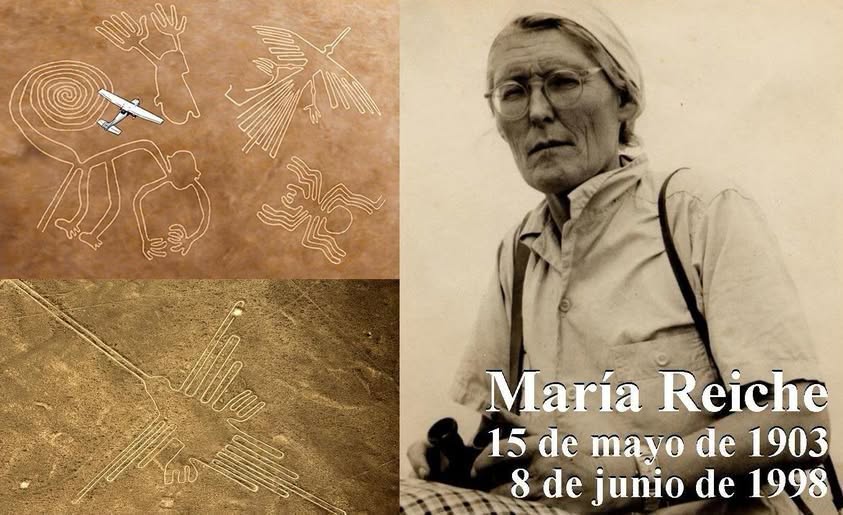
Across the desert plains of Nazca and Palpa, the ground preserves an open air archive of straight lines, trapezoids, spirals, and figures of animals and people drawn across the desert gravel. This vast collection developed over nearly two thousand years. Today, researchers understand the techniques used to create the geoglyphs and part of their chronology in considerable detail. What remains unresolved is what these markings meant to the people who made them.
The landscape is not a single drawing
A geoglyph is created by removing the layer of dark stones on the surface and exposing the lighter ground underneath. The contrast alone is enough to make the design visible. Some figures can be recognized from a distance, while complex geometric networks only begin to make sense when viewed as a whole.
UNESCO places most of this activity between 500 BC and AD 500. One phase is associated with the Paracas culture, around 400 to 200 BC, and another with the Nasca culture, around 200 BC to AD 500. The landscape was reused over time. Some lines cross over others. Saying that the Nasca people created everything oversimplifies a much longer history.
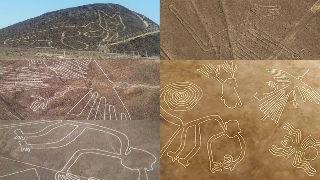
How the Nazca Lines were made
There is no need to imagine impossible tools. Stakes, ropes, and reference points are enough to align and enlarge designs. Stakes have been found beside some of the lines. The real challenge was planning the designs and coordinating the work across an enormous desert plain.
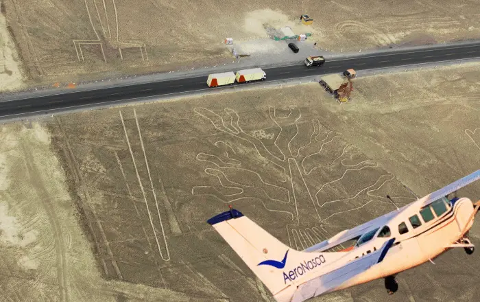
The climate did the rest. Extreme dryness slowed erosion and kept the lines visible. That same dryness also makes them fragile. A tire track or trench can remain visible for decades.
From the ground to the airplane
People living in the area had always seen lines across the desert. The twentieth century “discovery” was something different. It involved measurement, photography, and scientific debate.
In 1926, Toribio Mejía Xesspe and Alfred Kroeber documented lines and figures near Cantalloc. Mejía Xesspe continued studying the subject and presented his ideas at the International Congress of Americanists in Lima in 1939. He interpreted the lines as paths used for ceremonial purposes. From the ground, however, it was still difficult to understand the full scale of the phenomenon.
The first aerial photographs appeared around 1929. As flights became more common during the 1930s and 1940s, researchers realized that many of the lines formed animal figures and that the trapezoids were not natural features of the landscape. Aviation did not create the mystery. It changed the scale of the question.
Kosok, Reiche, and the idea of the sky
Paul Kosok arrived in the late 1930s. In 1941, he studied the site with support from Peruvian aviation and connected certain alignments with the Sun. He proposed that some of the lines had an astronomical function.
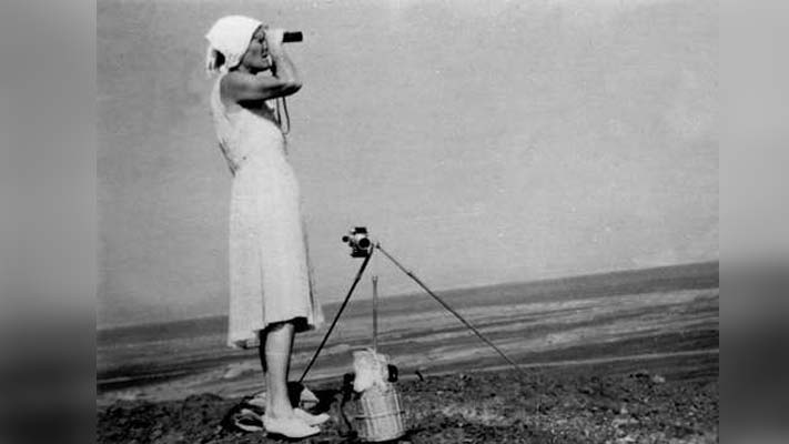
María Reiche, a German mathematician who settled in Peru, continued exploring that idea and spent decades measuring and drawing the lines while also calling for their protection at a time when the site had little supervision. She believed that some of the lines served as an agricultural calendar. Her work helped bring Nazca to international attention.
Later research did not confirm the existence of a single astronomical calendar capable of explaining the thousands of lines. Some intriguing alignments remain, but they are not enough to explain the entire site.
What researchers debate today
Several interpretations exist, and more than one may be correct.
Some straight lines point toward features in the sky. That does not mean the entire desert plain functioned as an observatory.
Other lines appear to have been routes. People may have walked along them, stopped, and made offerings. Seen this way, the site becomes a ritual and social landscape rather than an image meant only to be viewed from a distance.
In a desert, water shapes everyday life. For that reason, researchers also study possible connections with fertility rituals, travel routes, and control of agricultural territory.
The most cautious approach is not to force every geoglyph into a single explanation. A trapezoid stretching for kilometers and a small figure beside an ancient path do not necessarily have to come from the same purpose.
What the evidence does not support
The idea of extraterrestrial visitors became popular during the twentieth century, but it is not supported by archaeological evidence. The geoglyphs can be explained through human labor, repetition, planning, and knowledge of the landscape. The real question is why these societies invested so much time in reshaping the desert plain.
The map is still growing
In 2024, a team from Yamagata University, using tools developed with support from IBM, identified potential geoglyphs in high resolution images and then verified them in the field. In six months, the researchers confirmed 303 figurative geoglyphs that had not been included in the previous inventory. Many are smaller and appear near ancient paths, while others are connected with larger networks of lines. This strengthens the possibility that different types of geoglyphs served different purposes.
In 1994, the Lines and Geoglyphs of Nasca and Palpa were added to the UNESCO World Heritage List. From Mejía Xesspe to modern drones, the objective has remained similar: document, protect, and understand a desert that continues to reveal new pieces of its history. The mystery does not depend on fantasy. It exists because no surviving text explains what each line meant.


