2026 Book your spot for the Inca Trail 2026!

Inicio » Cusco » Page 8

The altitude of the Rainbow Mountain, also called Vinicunca, is approximately 5,200 m s. n. m. according to the official tourism inventory. The viewpoint that most travelers reach sits near 5,036 m s. n. m. Because of this elevation, it is advisable to acclimate before doing the excursion.

The mountain and the viewpoint are not always at the same altitude, since the tourist point is located along the access trail and the mountain formation extends over a larger area. At this altitude there is less oxygen available, so the hike can be demanding even for people in good physical condition.

What altitude is the Rainbow Mountain at?

Vinicunca is registered at 5,200 m s. n. m. in the official tourism inventory. This figure corresponds to the formation known as the Rainbow Mountain, located in the upper area of the Vilcanota mountain range, in Cusco.

The observation point visited during the excursion is usually around 5,036 m s. n. m. It is normal to find small differences between sources, because the measurement can vary depending on whether the mountain, the viewpoint, the trail, or the parking area is taken as the reference.

Altitude of Vinicunca in meters and feet

The official reference altitude of Vinicunca is 5,200 m s. n. m., equivalent to about 17,060 feet above sea level. This figure helps explain why the climb requires different preparation than other attractions near Cusco.

It is best not to confuse this altitude with that of the start of the route, the parking area, or the final stretch of the trail. Each section of the route is at a different elevation, and the visitor does not necessarily reach the highest point of the mountain formation.

Altitude of the Rainbow Mountain viewpoint

The tourist viewpoint of the Rainbow Mountain sits at approximately 5,036 m s. n. m. From there you get the usual view of Vinicunca and of the high-mountain landscape that surrounds the route.

This point is one of the highest sectors reached during the excursion. Although the final distance may seem short, walking at that altitude requires managing your effort, breathing calmly, and paying attention to any symptom.

Comparison between the altitude of Cusco and Vinicunca

The city of Cusco is located at about 3,399 m s. n. m., while Vinicunca reaches 5,200 m s. n. m. The difference is around 1,800 meters, a considerable change for the body.

For this reason, sleeping one or more nights in Cusco does not necessarily mean being adapted to the altitude of the Rainbow Mountain. The excursion takes you to an area much higher than the city and requires additional caution.

Why is it hard to breathe on the Rainbow Mountain?

At higher altitude, the atmospheric pressure decreases and the body receives less oxygen with each breath. The air still contains oxygen, but its lower pressure means the body has to work harder to make use of it.

During the hike, that change is felt more intensely because the muscles need more oxygen. That is why breathing fast, moving slowly, or getting tired sooner than usual can happen even in active travelers.

Effects of altitude on the body

At altitude, the body needs to increase its work to carry out activities that would be easy at a lower elevation. It is common to feel fatigue, rapid breathing, a slower walking speed, or a slower recovery after a slope.

Adaptation does not depend on willpower or training alone. The body needs time to gradually adjust to the lower oxygen availability, and that response varies from one person to another.

Why the hike can feel harder

The difficulty of the route does not depend solely on its kilometers, the condition of the path, or the slope. The elevation of the viewpoint means that a relatively short hike can feel much more demanding than expected.

The cold, the wind, the uneven terrain, and a very early departure can also increase the feeling of effort. For that reason, the goal should not be to finish fast, but to keep a safe and sustainable pace.

What is altitude acclimatization?

Acclimatization is the natural process by which the body gradually adapts to a lower oxygen availability. During that period, the body makes adjustments that allow it to better tolerate staying and doing physical activity in high places.

This process does not happen immediately upon landing in Cusco. Arriving from a city near sea level and doing Vinicunca the same day or the next can increase the chance of feeling unwell during the excursion.

How much time to acclimate before visiting Vinicunca

There is no number of days that completely eliminates the risk of altitude sickness. As a prudent measure, it is a good idea to first spend a reasonable period in Cusco or combine your arrival with lower-elevation destinations before scheduling Vinicunca.

Many travelers book the Rainbow Mountain after several days of adaptation and moderate activities. The decision should take into account how each person feels, their itinerary, and any prior medical recommendation.

Does everyone acclimate in the same way?

No. The response to altitude can vary even among people of a similar age, with the same level of physical activity, or who follow the same itinerary. Some adapt quickly and others need more time.

Being in good physical condition helps in facing the effort of the trail, but it does not guarantee immunity from altitude sickness. An athlete can also develop symptoms if they climb too fast or do not respect their body’s signals.

How to acclimate before climbing the Rainbow Mountain

Acclimatization is helped by a gradual ascent, rest, and moderate activities during the first days of the trip. These measures can reduce the risk of discomfort, though they do not guarantee that a person will not develop symptoms at altitude.

Before the excursion, it is a good idea to plan the itinerary with some margin. This lets you observe how your body responds in Cusco and adjust the plan if persistent headache, unusual fatigue, or other discomfort appears.

Staying in Cusco first

Avoid scheduling Vinicunca immediately after arriving from Lima, the coast, or another low-altitude city. It is preferable to first stay in Cusco and do calm activities that do not require intense physical effort.

A gentle city walk, visits near your lodging, and a rest day can be reasonable options at the start. If there is already significant discomfort in the city, it is not wise to assume that the body will tolerate a higher elevation well.

Doing lower-altitude activities

During the first days you can prioritize city tours and attractions located at a lower altitude than Vinicunca. This helps you keep an active itinerary without immediately exposing the body to more than 5,000 m s. n. m.

The choice of activities should be made with judgment. An apparently simple tour can be quite demanding if it includes many stairs, long walks, or is done at a high elevation.

Resting before the excursion

Sleeping properly the night before helps you arrive with better energy reserves for the transfer and the hike. It is also a good idea to avoid intense workouts, nights out, or physically demanding days before the climb.

Rest does not replace acclimatization, but it reduces factors that can make the route harder. If you sleep poorly for several days or have accumulated exhaustion, it is prudent to consider whether it is worth rescheduling the excursion.

Eating lightly

Before the hike, it is preferable to choose simple, moderate meals that are easy to digest. A very heavy meal can increase discomfort during the vehicle ride or the climb.

There are no foods that cure or prevent altitude sickness on their own. Food should be seen as support for maintaining energy, not a substitute for gradual adaptation or for a medical evaluation when one is needed.

Maintaining proper hydration

Drink water regularly during the days before and throughout the excursion. The cold weather can make the sensation of thirst weaker, even though the body still needs fluids.

Proper hydration does not by itself prevent altitude sickness, and drinking too much is not advisable either. Each traveler should adjust their intake to their needs, activity, and health conditions.

Avoiding alcohol before the climb

It is advisable to avoid alcohol before the hike, especially the night before. It can affect the quality of your rest, promote dehydration, and increase the feeling of fatigue the next day.

In addition, some effects of alcohol can be confused with altitude-related discomfort. Arriving rested and clear-headed enough to recognize symptoms makes it easier to make safe decisions during the route.

How to walk at more than 5,000 meters of altitude

Walking at more than 5,000 m s. n. m. requires managing your energy from the start. The priority should be to move safely, breathe in a controlled way, and stop when the body needs it, not to be the first to reach the viewpoint.

The route, the weather, and the condition of the terrain can vary. Always follow the guide’s instructions, stay on the designated paths, and avoid moving away from the group without letting anyone know.

Walking slowly and keeping a steady pace

Take short steps and keep a pace that lets you breathe without feeling excessive effort. Starting too fast tends to cause early exhaustion and makes it harder to catch your breath on the slopes.

Brief, regular pauses can be useful for drinking water, adjusting your clothing, and catching your breath. You do not have to wait until you are completely exhausted to slow down.

Avoiding competing with other travelers

Each person responds differently to altitude. Trying to keep up with travelers who walk faster can push you to a level of effort that does not match your physical condition or your adaptation.

It is preferable to tell the guide if you need to move slowly or take a break. Arriving safely matters more than the time spent completing the trail.

Using trekking poles

Trekking poles can provide stability on uneven terrain and reduce part of the load on your legs. They are especially useful on the descents, where the ground can be loose, wet, or slippery.

Use them at an adjusted height and without turning them into a reason to rush your pace. The poles support your walking, but they do not reduce the exposure to altitude or replace proper acclimatization.

Protecting yourself from the cold and the wind

In high-altitude areas, the weather can change quickly. Dressing in layers lets you add or remove garments depending on the wind, the sun, the rain, or the physical effort each stretch demands.

Bring a waterproof jacket, a hat, and gloves, even if the morning starts clear. Getting cold during a break can make the hike feel more uncomfortable and difficult.

Common symptoms of altitude sickness

After ascending quickly, some people may develop symptoms related to altitude. Knowing them lets you report any discomfort in time and avoid continuing when the body is not tolerating the elevation well.

This information is for guidance and does not replace a medical evaluation. If the symptoms are intense, progress, or raise doubts, you should follow the guide’s instructions and seek professional care.

  • Headache and fatigue
  • Dizziness, nausea, and loss of appetite
  • Difficulty sleeping

Is it advisable to take medication for the altitude?

It is not appropriate to recommend altitude medication in a general way or to promote self-medication. Needs, medical history, allergies, and ascent itineraries are different for each traveler.

People with a history of altitude sickness or with plans for a rapid ascent should consult a health professional beforehand. Medical guidance makes it possible to assess risks and receive personalized instructions before the trip.

Consulting a doctor before the trip

A medical consultation is advisable for travelers with heart, respiratory, neurological, or other relevant conditions. It may also be necessary if you take medication regularly or have had previous problems at altitude.

The professional will be able to assess whether the itinerary is suitable and what precautions apply in each case. Bring clear information about the altitude of Cusco and Vinicunca so the evaluation takes into account the real demand of the route.

Why you should not rely on medication alone

No medication replaces gradual acclimatization, the monitoring of symptoms, or descending when it becomes necessary. Relying only on a pill can lead you to ignore signals that require stopping the activity.

Planning, rest, walking pace, and communication with the guide remain central measures. If a professional has indicated a treatment, it should be followed only according to that instruction.

Infusions and traditional remedies

Some travelers drink traditional infusions during their stay in Cusco. They can be part of local or personal habits, but they should not be presented as scientifically proven methods to prevent or cure altitude sickness.

If there is any medical condition, pregnancy, allergy, or ongoing treatment, it is a good idea to consult before consuming herbal products. The safe response to worsening symptoms remains stopping the ascent and descending if appropriate.

Who should take greater precautions

Some people should seek medical guidance before exposing themselves to high altitudes such as that of Vinicunca. This does not mean the excursion is ruled out, but rather that the decision should be made individually and in a well-informed way.

Beyond health, you should consider physical capacity, previous experience at altitude, the time available to acclimate, and the conditions on the day of the visit.

Travelers with heart or respiratory conditions

Travelers with heart or respiratory conditions should consult a professional before booking the hike. The altitude and the physical effort may require a specific evaluation to determine the necessary precautions.

They should also carry the personal medications indicated by their doctor and keep them in an accessible place. The guide should be aware of any condition that could affect the safety of the route.

People with a history of altitude sickness

Having experienced altitude sickness on previous trips can be a reason to plan the acclimatization with more care. It is a good idea to mention this history when booking and to seek medical guidance before traveling.

A history does not allow you to predict with certainty how the response will be on a new trip, but it does justify adopting a more gradual itinerary and paying special attention to the first symptoms.

Children and older adults

For children and older adults, the decision should consider their state of health, physical capacity, previous experience at altitude, and tolerance for long walks. Age alone does not determine whether a person can take part.

When there are previous illnesses, doubts about adaptation, or mobility limitations, a professional assessment is advisable. It is also a good idea to confirm with the operator the real characteristics of the available route.

Preparing for a high-altitude tour

Before booking, review the planned pace of the hike, the open route, the departure time, the company of the guide, and the services included. Access conditions can change due to weather, maintenance, or local rulings.

Also ask about the emergency protocol and what happens if a traveler needs to descend before reaching the viewpoint. Having this information avoids rushed decisions on the day of the excursion.

Booking an organized excursion

An organized excursion lets you coordinate transport, schedules, and company during the hike. To review the logistics, the level of demand, and the services of the departure, you can check the 7-Color Mountain tour before deciding on your date.

Before confirming, verify whether the operator includes a guide, meals, admission, poles, or assistance during the route. Do not take for granted that all tours offer the same services or follow the same route.

Checking the safety equipment

Ask whether the operator carries a first-aid kit, supplemental oxygen for emergencies, means of communication, and staff trained to respond to altitude-related problems. These resources should be part of a clear protocol, not just a commercial promise.

Asking about the available assistance does not replace the individual responsibility to acclimate and report symptoms. Even so, it helps you choose a departure that is better prepared to handle unexpected situations.

Informing the guide about medical conditions

Before starting the hike, tell the guide about any relevant medical condition, allergy, regular medication, or history of altitude sickness. This information can be useful if you need support during the route.

Informing them does not mean you have to share unnecessary details with the whole group. It is enough to give the person in charge the information that could affect a safe response in an emergency.

Group with an agency

What to bring to handle the altitude and the weather

Preparation for Vinicunca should include suitable clothing for temperature changes, sun protection, and basic items to stay comfortable during the hike. The high-mountain weather can go from intense sun to wind, cold, or rain in a short time.

The gear does not replace acclimatization or eliminate the effects of altitude, but it helps reduce avoidable discomfort. Check the forecast before setting out and confirm which items the tour provides.

  • Clothing for changing temperatures
  • Protection against solar radiation
  • Water and snacks
  • Personal medications

Bring only the medications prescribed for you and keep them in their original packaging. It is helpful to have them accessible and not at the bottom of a backpack that may be hard to open during a break.

Do not share medications with other travelers or use altitude products without professional guidance. When symptoms worsen, the priority is to alert the guide and consider descending.

Frequently asked questions about the altitude of the Rainbow Mountain

These answers clarify the most common questions about the altitude of Vinicunca and the precautions before the hike. Personal conditions and the available route can vary, so it is always a good idea to confirm the details before setting out.

At how many meters is the Rainbow Mountain?

Vinicunca has an official reference altitude of 5,200 m s. n. m. The tourist viewpoint is usually located near 5,036 m s. n. m., so both figures can appear in different sources without necessarily being contradictory.

How many days do you need to acclimate?

There is no identical amount of time for everyone. The prudent approach is to first spend a reasonable period in Cusco, do moderate activities, and observe how your body responds before scheduling the excursion to Vinicunca.

Can you visit Vinicunca on your first day in Cusco?

It is usually not advisable if you arrive directly from a low-altitude city. The jump from Cusco, at 3,399 m s. n. m., up to the Vinicunca viewpoint means a considerable climb in a short time.

Can a person in good physical condition get altitude sickness?

Yes. Physical condition helps with the muscular effort, but it does not guarantee that the body will adapt without symptoms to the lower oxygen availability. Acclimatization is still necessary for all travelers.

Is it normal to get tired during the hike?

It is common to feel greater effort because of the altitude, even on short stretches. However, intense, progressive symptoms, or ones present while at rest, should not be ignored and should be reported to the guide.

What should I do if I get a headache during the climb?

Stop, let the guide know, and rest. Do not keep climbing if the pain increases, does not improve, or appears together with dizziness, nausea, loss of coordination, or other symptoms.

Does portable oxygen prevent altitude sickness?

Supplemental oxygen can be used as temporary support in certain situations, according to the operator’s protocol or professional guidance. It does not replace descending, medical evaluation, or proper acclimatization.

Can you go up on horseback to avoid the effects of altitude?

A horse can reduce part of the physical effort on some stretches where this service is available, but it does not eliminate the exposure to altitude. Even while riding, a person can develop symptoms and should inform the guide.

What is the altitude difference between Cusco and Vinicunca?

Cusco is located at about 3,399 m s. n. m. and Vinicunca at 5,200 m s. n. m. The approximate difference is 1,800 meters, a clear reason to acclimate before doing the excursion.

Inicio » Cusco » Page 8

The best time to visit the Maras Salt Ponds is usually between May and October, during Cusco’s dry season. In those months there is less rain, more hours of sunshine, and better conditions for touring the area and observing the pools. Even so, this attraction can be visited year-round: the experience changes with rainfall, the salt production process, and the number of visitors present.

The Maras Salt Ponds are made up of thousands of pools fed by a saltwater spring. Their appearance is not identical every day or in every season. The light, the water level, the work in each pool, and the rains all influence the tones and textures the traveler will see.

What is the best season to visit the Maras Salt Ponds?

The dry season, from May to October, usually offers the most favorable weather conditions for visiting the Maras Salt Ponds. The days tend to be clearer and rain is less frequent, which makes the trip from Cusco or the Sacred Valley easier and lets you take in the landscape more fully.

The choice depends on each traveler’s priorities. Those looking for clearer skies and stable conditions for photography tend to prefer the dry season. Those who value green landscapes or want to avoid part of the tourist crowd may consider the rainy season, especially outside of holidays and high-demand dates.

Visiting the Maras Salt Ponds in the dry season

The dry season generally runs from May to October. It is marked by less frequent rainfall, sunny days, and temperatures that can drop quite a bit during the night and the early morning hours. The sun can feel intense even when the air is cool.

These conditions tend to make touring the viewpoints and designated trails more comfortable. They also favor the evaporation of the saltwater in the pools, a process related to the formation of the salt crystals. Even so, the specific state of each pool depends on the management carried out by the producing families.

Weather and the state of the pools

With less rain and more sun exposure, the water in the pools tends to evaporate more easily. This can make it possible to see the white surfaces or the salt deposits that form during the crystallization process more clearly.

The appearance varies from pool to pool because not all of them are in the same production stage. Some may have more water, others may show visible crystals, and others may be under maintenance. For that reason, it is best not to expect the whole set to have a single color or a uniform look.

Advantages of traveling between May and October

Between May and October there tend to be clearer days, good visibility of the surroundings, and less muddy paths. These conditions help those who want to combine Maras with Moray or other places in the Sacred Valley in a single day.

It is also a favorable time for taking photos with well-defined light and a lower chance of rain during the tour. The trade-off is that it coincides with the high tourist season in Cusco, so the crowds can grow, especially between June and August.

Disadvantages of the dry season

The main disadvantage is the larger presence of visitors. Organized groups, tour vehicles, and independent travelers tend to concentrate during the middle hours of the day, especially during school vacations, weekends, and holidays.

Mornings and nights can be cold, while at midday the solar radiation is strong. A common mistake is bringing only light clothing because the day looks clear. The most practical approach is to dress in layers to adapt to the temperature changes.

Maras in the dry season

Visiting the Maras Salt Ponds in the rainy season

The rainy season usually runs from November to April, with the heaviest rain typically between January and March. During these months the Sacred Valley landscape takes on greener tones, but sudden rains, cloud cover, and quick changes in trail conditions can also occur.

Visiting the salt ponds at this time is possible, though it requires more flexibility. Rainfall can change the look of the pools and affect the comfort of the tour. It is a good idea to leave room in your itinerary, check the forecast, and avoid fully relying on a sunny morning.

Weather and trail conditions

In the rainy season, short or prolonged rainfall can occur, even if the day starts clear. Dirt and stone surfaces can become wet or slippery, so it is recommended to walk carefully and respect the marked areas.

Before setting out, check the local forecast and bring footwear with good traction. A light rain jacket is more useful than an umbrella in open areas, since it leaves your hands free to walk and steady yourself on trails with uneven ground.

Changes in the landscape and the pools

The rains make the nearby hills and fields look greener. In exchange, the cloud cover can reduce the direct light and change how the colors in the pools are perceived. For some travelers, this setting offers photos with contrasts different from those of the dry season.

Rainwater can change the level, the color, and the appearance of the pools. You should not assume that all of them will be active or that they will look the same during a visit. Production follows its own rhythms, and each pool may be in a different phase.

Advantages of traveling in the rainy season

One advantage is the greener landscape around Maras, especially after periods of rain. There may also be fewer visitors outside of Christmas, New Year, Holy Week, and other high-demand holidays.

Those traveling on flexible dates can take advantage of moments of good light between rain showers. To do so, it is advisable to plan the visit early and bring protection for cameras, phones, and documents. Fewer people does not mean the place will be empty, but it can allow for a more unhurried tour on certain days.

Maras in the rainy season

What is the best month to visit the Maras Salt Ponds?

There is no single perfect month for all travelers. May, June, September, and October tend to offer a favorable balance of relatively dry weather, visible landscapes, and crowds that can be more manageable than in the peak months of international vacations.

June can have very clear days, though it also receives many visitors because of the high season in Cusco. May and October are transition months that can combine pleasant conditions with less saturation compared to July and August. September usually keeps a good chance of dry days, though changes in the weather may already appear toward the end of the month.

What is the best time of day to visit the Maras Salt Ponds?

The early morning hours tend to be a good option for finding fewer visitors, moderate temperatures, and enough time to tour without rushing. The afternoon can also offer good light, but you need to factor in the return trip and weather changes, especially between November and April.

The official opening hours can change based on local rulings, maintenance, or the season. It is a good idea to verify them before traveling and to arrange your return transport in advance, especially if you visit Maras on your own from Cusco or the Sacred Valley.

Visiting the salt ponds in the morning

During the early hours there are usually fewer groups at the viewpoints and visitor paths. The temperature can be cool, especially during the dry season, but walking is more comfortable before the solar radiation increases.

The morning light can be favorable for observing the contours of the pools and taking photos without as many people around. Bring a warm layer you can put away later, along with sunscreen, since the sun gains intensity quickly.

Visiting the salt ponds in the afternoon

The afternoon light can highlight the textures, the changes in elevation, and the color variations in the pools. It is an interesting option for photography, as long as you have enough time to complete the tour and return without rushing.

During the rainy season, conditions can change quickly in the afternoon. If dark clouds form or it starts to rain, it is better to prioritize safety while walking. Also check that the transport you hired waits for the agreed amount of time.

Visiting the salt ponds in the afternoon

How does the weather affect salt production?

Salt production depends on the evaporation of the saltwater that flows toward the pools. When there are dry, sunny days, the water evaporates faster and crystal formation is favored. This process is one of the factors that explains why the dry season tends to be favorable for observing certain production stages.

Rain does not necessarily stop all activity, but it can alter the pace of work. The water level rises, the salt concentration can vary, and crystallization can progress more slowly. For that reason, the appearance of the salt ponds is tied both to the weather and to the work carried out in each pool.

Salt production during the dry season

The solar radiation and the low frequency of rain make it easier for the water in the pools to evaporate. As the water decreases, the salt concentrates and crystals can form that are later gathered according to the producers’ work schedule.

For the visitor, this can mean a greater chance of observing surfaces with salt deposits. However, not all the pools are harvested at the same time. Respecting the access limits and not walking on the structures is an essential part of a responsible visit.

Salt production during the rainy season

Rainfall can dilute the water in the pools, raise its level, and reduce the rate of evaporation. As a result, the crystallization process can be slower or show changes compared with the dry months.

This does not mean the salt ponds lose their visual appeal. The set can show reflections, different tones, and a greener setting. The difference is that the traveler should adjust their expectations and understand that salt production responds to variable natural conditions.

Dry season in Maras
Dry season in Maras

When are there fewer tourists at the Maras Salt Ponds?

The smaller crowds usually occur during the low season, between November and March, outside of holidays and festive dates. It is also more likely to find fewer visitors on weekdays and during the first opening hours.

Weekends, Holy Week, the Fiestas Patrias, Christmas, and New Year can increase the number of travelers, even in rainy months. If you are looking for a quieter tour, avoid arriving at midday and try not to schedule your visit on the dates of heaviest tourist activity in Cusco.

Tips for visiting the Maras Salt Ponds by season

Cusco’s weather can change quickly at any time of year. Dressing in layers, bringing water, and protecting yourself from the sun are useful measures in both the dry season and the rainy months. It is also a good idea to wear non-slip footwear, since some stretches can have uneven surfaces.

Do not enter the pools or leave the authorized routes to get photos. Beyond avoiding accidents, this practice helps protect a workspace that is still used for salt production. If you need to arrange transport, schedules, or a route that includes Maras and Moray, Incredible Peru Tours can guide you with that logistics before your trip.

What to bring during the dry season

During the dry season, bring sunscreen, a hat or cap, sunglasses, and enough water. Sun exposure can be intense, even on days with cold wind. A light long-sleeve layer can also help protect your skin.

Wear light clothing for the day, but add a jacket or warm layer for the morning and the late afternoon. If you leave Cusco early, you will feel lower temperatures before the sun warms the surroundings.

What to bring during the rainy season

In the rainy season, include a rain jacket, a waterproof case or bag for electronic devices and documents, and footwear with good traction. An umbrella can help during short stops, but it does not replace a waterproof garment during the tour.

If your itinerary continues to other places after Maras, bring a change of clothes or at least extra socks. Avoid smooth-soled footwear, since wet paths can be slippery. Keep your phone and camera protected even if the rain seems light.

Dry season
Dry season

Frequently asked questions about the best time to visit the Maras Salt Ponds

These answers help resolve common questions before choosing the date and time of your visit. Conditions can vary depending on the day’s weather and the activity in the pools.

Can the Maras Salt Ponds be visited year-round?

Yes, the Maras Salt Ponds can be visited year-round. The difference lies in the weather, the condition of the paths, and the appearance of the pools.

In the dry season there is less rain, while in the wet months the landscape tends to look greener and the pools can change in appearance.

When are there fewer tourists?

There are usually fewer visitors during the low season, mainly between November and March, outside of holidays. Weekdays also tend to be quieter.

To reduce the crowds, it is best to arrive in the early morning hours and avoid weekends or festive dates in Cusco.

In which season are the salt pools best observed?

During the dry season it is usually easier to observe the evaporation and the salt deposits, thanks to the greater sun exposure and the lower frequency of rain.

The exact appearance depends on the work done in each pool. Not all of them have the same water level or the same amount of crystals.

Is it advisable to visit the salt ponds during the rainy season?

Yes, it is possible to visit the salt ponds during the rainy season. The traveler should be prepared for rainfall, temperature changes, and wet paths.

A rain jacket, non-slip footwear, and a flexible itinerary make the visit more comfortable during those months.

What clothing should you bring by season?

Year-round, it is recommended to dress in layers, because temperatures can vary between the morning, midday, and afternoon.

In the dry season, add sun protection and a light jacket. In rainy months, prioritize waterproof garments and footwear with good traction.

What is the best time of day to take photos?

The morning and the late afternoon hours usually offer softer light for photographing the pools and their contours. In the morning there may also be fewer people.

The final lighting depends on the cloud cover and the day’s weather conditions. In the rainy season, it is a good idea to anticipate possible changes in light and rainfall.

Inicio » Cusco » Page 8

The Maras Salt Ponds are a group of thousands of small pools where salt is produced through the natural evaporation of saltwater. They sit in a ravine near the town of Maras, in the Sacred Valley of Cusco. Their terraced arrangement along the hillside creates an unusual landscape, made up of ponds of different shades and sizes. Production follows traditional techniques that families from the Maras community have passed down across generations.

The visit lets you observe a water-use system that remains active. More than a photo spot, the salt ponds are a place of community work where the flow, the channels, and the pools require constant maintenance. The look of the site changes with the season, the amount of water, and how far the evaporation has progressed.

History of the Maras Salt Ponds

The history of the Maras Salt Ponds is tied to the long-term use of a spring with a high salt concentration. The available evidence indicates that the use of this resource predates the Inca period and that salt played a practical role in food, in preserving products, and in exchange among the region’s populations.

There are also local accounts about the origin of the salty water and the ponds. These stories are part of Maras’s memory, but they should be distinguished from the historical and archaeological information that can be verified through studies and documented sources.

Origin of the Maras Salt Ponds

Salt extraction in this area dates back to times before the Inca Empire. The presence of the salt spring and the location of the ravine allowed different populations to make use of the resource through pools built on the natural slope.

There is no single, fully verified date for when all of the current pools began. The system has been adapted, repaired, and expanded over time, so its present appearance is the result of an ongoing process of collective work rather than a structure built at one single moment.

The presence of the salt spring and the location of the ravine

The salt ponds during the Inca era

During the Tahuantinsuyo, salt was a necessary product for daily consumption and for preserving food. Its value did not depend on cooking alone: it made it possible to store meat, fish, and other products that had to be transported or kept for longer periods.

Exchange routes connected areas with different resources, and salt was part of that flow. The salt ponds near Maras offered a valuable resource for the surrounding populations and for exchanges with other parts of what is now Cusco.

The Maras Salt Ponds today

The pools continue to be worked by families from the Maras community. Each unit requires controlling the arrival of water, removing sediment when necessary, and harvesting the salt after the crystals form.

Production activity coexists with tourism. For that reason, traveler access is organized through authorized routes and sectors, in order to avoid damage to the walls, the channels, and the areas that remain in use.

Maras today
Maras today

How do the Maras salt pools work?

The Maras salt pools work through a simple process, though it requires constant care: saltwater from a spring is directed into small pools, and the sun evaporates the liquid until salt crystals are left behind. The slope of the ravine lets the water flow by gravity.

The outcome depends on factors such as the intensity of the sun, rainfall, the flow of the spring, and how each pool is managed. When it rains often, evaporation decreases and production can slow down.

Where the salty water comes from

The water comes from a natural spring located in the upper part of the ravine. Before it surfaces, it passes through geological formations that add minerals and salts, so it reaches the surface with a high salt concentration.

The exact geological origin of that salinity is part of the studies on the area, but for the operation of the salt ponds the key factor is controlling the flow. The water must arrive at a steady rate to feed the pools without overflowing them or altering the dividing walls.

Water distribution through channels

From the spring, the water is carried through small channels toward the different terraces. These conduits distribute the flow among the pools and take advantage of the natural incline of the terrain so the water moves without the need for pumps.

Filling is controlled by hand. Workers open, close, or adjust the water passages according to the state of each pool, a task that requires knowing how the flow behaves and the production conditions of each day.

Evaporation and crystallization of the salt

Once the pool is full, the water stays exposed to the heat and the wind. As the water evaporates, the salt concentration rises until crystals begin to form on the bottom and the edges of the pool.

The appearance of the surface changes during this process. Some pools look wet and dark when they have just received water; others take on lighter tones when crystallization is more advanced and the salt layer covers a larger part of the bottom.

Extraction and gathering of the salt

When the salt layer reaches the right thickness, workers remove it with hand tools. The salt is gathered carefully so as not to damage the bottom of the pool or the edges that hold the water.

After gathering, the pool can be filled again to start another cycle. During favorable periods, this process can be repeated several times, though the frequency depends on the weather and the particular state of each pool.

Extraction and gathering of the salt

What are the Maras salt pools like?

The Maras pools are small, irregularly shaped ponds distributed across different levels on the hillside. They are separated by low walls made mostly of mud and stone, materials that help hold the water and guide its path.

From the authorized trails you can see an extensive network of compartments that follows the contour of the ravine. This adaptation to the terrain is one of the features that sets the salt ponds apart from other salt-production systems.

Construction of the pools

The pools were adapted to the natural shape of the mountain. Instead of fully leveling the hillside, work surfaces were created at different heights to make it easier for water to arrive from the upper channels.

The walls require periodic repairs, especially after heavy rains or when the water alters small parts of the edges. Keeping them in good condition is necessary to prevent leaks between pools and to maintain control of each one.

The landscape formed by the pools

The colors of the Maras Salt Ponds range from white to brown, beige, and pink. These changes are related to the amount of water, the stage of evaporation, the minerals present, and the light the ravine receives throughout the day.

In the dry season, many pools show lighter surfaces because of the salt buildup. In rainy periods, water can cover more pools and the earthy tones become more prominent. For that reason, photographs of the site can look very different depending on the visit date.

Salt process pools
Salt process pools

Traditional salt production in Maras

Salt production in Maras is artisanal and is organized around the management of the family pools. The work includes channeling the water, watching the evaporation, tending the walls, and gathering the salt at the right moment.

Not all the pools are in the same phase at the same time. While some are being filled, others are evaporating or ready for harvest. This variety helps you understand that the complex works as a network of small production units.

The work of the Maras families

Many pools are managed and worked by families from the Maras community. The use of these spaces remains tied to family and communal relationships, with specific responsibilities for the care and use of each pool.

Knowledge about managing the water and gathering the salt is passed down across generations. This continuity makes it possible to preserve practices suited to the conditions of the ravine, without relying on industrial processes for the basic production.

Salt production season

Production depends directly on weather conditions. The dry season tends to favor faster evaporation, because there is more sun and less rain to dilute the saltwater collected in the pools.

During the rainy season, the process can slow down and the look of the pools changes. If your main interest is seeing pools with more crystallization, it is worth checking recent conditions before planning the visit.

Types of salt obtained

Maras salt can be sold in different presentations, such as coarse salt, fine or ground salt, and pink salt, depending on its selection and later processing. You can also find products intended for culinary use and others for non-food purposes.

The color can vary because of the natural presence of minerals and the degree of refinement of the product. When buying salt, check the labeling, the origin, and the use recommended by the producer, especially if you are looking for a food-grade presentation.

Families at work
Families at work

Historical and cultural importance of the salt ponds

The Maras Salt Ponds represent a continuity of local practices for making use of a natural resource available in the ravine. The system combines knowledge of the terrain, control of the water, and organization among families who keep the pools active.

Their cultural value is also tied to the persistence of an economic activity connected to the place. Responsible visiting helps ensure that tourism does not interfere with the daily work or with the preservation of the channels and walls.

Salt in the Andean economy

Salt was used for daily consumption and for preserving food. In areas where products had to be stored or moved, having salt made it possible to extend their use and reduce losses.

It also served as a good for exchange among communities from different regions. Territories with access to salt could trade it for agricultural products, fibers, meats, or other resources that were not available in their immediate surroundings.

Traditional knowledge of the community

Managing the channels requires knowing when to divert the water, how long to keep a pool full, and how to prevent leaks. These decisions are adjusted to the slope, the flow, and the changes in the weather.

The gathering techniques also aim to protect the structure of each pool. The care built up over generations allows the pools to keep producing and lets the system keep working with simple tools.

Salt in the Andean economy

What to see during a visit to the Maras Salt Ponds

During a visit you can observe the terraced pools, the channels that carry the saltwater, and the relief of the ravine. At some points along the route you can see the relationship between the production terraces and the spring that feeds the system.

The visit should be done from the designated paths. Access to work areas can vary depending on production, safety, and the conservation measures in effect at the complex.

Viewpoints over the salt pools

The authorized viewpoints and trails let you take in the extent of the pools and their distribution across the hillside. From there it is easier to understand how the channels connect the upper areas with the pools located at lower levels.

Respect the barriers, the signs, and the restricted areas. Getting close to the edges or crossing walls to take a photo can affect production, damage the structures, and create risks for other visitors.

Artisanal production process

Depending on the season and the time of day, you may be able to observe some stages of the artisanal work. You might find pools being filled, surfaces where the water is evaporating, or workers removing salt that has already crystallized.

There is no guarantee of seeing a specific phase on any given visit, because the work responds to the weather and the families’ planning. If you want to understand the process better, watch from the permitted areas and avoid interrupting those who are working.

Maras viewpoint
Maras viewpoint

How to visit the Maras Salt Ponds

The Maras Salt Ponds can be visited from Cusco, Urubamba, or Ollantaytambo by organized tour, private transport, taxi, or a combination of public transport and local service. The choice depends on your budget, the time you have available, and whether you want to combine the visit with Moray.

From Cusco, the visit usually requires several hours between transfers and the walk itself. From Urubamba or Ollantaytambo, the distance is shorter, though it is still a good idea to arrange your return transport before reaching the area.

Visiting the salt ponds with an organized tour

Many tours combine the Maras Salt Ponds with the archaeological site of Moray and, in some cases, with Chinchero. This option simplifies transport, avoids having to negotiate several trips separately, and lets you see the sites along a planned route.

Before booking, confirm whether the price includes admission, guide, pickup, return to Cusco, and visiting time at each stop. If you need to arrange a private route or combine Maras with other Sacred Valley activities, Incredible Peru Tours can help you organize the logistics according to your itinerary.

Visiting the salt ponds on your own

On your own, you can first reach the town of Maras and from there continue by taxi or local transport toward the salt ponds. Another option is to hire a private vehicle from Cusco, Urubamba, or Ollantaytambo to make the trip with more flexibility.

This option can be convenient if you are traveling in a group, but it requires arranging the trip there and back in advance. A common mistake is arriving without confirmed return transport, especially when the number of local taxis is limited.

Maras visit with a travel agency

Admission and hours for the Maras Salt Ponds

Admission to the Maras Salt Ponds is paid separately and is normally not included in the Cusco Tourist Ticket. The fee, opening hours, payment methods, and access conditions can change, so they should be verified through official sources or with the local administration before publishing or traveling.

As a practical note, bring cash in soles and ask whether other payment methods are accepted on the day of your visit. It is not wise to assume that admission included in a tour covers every payment: always check the services detailed in your booking.

Are the Maras Salt Ponds included in the Tourist Ticket?

No. The Maras Salt Ponds usually have a separate admission and are not part of the Cusco Tourist Ticket. Because of this, you should factor in this additional payment when calculating the total cost of the excursion.

Access conditions can change based on decisions by the community or the site’s administration. Confirm the current information before setting out, especially if you are visiting on your own or traveling during high season.

Recommended time to visit the salt ponds

The early morning hours usually have fewer visitors and offer good conditions for touring the viewpoints more calmly. The soft light can also help you appreciate the color differences between the pools.

Avoid arriving too late if you depend on local transport to return. Factor in travel time, possible rain, and the length of your stops if you plan to combine the visit with Moray or other nearby places.

Best time to visit the Maras Salt Ponds

The dry season tends to be the most favorable for observing the evaporation process and finding trails with less mud. The sunnier days help the water evaporate more quickly, so some pools may show more visible salt layers.

During the rainy season the landscape is also interesting, but the pools can look wetter and the paths may have mud or slippery surfaces. Wear footwear with good soles and check the condition of the route if you plan to travel on your own.

Tips for visiting the Maras Salt Ponds

Before visiting the Maras Salt Ponds, try to acclimate to the altitude of Cusco if you have just arrived in the region. Although the visit does not require a long hike, the altitude, the sun, and moving along uneven paths can feel more demanding than expected.

Bring sun protection, a hat, water, layered clothing, and comfortable footwear with firm soles. The weather can change during the day, and mornings or afternoons can be cool even when it is sunny.

  • Do not touch the saltwater or enter the pools.
  • Do not cross the walls or the areas marked off for visitors.
  • Respect the families who are working and avoid blocking the channels.
  • Bring cash in soles for payments that do not accept cards.
  • If you are traveling on your own, arrange your return transport before starting the visit.

Caring for the site depends largely on how visitors behave. Following the local instructions helps protect both the salt production and safety on a hillside with narrow, uneven surfaces.

Frequently asked questions about the Maras Salt Ponds

These answers gather common questions that come up when planning a visit to the Maras salt pools. Access conditions and production activity can vary, so it is a good idea to confirm operational details before traveling.

How many salt pools are there in Maras?

The complex is made up of thousands of small salt pools spread across the ravine. The figures reported can vary depending on the count and the use status of the pools, so it is better not to use an exact number without an updated official source.

Why is the water in Maras salty?

The water is salty because it passes through geological formations that contain minerals and salts before surfacing at the spring. That natural concentration means that, as the water evaporates, salt crystals form in the pools.

Who owns the pools?

The pools are managed by families from the Maras community. The use of many of them can be passed down across generations, along with the responsibilities of maintenance and water management.

How is Maras salt obtained?

The saltwater is distributed through channels to the pools. Then the sun evaporates the water and leaves salt crystals, which are gathered by hand when they reach the right point.

Are the Maras Salt Ponds still in operation today?

Yes. The pools continue to be used to produce salt through traditional techniques. At the same time, they receive visitors and are one of the most visited spots in the area around the Sacred Valley.

Can you walk among the salt pools?

Access to certain sectors may be restricted to protect production and visitor safety. You should walk only along the designated trails and follow the instructions of the local staff.

Can you visit Moray and the Maras Salt Ponds on the same day?

Yes. Moray and the Maras Salt Ponds are relatively close and are often combined into a half-day excursion from Cusco. The total time will depend on traffic, the type of transport, and the planned stops.

How much time do you need to visit the salt ponds?

To walk the viewpoints and observe the pools, plan for roughly 45 minutes to 1 hour. If you include transfers, local shopping, or a combined visit with Moray, the total duration will be longer.

Inicio » Cusco » Page 8

How to get to Maras and Moray from Cusco depends on the time, budget, and level of comfort you’re after. Both attractions sit in the Sacred Valley of the Incas, roughly 40 to 55 km from Cusco depending on your destination and the route you take. You can go on an organized tour, use public transportation combined with local taxis, take a direct taxi, or hire a private service. Because they’re so close together, Moray and the Maras Salt Mines are normally visited on the same day.

The simplest option is usually a half-day tour, while going on your own can cost less but requires coordinating several legs of the trip. If you want to add Chinchero, have lunch in the Sacred Valley, or make photo stops, you’ll want a full day or a private transportation service.

Where are Maras and Moray?

Maras and Moray are located in the province of Urubamba, within the Sacred Valley of the Incas, in the Cusco region. Moray is an archaeological complex set on high ground, while the Maras Salt Mines sit on a nearby hillside, where thousands of salt evaporation pools spread across the slope.

From Cusco, the route generally follows the highway toward Chinchero and Urubamba. Chinchero comes before the Maras area when traveling from Cusco, and other nearby places include Urubamba, Ollantaytambo, and Pisac. This location makes it easy to fold the visit into a broader tour of the Sacred Valley.

Maras
Maras

Distance from Cusco to Maras and Moray

The road distance from Cusco to Moray is approximately 50 km, though it can vary depending on your starting point and the turnoff you use. It’s about 40 km to the town of Maras, while the salt mines are usually around 50 km from Cusco’s historic center.

These figures shouldn’t be taken as fixed measurements. The final distance changes if your vehicle leaves from a hotel outside the center, stops in Chinchero, or takes secondary roads. Detours, road work, and stops along the way also make a difference.

How long does the trip take?

The transfer from Cusco to Moray generally takes between an hour and a half and two hours by tourist transportation, taxi, or private vehicle. That time can stretch during busier hours, in the rainy season, or if you stop along the way.

Travel time isn’t the same as the total length of the visit. A half-day excursion usually runs 5 to 6 hours counting pickup, transfers, and stops. If you add Chinchero, a lunch, or more time at each site, plan on an 8 to 10 hour day.

How to get to Maras and Moray from Cusco

Your options are an organized tour, public transportation combined with local taxis, a taxi from Cusco, or a private service. The tour simplifies the logistics; public transportation cuts the cost but demands more coordination; and a taxi or private service gives you more freedom with your schedule.

Before choosing, consider whether you only want to see Moray and the salt mines or whether you’d like to add other spots in the Sacred Valley. Also check whether the price covers a guide, admission, waiting time, and the return to Cusco, since those items can change the final cost.

Moray
Moray

Getting there on an organized tour

An organized tour is a practical option if you’re in Cusco for only a few days or would rather not arrange transportation for each leg. It normally includes tourist transportation, a guide, and the tour of Moray and the Maras Salt Mines. Admission, meals, and personal expenses may or may not be included, depending on the operator.

To check the schedule, what’s included, and availability, take a look at the Maras and Moray tour in Cusco before booking. Shared tours typically cost around USD 20 to USD 45 per person, not counting admission when it isn’t expressly listed in the booking.

Getting to Maras and Moray on your own

You can visit Maras and Moray on your own, though you’ll need to combine intercity transportation, local shared vans, and often taxis. There’s no direct, steady public connection between all the attractions, so this option means leaving early and leaving yourself room for route or availability changes.

It can be an economical choice for travelers with time and some experience using local transportation. Getting around may run somewhere between USD 8 and USD 20 per person, depending on the taxis you need to hire and whether you share the ride. The main drawback is that the return to Cusco can be less predictable late in the afternoon.

From Cusco to Maras by public transportation

Shared vans and minivans to Urubamba generally leave from the area around Calle Pavitos and nearby streets in downtown Cusco. It’s worth confirming the exact departure point the same day, since stops and companies can change. There are also vehicles running routes toward Chinchero and Urubamba.

To continue on to Maras, you can get off at the Maras turnoff or go all the way to Urubamba first, depending on the vehicle’s route. From there you’ll need to find a local shared van or negotiate a taxi to the town. Ask ahead about the last return time, the drop-off point, and the fare, especially if you’re traveling in the afternoon.

How to get from Maras to Moray

There isn’t always direct, frequent public transportation between the town of Maras and Moray. In practice, many travelers hire a local taxi for that leg or arrange for a driver to wait while they visit.

Walking is possible in certain stretches, but the distances, the altitude, and roads without consistent signage can make it inconvenient. If you go this route, arrange your transportation before leaving Maras and confirm whether the driver can take you afterward to the salt mines or to Urubamba.

Getting there by taxi from Cusco

A taxi from Cusco lets you leave whenever you like, stop at viewpoints, and adjust the order of your visits. It’s a good option for couples, small groups, or travelers who want to avoid the fixed schedule of a shared tour.

A round trip with waiting time can cost roughly USD 60 to USD 110 per vehicle, depending on the length, the type of car, and the season. Agree in writing or by message on the total price, the stops, the waiting time, the fuel, the return to Cusco, and whether the driver knows the access roads to Moray and the salt mines.

Getting there by private transportation

Private transportation works well for families, groups, or anyone who wants to do the route at their own pace. It can include a van or car with a driver, hotel pickup, and stops set in advance, without depending on a shared group’s timing.

As a reference, a private service for a half-day route can start at around USD 90 and go past USD 160 depending on the number of passengers, the vehicle, and any added stops. This option makes it easy to combine Maras and Moray with Chinchero, Urubamba, or other spots in the Sacred Valley without switching vehicles.

Private Transportation

How to visit Maras and Moray by ATV

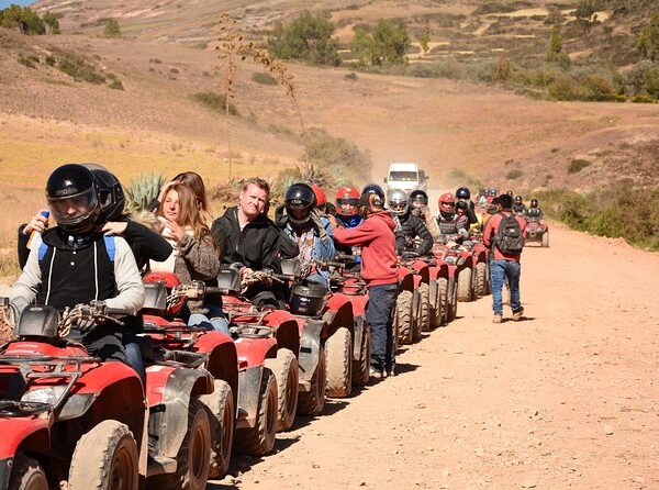
ATV tours generally run along rural roads near Maras and Moray. As a rule, you drive the ATV yourself on a set circuit, accompanied by a guide and after receiving basic handling and safety instructions.

Final access to certain points, such as the Maras Salt Mines, may be by support vehicle or additional transportation, since not every sector allows ATVs. Check which part you cover behind the wheel, what the price includes, and whether you need a license. Always follow the operator’s instructions, wear a helmet, and stay on the authorized route.

Recommended route for visiting Maras and Moray

A practical route from Cusco is to leave early for Moray, continue on to the Maras Salt Mines, and return via Chinchero or Urubamba, depending on the transportation you’ve hired. This order keeps you from doubling back on the same highway and makes better use of the daylight.

The final choice depends on your starting point, road conditions, and access hours. If you’re traveling on your own, it helps to settle each stop with the driver before setting out so you don’t lose time looking for a ride in rural areas.

Cusco, Moray, and the Maras Salt Mines

The usual order is Cusco, Moray, and then the Maras Salt Mines. Moray tends to come first because it sits at a higher elevation and fits well with routes passing through Chinchero. The descent to the salt mines then closes out the tour before heading back to Cusco.

This order can change based on the operator’s call, traffic, weather, or your pickup point. Some tours go to the salt mines first to avoid overlapping with other groups, while others reroute when road work or rain affects the secondary roads.

Combining Maras and Moray with Chinchero

Chinchero can be added to the route if you have a full day or if your Maras and Moray visit starts early. There you can see the archaeological site, the town, and some textile workshops, though what’s available depends on the hour and the program you choose.

It’s not a good idea to pack too many stops into a short itinerary. If you want to take Chinchero at an easy pace, have lunch in the Sacred Valley, or continue on to Ollantaytambo, plan a full day. On a half day, the sensible move is to focus on Moray and the Maras Salt Mines.

How much time you need to visit Maras and Moray

Seeing Moray and the Maras Salt Mines from Cusco normally takes 5 to 6 hours on an organized half-day excursion. The transfer eats up a meaningful part of the day, so don’t count only the time you’ll spend at each attraction.

At Moray, travelers usually spend 40 minutes to an hour. At the salt mines, 30 to 50 minutes is generally enough to walk the designated viewpoints, take photos, and browse the authorized stalls. These times can shift with the group’s pace and the weather.

Visiting Maras and Moray in half a day

A half-day visit covers Moray and the Maras Salt Mines with brief stops and a set schedule. It’s a good option if you have the afternoon free to explore Cusco, rest, or do something else without leaving the city.

For it to work well, you need to leave early or pick a tour with clear timing. This option leaves less room for delays, long lunches, or extra stops. If you go on your own, half a day can feel tight given the need to find shared vans and taxis at different points.

Visiting Maras and Moray in a full day

A full day lets you see both attractions without rushing, add Chinchero, or sit down for lunch in Urubamba. It also gives you more flexibility to stop at viewpoints, take your time, and adjust the pace for children, older travelers, or anyone still acclimatizing.

This option is worth it if you’re in a private service or want to connect the route with other places in the Sacred Valley. Avoid planning too many far-flung stops in a single day, since the roads and travel times can make the itinerary exhausting.

Maras Moray

Admission for Maras and Moray

Moray and the Maras Salt Mines use different tickets. Entering Moray requires one of the Cusco Tourist Ticket options, while admission to the salt mines is paid separately on site. Having your transportation sorted doesn’t mean admission is covered.

Rates, entry conditions, and hours can change. Check the current information on the official channels for the Cusco Tourist Ticket and the Maras Salt Mines before you travel. Carry cash in soles as a backup, since some points of sale don’t take cards.

Admission to Moray and the Tourist Ticket

Moray is included in Circuit III of the Cusco Tourist Ticket, known as the Sacred Valley Circuit. This option is valid for 2 consecutive days and also covers the archaeological sites of Pisac, Ollantaytambo, and Chinchero. The reference rate for foreign visitors is S/70, roughly USD 19, though you should confirm it before buying.

The Full Tourist Ticket also includes Moray and is valid for 10 consecutive days. Its reference price is S/130, roughly USD 35, and it grants access to more cultural and archaeological attractions in Cusco. Verify the options, rates, and conditions through official sources, since they can be updated.

Full ticket
Full ticket

Admission to the Maras Salt Mines

Admission to the Maras Salt Mines is paid separately and isn’t covered by the Cusco Tourist Ticket. The published reference rate for visitors is S/20, roughly USD 5.50 per person.

Before leaving Cusco, confirm the current price and payment method with the operator, the driver, or the salt mines administration. Carrying cash in soles helps you avoid trouble, especially if you’re visiting on your own without a guide to handle the entry.

Best time of year to visit Maras and Moray

The dry season, generally from April to October, brings more clear-sky days and less chance of rain. The highways and rural roads tend to be in better shape, though there are more visitors, especially from June to August.

During the rainy season, from November to March, the landscape usually looks greener and some hours draw fewer visitors. That said, rainfall can affect the secondary roads, cut visibility, and cause delays. Bring a rain jacket and build in extra time if you travel in those months.

Best time of day to leave Cusco

Leaving Cusco early helps you avoid some of the city traffic, make use of the natural light, and take the attractions at an easier pace. For a visit on your own, departing between 6:30 a.m. and 7:30 a.m. usually gives you more room to arrange transportation and get back before the shared vans thin out.

Half-day tours have set pickup times and can leave in the morning or the afternoon. If you take the afternoon slot, confirm the estimated return time and keep in mind you’ll have less daylight, especially between May and August.

What to bring to Maras and Moray

The temperature can shift over the course of the route thanks to the change in altitude and the variable weather of the Sacred Valley. Bring layered clothing, a light jacket, sunscreen, sunglasses, and a hat. Even if the day starts cold in Cusco, the sun can be intense at Moray and the salt mines.

It’s also worth carrying water, comfortable shoes with good soles, personal documents, and cash for admission, restrooms, small purchases, or local taxis. Between November and March, add a rain jacket or poncho. Stay on the marked trails to protect the setting and prevent accidents.

Tips for getting to Maras and Moray

If you’ve just arrived in Cusco, try to acclimatize for at least a day before taking on activities at high elevation. Moray sits above 3,500 m.a.s.l., so walking slowly, staying hydrated, and avoiding heavy meals before the tour can help you feel better.

Hire formal transportation or recommended drivers, confirm what’s included, and save the service’s contact details. Look into the required admission ahead of time and don’t assume you’ll be able to pay by card. If you’re going on your own, plan your return to Cusco before you set out, especially if you depend on shared vans.

Respect the trails, the restricted areas, and the instructions from staff. At the salt mines, don’t step into the pools or cross closed-off areas to take photos. These are working and conservation sites, so caring for the heritage should be part of your visit.

Maras

Frequently asked questions about getting to Maras and Moray

These answers cover common questions about routes, times, and forms of transportation from Cusco. Road conditions, rates, and hours can vary, so it’s worth confirming them before you leave.

Can you visit Maras and Moray on the same day?

Yes. Moray and the Maras Salt Mines are relatively close together and are normally part of the same excursion. A half-day tour is usually enough if you only want to see both places.

To include Chinchero, Urubamba, or a lunch stop, it’s better to book a full day. That way you avoid running the route on too tight a schedule.

Is it better to go on a tour or on your own?

A tour is better if you want comfort, a guide, and transportation coordinated from Cusco. It helps when you have only a few days available and want to avoid haggling over taxis or hunting for shared vans at different points.

Going on your own can be cheaper, but it takes time, organization, and flexibility. You’ll need to combine several legs and think ahead about how to get back from areas where public transportation is limited.

Which do you visit first, Maras or Moray?

The order depends on the route, the operator, the weather, and your pickup point. Many excursions visit Moray first and then the Maras Salt Mines, following a practical route from Cusco.

It’s also possible to do it the other way around. The best move is to confirm the itinerary before setting out and not worry too much about the order, since both places can be covered on the same day.

Can you get there by public transportation?

Yes, but there’s no simple, direct public connection for the whole route. From Cusco you’ll need to catch a ride toward Urubamba or the Maras turnoff and then continue by local shared van or taxi.

Getting between Maras, Moray, and the salt mines may require local taxis. This option works best if you leave early, carry cash, and have extra time in case of waits.

How much does it cost to get to Maras and Moray from Cusco?

A shared tour usually costs between USD 20 and USD 45 per person, without admission when it isn’t included. Taking public transportation and filling in with local taxis can cost roughly USD 8 to USD 20 per person, depending on the legs and whether you share the taxi.

A round-trip taxi from Cusco can run USD 60 to USD 110 per vehicle, while a private service can start at USD 90 and go past USD 160. Verify current rates before you travel and always confirm which services are included.

Inicio » Cusco » Page 8

Moray is an Inca archaeological site located near the town of Maras, within the Sacred Valley of Cusco. It’s known for its large circular terraces built into natural depressions in the ground, an unusual configuration among Inca agricultural systems. Its design, depth, and relationship with the landscape make it one of the most distinctive archaeological places in the area.

The exact function of Moray’s terraces is still being studied. The most widespread interpretation points to a space for agricultural experimentation, though there are also hypotheses involving crop adaptation and possible ceremonial uses. These theories should be understood as archaeological interpretations, not as settled conclusions.

What is Moray?

Moray is an Inca archaeological complex made up of several groups of circular and semicircular terraces. It sits near Maras, in the Cusco region, at an approximate altitude of 3,500 m.a.s.l. Its terraces were built by taking advantage of natural depressions, which were then transformed with retaining walls, stairways, and water management systems.

The best-known sector has a shape similar to a stepped amphitheater. The terraces descend gradually toward a deep center, creating levels with different conditions of sun exposure, wind, humidity, and temperature. This makeup has turned Moray into a key place for studying the agricultural and hydraulic knowledge developed during the Tahuantinsuyo.

Where is Moray located?

Moray is located in the district of Maras, province of Urubamba, within the Sacred Valley of Cusco. It’s roughly 50 km from the city of Cusco by road, though travel time usually runs between an hour and a half and two hours, depending on the route, traffic, and stops along the way.

The site is relatively close to the Maras Salt Mines, so both attractions are usually visited on the same outing. It’s also common to combine the visit with Chinchero. That closeness makes a half-day route workable, though you’ll want to account for the travel time to and from Cusco.

Why is Moray different from other Inca sites?

Moray’s main difference is its circular design. While many Inca terraces were built on hillsides to expand the land available for farming, here the terraces are arranged around natural depressions, forming concentric rings that step down toward the center.

Its various levels, the depth of the main sectors, and its precise adaptation to the topography set the complex apart from other agricultural systems in Cusco. Moray shouldn’t be understood as just a series of terraces: its layout reveals planning tied to the soil, the water, and the local climate conditions.

What are Moray’s circular terraces like?

Moray’s circular terraces are made up of stepped platforms bounded by stone walls. Each level follows the contour of the depression and connects to the others through stairways built into the walls. From the upper edges you can clearly see how the terraces descend step by step toward the center.

Along with the walls and stairs, the site shows evidence of channels and drainage solutions. The construction made it possible to stabilize the ground and carry rainwater away without letting it pool on the lower platforms. The site’s current condition also reflects conservation work carried out over the years.

The main sectors of Moray

The Moray complex is made up of several groups of terraces, not a single circular depression. The deepest and most photographed sector draws most of the attention, but there are other smaller groups nearby that help you grasp the full scale of the place.

During the visit, the terrace groups can be seen from trails, walking platforms, and authorized viewpoints. It’s worth walking slowly and pausing at the marked points, since the perspective from up top makes it easier to recognize the shape of the circles, the walls, and how the different sectors relate to one another.

The drainage system of the terraces

The terraces were designed to handle rainwater and reduce the risk of erosion or flooding. The walls, the internal layers of the terraces, and the conduits associated with the site would have helped keep the platforms stable through the wet season.

Some specific aspects of how Moray’s water system worked remain under study. That’s why it’s more accurate to say the site incorporates drainage solutions adapted to the terrain than to claim the original path of the water or the exact use of each channel is fully known.

MORAY

What were Moray’s circular terraces used for?

There’s no full consensus on Moray’s function. The best-known hypothesis suggests its terraces may have been used to observe how crops behaved under different environmental conditions. That idea rests on the variation between levels and on the possible differences in temperature and humidity within the depressions.

Interpretations tied to agricultural administration, the reproduction of conditions from different territories, and ceremonial activities have also been proposed. Popular accounts tend to present Moray as an Inca agricultural laboratory, but it’s worth recognizing that the archaeological evidence is still being weighed and that “laboratory” is a modern comparison.

Moray as a possible center of agricultural experimentation

The most widespread theory holds that Moray may have worked as a space for studying crops in distinct environments. The Incas managed products from regions with varied climates, so a place with terraces at different depths would have allowed them to observe how certain plants responded to local changes in temperature, humidity, and sun exposure.

This interpretation fits well with how central agriculture was to the Inca Empire, but it shouldn’t be presented as a proven fact in every detail. It isn’t known with certainty which species were grown at each level or how all the activities carried out at the complex were organized.

The microclimates of Moray

The depth, orientation, and arrangement of the terraces can create environmental variations between the upper and lower levels. Wind behavior, sun exposure, and moisture retention aren’t necessarily the same on every platform, especially at certain hours of the day or times of year.

These differences are usually described as microclimates. That said, the temperature figures that circulate about Moray should be treated carefully, because not all the published data comes from comparable studies or from measurements taken under the same climate conditions.

Crop adaptation at different elevations

One possibility raised by various studies is that the terraces allowed the Incas to observe how products from different parts of their territory adapted. The Tahuantinsuyo included valleys, highlands, and regions with different productive conditions, so knowledge about farming was key to running the state.

Moray may have been part of a broader network of agricultural management, seed exchange, and variety observation. This reading helps place the site within a complex territorial system, though it doesn’t let us claim that each terrace held a specific crop or served a single function.

MORAY

Did Moray also have a ceremonial function?

Some researchers and local traditions connect Moray with ceremonial activities, partly because of the shape of the site and the symbolic weight certain landscapes and built spaces could carry. The presence of ritual activity wouldn’t be incompatible with agricultural or administrative uses.

Even so, there’s no conclusive proof that would let us define Moray primarily as a ceremonial center. The most responsible approach is to treat this possibility as a complementary interpretation and avoid claiming the terraces were built exclusively for rituals.

How did the Incas build Moray’s terraces?

The Incas made use of natural depressions in the ground and turned them into systems of stepped platforms. To do that, they raised retaining walls, leveled growing surfaces, built stairways, and applied solutions for channeling or filtering water based on the soil’s characteristics.

Moray’s construction reflects a careful adaptation to the topography. Rather than reshaping the landscape entirely, the builders used the existing form of the hollows and organized the terraces around them. That choice reduced the need for large fills and let the complex blend into its setting.

Inca agricultural knowledge and engineering

Building terraces called for knowledge of gradients, wall stability, drainage, and soil quality. The Incas developed agricultural systems capable of making use of geographically complex spaces, from valleys to steep hillsides and areas of varying elevation.

At Moray, that knowledge shows in how the levels are organized and in the way the terraces adapt to the shape of the ground. The site makes clear that Inca agriculture didn’t depend only on expanding the area under cultivation, but also on controlling conditions that could affect crop yields.

Materials used in the terraces

Inca terraces were generally built with stone walls and internal layers meant to aid drainage and hold the agricultural soil in place. In different parts of Cusco, those layers could include larger stones, gravel, sand, and soil suited to farming, depending on what materials were available and on the conditions of the ground.

At Moray, the use of stone in the walls made it possible to define and stabilize the circular levels. The exact composition of each platform can vary and has to be analyzed sector by sector, so it’s best not to assume every terrace had the same internal structure or the same type of soil.

The importance of Moray during the Inca Empire

Moray may have been connected to agricultural production and to the knowledge needed to manage crops across different environments. In a state that administered vast and varied territories, the ability to select, adapt, and distribute products was fundamental to feeding the population and to economic organization.

The site is also linked to an understanding of ecological tiers, a principle that allowed the Incas to draw on resources from different altitudes. Although Moray’s specific administrative role can’t be determined with certainty, its design shows that managing the landscape and agricultural production involved complex planning.

Moray and the ecological tiers

Ecological tiers are altitude bands with different conditions of temperature, rainfall, soil, and vegetation. Those differences shape which products can be grown and which activities take place in each territory. In Cusco, a few kilometers can mean meaningful changes in climate and production.

The Incas made use of that diversity through exchange networks, population movement, and the complementary management of land. Moray’s possible connection to this system rests on the idea that its terraces allowed people to work with or study different environmental conditions within a single complex.

The value of agriculture for the Incas

Agriculture sustained the population’s food supply, the storage of goods, and the redistribution organized by the Inca state. Crops such as potatoes, corn, quinoa, and other foods adapted to specific conditions, which made knowledge of climate and soil decisive.

The expansion of the Tahuantinsuyo also required systems of collective labor, irrigation infrastructure, terraces, and storehouses. Sites like Moray are interpreted within that context, where producing food and reducing climate-related risk were part of territorial management.

What to see during a visit to Moray

During a visit to Moray you can take in the large circular terraces, the stone walls, the stairways, and the site’s secondary sectors. The viewpoints let you appreciate the depth of the depressions and the orderly shape of the levels, especially in the main group.

The route also offers views of the rural landscape around Maras and of the mountains ringing the Sacred Valley. Bringing a camera or a charged phone is useful, but avoid stopping in narrow passages or getting close to unmarked edges for a photo.

Viewpoints over the circular terraces

The viewpoints on the upper edges are the best places to grasp Moray’s scale and design. From there you can make out the sequence of concentric platforms and the way the terraces drop toward the center of each depression.

Always respect the marked zones, the barriers, and the instructions from site staff. Entering restricted sectors can affect the conservation of the walls and soil, and it creates risks from drop-offs, uneven surfaces, or access changes tied to maintenance work.

Trails and the archaeological route

The visit follows marked trails and authorized observation points. The route is relatively easy, though the altitude and uneven ground can tire out anyone who arrived in Cusco that same day or isn’t used to walking at high elevation.

To take in the complex without rushing, count on 45 minutes to an hour and a half inside the site. If you’re on a tour, check how much free time is included, since some tight itineraries leave little room to walk the secondary sectors and take photos at an easy pace.

Moray
Moray

How to visit Moray from Cusco

From Cusco you can visit Moray on an organized tour, by private transportation, by taxi, or by combining public transportation with a local taxi. The most practical option for most travelers is an organized route, especially if you want to include the Maras Salt Mines on the same day.

Going on your own gives you more flexibility with timing, but it means coordinating several legs and confirming access ahead of time. The road can vary depending on the route you choose, so it’s a good idea to leave early and allow extra time if you’re traveling in the rainy season.

Visiting Moray on an organized tour

Organized tours usually combine Moray with the Maras Salt Mines and, in some cases, with Chinchero. This option simplifies the transportation and makes better use of a morning or afternoon, though it normally follows a fixed schedule and the time at each attraction can be limited.

If you’re looking for a half-day outing that covers both places, take a look at the Maras Moray Tour in Cusco and confirm the pickup time, the admissions included, and the conditions of the route beforehand. Also check whether the service covers the Tourist Ticket and admission to the salt mines, since those are usually handled separately.

Visiting Moray on your own

To visit Moray on your own, you can take transportation from Cusco toward the Maras or Urubamba area and finish the trip with a local taxi. Another possibility is hiring a private taxi from Cusco for several hours, agreeing in advance on the route, the waiting time, and the return.

This option takes more planning, since public transportation doesn’t always drop you directly at the entrance to the complex. Ask about the last return time, carry cash in soles for local rides, and avoid depending on a tight connection if you have another transfer or activity scheduled that day.

Admission and hours for Moray

Entering Moray generally requires the Cusco Tourist Ticket in the option covering the Sacred Valley attractions. The Maras Salt Mines aren’t part of that ticket and normally charge separately. Access conditions can change due to rulings from cultural authorities or conservation work.

As a reference, the archaeological sites managed within this circuit generally operate during daylight hours, typically from morning until afternoon. Before you travel, confirm the hours, the current ticket option, prices, and restrictions directly through the official channels of the Comité de Servicios Integrados Turístico Culturales Cusco and the Ministry of Culture.

Is Moray included in the Tourist Ticket?

Moray is normally included in the General Cusco Tourist Ticket and in Circuit III, known as the Sacred Valley circuit. That option usually covers sites such as Pisac, Ollantaytambo, and Chinchero as well, along with other attractions listed in the ticket’s current terms.

Prices, validity periods, categories for national or foreign visitors, and rules of use can change. Don’t buy a ticket based only on old information: verify which option you need before your visit, especially if you plan to combine Moray with museums or sites from other circuits.

Ticket includes Moray

Recommended time of day to visit Moray

Visiting Moray in the early hours usually means fewer groups and softer light for photos. It can also work well if you want to continue on to the Maras Salt Mines, Chinchero, or another spot in the Sacred Valley without rushing the route.

Morning temperatures can be low, even in the dry season, so bring a warm layer. If you visit in the afternoon, keep in mind that the weather can shift quickly and that you need to account for the time it takes to get back to Cusco before local transportation thins out.

Best time of year to visit Moray

The dry season, which generally runs from roughly May to October, brings days with less chance of rain and roads that are usually more stable. It’s a good time for anyone who wants clear views and more predictable transfers, though it coincides with heavier visitor numbers in Cusco and the Sacred Valley.

During the rainy season, roughly November to March, the landscape tends to look greener and the fields take on more color. In exchange, you may run into heavy rain, mud on some trails, and quick weather changes. Bring a rain jacket and shoes with good soles, and avoid planning connections that are too tight.

Tips for visiting the Moray terraces

Before visiting Moray, try to acclimatize in Cusco for at least a day or two if you’re coming from a low-altitude city. Walk at an easy pace, drink water along the way, and avoid heavy meals or too much alcohol the night before. The altitude can affect even people who feel fine at the start of the trip.

Bring layered clothing, sunscreen, a hat, sunglasses, and a rain jacket depending on the season. The weather can move from a cold morning to intense midday sun to afternoon rain. Comfortable shoes with good traction are better than smooth-soled footwear.

Respect the marked trails and don’t climb on walls, closed platforms, or areas with barriers. Don’t leave trash behind or pick up stones, plants, or fragments from the site. A common mistake is assuming every sector is open: restrictions can change to protect areas under conservation.

Frequently asked questions about Moray

These answers cover common questions before visiting the circular terraces of Moray. For operational information such as access, hours, or tickets, confirm the current details before leaving Cusco.

Was Moray an Inca agricultural laboratory?

That’s the best-known theory about the site. The terraces are thought to have served for observing crops under different environmental conditions, but Moray’s exact function remains a subject of archaeological research. The word “laboratory” is a modern way of explaining that possible function.

Why are Moray’s terraces circular?

Their circular shape makes use of natural depressions in the ground and organizes different terrace levels around a central point. This design sets Moray apart from terraces built mainly on hillsides and may have influenced the conditions on each platform.

What temperature difference exists between the terraces?

Variations in temperature and humidity can occur between the upper and lower levels, due to depth, sun, and wind. That said, exact figures should come from verifiable studies, since much of the data repeated in guides and on social media doesn’t cite a reliable source.

Can you go down to the center of Moray?

Access to the terraces and the lower sectors depends on the site’s current restrictions. Some areas may be closed for conservation or safety. Follow the trails, barriers, and posted signs, even if you’ve seen older photos showing different routes.

Can you visit Moray and the Maras Salt Mines on the same day?

Yes. Moray and the Maras Salt Mines are close together and are normally visited on a half-day excursion from Cusco. Keep in mind that each place has different entry conditions and that the salt mines usually require a payment separate from the Tourist Ticket.

Inicio » Cusco » Page 8

Ollantaytambo is a town of Inca origin and an archaeological complex in the Sacred Valley of the Incas, at about 2,792 m.a.s.l. and roughly 72 km northwest of Cusco. It stands out for preserving an Inca street layout that’s still inhabited, for its terraces and temples built into a mountainside, and for being one of the main train stations serving Machu Picchu. On a visit you can tour the archaeological site, walk stone streets lined with water channels, see the qolqas of Pinkuylluna, and spend the night before continuing on to Aguas Calientes.

Why visit Ollantaytambo?

Ollantaytambo is one of the most complete destinations in the Sacred Valley because it brings together archaeology, local life, scenery, and transportation connections in a single place. Unlike other archaeological centers in the area, here the town itself is part of the visit: its narrow streets, irrigation channels, and walls preserve an urban organization dating back to the Inca period.

The archaeological complex lets you take in massive terraces, ceremonial enclosures, fountains, and defensive sectors. From the upper areas you can also see the valley, the town, and the nearby mountains. On top of that, Ollantaytambo simplifies logistics for travelers heading to Machu Picchu, since numerous daily trains to Aguas Calientes depart from its station.

History and importance of Ollantaytambo

Ollantaytambo was a highly significant Inca center during the reign of Pachacutec, probably from the 15th century onward. Archaeological evidence shows it served agricultural, administrative, religious, and military functions. Its location made it possible to control access through the Patacancha River valley and connect different sectors of the Sacred Valley.

The terraces turned steep hillsides into productive land and helped manage water and soil. The enclosures, plazas, channels, and storehouses reflect complex planning. Some popular stories link the place to figures and tales passed down over centuries, but it’s worth separating those traditional interpretations from the available archaeological evidence.

Ollantaytambo, the living Inca town

Ollantaytambo is often called a living Inca town because its historic urban design remains part of daily life. Many homes today stand on Inca foundations, while several streets keep their stone walls, narrow entrances, and a block layout that retains features of the ancient settlement.

The water channels running through town still serve a practical purpose. Walking the sectors near the square lets you see how residents, businesses, lodgings, and tourist services share a space that doesn’t function purely as a museum. So walk through it respectfully, without entering private courtyards or homes.

The battle of Ollantaytambo

In 1537, Ollantaytambo was the site of a clash between the forces of Manco Inca and Spanish troops led by Hernando Pizarro. The Inca army used its knowledge of the terrain, the terraces, and the channels to defend access to the town and slow the invaders’ advance.

The chronicles indicate that Manco Inca won a temporary victory here. Even so, Spanish military pressure continued and the Inca leader later withdrew toward Vilcabamba. The story of the battle helps explain why Ollantaytambo’s location and structures also served a defensive purpose.

What to see at the Ollantaytambo archaeological site

The Ollantaytambo archaeological site is toured mainly along the hillside overlooking the town. The circuit takes in terraces, stairways, stone enclosures, fountains, ceremonial sectors, and spaces tied to the administration of the settlement. The visit involves walking uphill, so set aside time to pause at the panoramic points.

The main entrance is near the square and the bridge over the Patacancha River. Most visitors walk the terraces first and continue on to the Temple of the Sun. A guide can add context about the function of each sector, though you can also tour the complex on your own.

Inca terraces and stairways

The terraces cover much of the mountain and showcase the Inca handling of slopes, drainage, and agricultural production. Some served a productive function, while others helped organize and protect access to the upper sectors. Their stone walls are shaped to the contours of the land.

The route includes tall stairways that are uneven in certain stretches. The altitude can make the climb feel more demanding, even for travelers used to walking. Move slowly, take short breaks, bring water, and don’t rush the ascent if you’ve just arrived from Cusco.

Terraces
Terraces at Ollantaytambo

Temple of the Sun and Wall of the Six Monoliths

The Temple of the Sun is one of the best-known sectors of the complex. It sits in an elevated zone and is associated with ceremonial activities, though not all of its elements survived intact. Its position helps you grasp the scale of the architectural project developed on this hillside.

This sector holds the Wall of the Six Monoliths, made up of large blocks fitted together with precision. The stones show fine workmanship and are joined with smaller pieces. There are various proposals about how the blocks were transported, what they were for, and what the ensemble meant, but not all of them can be considered settled.

Temple of the Sun

Temple of the Ten Niches

The Temple of the Ten Niches takes its name from the trapezoidal niches visible in one of its walls. This type of opening is characteristic of Inca architecture and shows up in spaces tied to ceremonial, administrative, or religious activities.

The niches may have held ritual objects or served a symbolic purpose within the enclosure. During your visit, it’s worth studying the shape of the stones, the fit between blocks, and the difference between the finer walls and the more utilitarian sectors of the complex.

Baño de la Ñusta and ceremonial fountains

Water was a central element in Ollantaytambo’s planning. Throughout the complex you’ll see carved channels, fountains, and enclosures tied to water management. These systems distributed the resource by gravity and reflect technical knowledge applied to farming, water supply, and possible ceremonial practices.

The name Baño de la Ñusta is used today for a worked stone fountain with channels and small waterfalls. The name comes from traditional interpretations and shouldn’t be taken as definitive proof of who used the place. What can be verified is the quality of the hydraulic system and how it’s integrated with the enclosure.

Baño de la Ñusta

Manyaraki enclosure

Manyaraki is a sector made up of walls, entryways, plazas, and spaces that help you understand the internal organization of the archaeological site. Its structures show a mix of circulation areas, enclosed rooms, and open zones that likely had distinct uses.

As you walk through it, look at the trapezoidal doorways, the height of the walls, and the way the paths connect different levels of the mountain. Not every sector has extensive signage, so a guided explanation can help you identify the visible elements without getting in the way of other visitors.

Best viewpoints at the archaeological site

The best spots for looking out over the town are on the middle and upper terraces, especially on the climb toward the Temple of the Sun. From there you can see the street layout, the Patacancha and Urubamba rivers, the nearby mountains, and the Pinkuylluna structures across from the complex.

To take photos without blocking the paths, stop at wide landings or beside walls where you won’t obstruct the stairways. Avoid sitting on archaeological structures, crossing protective ropes, or using tripods in narrow passages. Morning light generally favors the views toward the town.

What to see in the town of Ollantaytambo

The town of Ollantaytambo deserves a walk of its own, apart from the archaeological complex. Its streets, channels, homes, and squares let you see how an ancient urban plan still runs through everyday life. You can walk it before visiting the ruins, after the archaeological circuit, or over an afternoon if you’re staying the night.

The heaviest concentration of restaurants, lodgings, ATMs, shops, and transportation agencies is around the Plaza de Armas and the nearby streets. Even so, walking a few blocks away is enough to find quieter areas with wooden doors, stone walls, and channels still crossing the town.

Plaza de Armas of Ollantaytambo

The Plaza de Armas is the main reference point for getting your bearings in Ollantaytambo. From here you can walk to the entrance of the archaeological site, to the Inca streets, and, with a bit more time, to the train station. It’s also a practical place to take a break before or after your walks.

The surrounding area has restaurants, cafés, bakeries, souvenir shops, currency exchanges, and small services for travelers. Prices tend to run higher than in less touristy towns, especially around train times. It’s worth asking the cost before ordering and carrying some cash for small purchases.

Inca streets and water channels

Ollantaytambo’s Inca streets preserve narrow cobbled stretches, stone walls, and channels carrying running water. The best-known sectors are behind and around the square, though the appeal lies precisely in walking without hurrying and noticing the details of the structures.

The channels are still used to carry water through town. During the rainy season they can run higher, so keep an eye on children and avoid resting luggage on their edges. Remember that many of these buildings are homes, not spaces open to the public.

Qolqas of Pinkuylluna

The qolqas of Pinkuylluna are ancient storehouses built into the mountain across from the main archaeological site. Qolqas were used to store agricultural products and other resources, taking advantage of the ventilation and the elevated position. The climb gives you a wide view of the town and Ollantaytambo’s terraces.

The trail starts near the northern edge of town and the climb usually takes 30 to 45 minutes, depending on your pace and acclimatization. It’s a steep path with loose stones in places and plenty of sun exposure. Wear shoes with good grip, check whether access is open, and don’t climb during storms or in low light.

Market and local life

Ollantaytambo’s market and small shops let you take in part of the town’s daily activity. They sell fruit, basic goods, drinks, textiles, crafts, and traveler supplies. It’s a good place to buy water, snacks, or simple food before a hike.

There are also stalls geared toward visitors, especially in higher-demand seasons. If you’re buying crafts, ask about the origin of the materials and compare prices at your own pace. The town isn’t just a stop on the way to Machu Picchu: many families live, work, and study here year-round.

Ollantaytambo Market

Admission, prices, and hours at Ollantaytambo

To enter the Ollantaytambo archaeological complex you normally need the Cusco Tourist Ticket, managed by COSITUC. A standalone admission for this site isn’t usually sold. Prices, hours, points of sale, and conditions can change, so confirm them directly with COSITUC or at an official point before you travel.

The price information below reflects reference rates verified for 2024 and 2025 in the information published by the Cusco Tourist Ticket system. Bring your passport or ID, since the ticket is personal and may be requested at the entrance.

Which ticket do you need to visit Ollantaytambo?

The Partial Tourist Ticket for the Sacred Valley covers Ollantaytambo, Pisac, Chinchero, and Moray. It’s typically valid for two consecutive days from first use, making it a good fit if your route centers on these places and you don’t plan to enter museums or sites near Cusco.

The Full Tourist Ticket covers the Sacred Valley circuit attractions plus other sites such as Sacsayhuaman, Qenqo, Puca Pucara, Tambomachay, Tipon, Pikillacta, and selected municipal museums. It’s typically valid for ten days. Check the current list, since the makeup of the circuits can change.

Tourist Ticket

Admission price and where to buy it

As a reference, the Partial Tourist Ticket for the Sacred Valley usually costs around USD 19 for foreign visitors and USD 11 for national visitors or students with valid accreditation, roughly 70 and 40 soles. The Full Tourist Ticket usually costs about USD 35 for foreign visitors and USD 19 for nationals or students, roughly 130 and 70 soles.

Rates should be verified before purchase, since they can be updated. The ticket can be bought at official COSITUC offices in Cusco and, depending on operational availability, at the ticket booths of some included sites, such as Ollantaytambo. Carry cash in soles as a practical measure and keep your receipt throughout the validity period.

Archaeological site hours

The Ollantaytambo archaeological site generally opens daily from roughly 7:00 a.m. to 5:30 p.m. Last admission may fall before closing time to allow for an orderly exit from the complex. If you want to finish the route without rushing, arrive by mid-afternoon at the latest.

Confirm the current hours through official sources before your visit. Conservation work, heavy rain, local holidays, or safety measures can cause occasional changes. Don’t schedule your entry to the complex too close to your train departure for Machu Picchu.

How to get to Ollantaytambo from Cusco

From Cusco you can reach Ollantaytambo by shared van, taxi, or private transportation, and on a Sacred Valley tour. The drive normally takes 1 hour and 30 minutes to 2 hours, depending on your departure point, traffic, stops, and the route taken.

The shared van is the cheapest option, while a private service offers more comfort and lets you bring luggage without squeezing into tight spaces. Tours are useful if you want to visit several places in the same day, though their schedules tend to be less flexible.

How to get there by shared van

Shared vans to Ollantaytambo generally leave from the Pavitos street area in Cusco, near the Grau bridge. Ask for vehicles going directly to Ollantaytambo and confirm whether they’ll stop in Urubamba. The trip normally costs USD 3 to USD 5 per person, around 10 to 18 soles, depending on the season and type of vehicle.

Estimated time is 1 hour and 45 minutes to 2 hours. Vehicles generally arrive in sectors near the center of Ollantaytambo, from which you can walk to the square or take a mototaxi if you have luggage. Leave early if you have a train booked, since shared vans don’t run on strict schedules.

How to get there by taxi or private transportation

A taxi or private transfer from Cusco to Ollantaytambo usually takes 1 hour and 30 minutes to 2 hours. It’s a convenient option for families, groups, travelers with large suitcases, or anyone who wants to stop at viewpoints, Chinchero, Maras, Moray, or Urubamba along the way.

The cost depends on the type of vehicle, the number of passengers, the itinerary, and whether it’s a direct transfer or one with stops. Before setting off, agree on the total price in dollars or soles, the waiting limit, the drop-off point, and whether the driver can carry all your luggage. A private vehicle tends to work out better when the cost is split among several people.

How to visit Ollantaytambo on a tour

Organized Sacred Valley tours usually combine Ollantaytambo with Pisac, Chinchero, Moray, Maras, or Urubamba. They’re a practical option if you have one day and prefer to have transportation and commentary along the way, though keep in mind that free time at each stop may be limited.

If you’re looking for an organized route covering the valley’s main highlights, the Classic Sacred Valley Tour 1 Day coordinates the transfers and the order of visits. If you’re catching a train the same day, confirm in advance that the tour schedule works with your departure from Ollantaytambo.

Ollantaytambo and the train to Machu Picchu

Ollantaytambo is one of the main departure points for trains to Machu Picchu Pueblo, also called Aguas Calientes. PeruRail and Inca Rail operate services from here with different categories, schedules, and fares. For many travelers, sleeping in Ollantaytambo cuts down the road transfer from Cusco before catching the train.

Train tickets should be booked in advance, especially between May and September, on holidays, and around Christmas or New Year. Availability depends on demand and the type of service. Check that the name on the ticket matches your passport exactly.

How to get to the train station

The Ollantaytambo train station is in the lower part of town, about 10 to 15 minutes on foot from the Plaza de Armas, depending on your lodging and walking pace. The route is straightforward, though there can be a lot of mototaxi, traveler, and luggage traffic around departure times.

Show up at least 30 minutes before the departure listed on your ticket, or with more buffer if you need to pick up luggage, find your car, or are traveling in high season. Keep your passport and your digital or printed ticket handy. Don’t count on arriving at the last minute, since the train generally doesn’t wait for late passengers.

Is it worth sleeping in Ollantaytambo before Machu Picchu?

Yes, spending a night in Ollantaytambo is usually worth it if your train to Machu Picchu leaves early. You avoid leaving Cusco before dawn, reduce the risk of road delays, and can walk to the station from your lodging. You’ll also have more time to explore the town outside the busiest hours.

The main drawback is that you’ll need to book an extra night and move your luggage. Many travelers leave their large suitcase at their Cusco hotel and bring a backpack for one or two nights. This option is especially practical if you’re visiting the Sacred Valley before continuing on to Machu Picchu.

How much time to spend in Ollantaytambo

To see the archaeological site you need 1 hour and 30 minutes to 2 hours and 30 minutes. If you also want to walk the town, sit down for an unhurried meal, and climb Pinkuylluna, the better call is a full day or a night in Ollantaytambo.

A short visit works if you have a tight itinerary or a train later on, but it requires organizing your timing well. It’s not a good idea to try to cover the complex, Pinkuylluna, and catch a train in a few hours if you’re not yet acclimatized or you’re carrying luggage.

Time needed to tour the archaeological site

Touring the archaeological site usually takes 1 hour and 30 minutes to 2 hours at a moderate pace. Allow more time if you want to take photos, read the panels, rest on the stairways, or visit with a guide.

Travelers with reduced mobility, those with small children, or anyone newly arrived at altitude may need more time and might not complete all the upper sectors. Start early to walk in cooler temperatures and keep the visit from competing with your transportation schedule.

Visiting Ollantaytambo in half a day

With half a day you can tour the main archaeological site, walk the Plaza de Armas, and explore some of the nearby Inca streets. Plan on around two hours for the ruins and an additional hour for the town, not counting transfers, meals, or shopping.

On a short visit, you’ll normally have to leave Pinkuylluna for another occasion or limit your time in restaurants and shops. If you have a train to catch, visit the archaeological complex first, return to your lodging for your luggage, and head to the station with enough buffer.

Visiting Ollantaytambo in a full day

A full day lets you enter the archaeological site early, walk the town at an easy pace, and have an unhurried lunch. Afterward you can explore the streets near the square, see the market, and climb Pinkuylluna if the weather, the hour, and your fitness allow.

This option is better for travelers who want to understand the place beyond its rail connection. It also makes it easier to adjust your plan if it rains, if you need to rest, or if you want to hire a local guide. If you sleep in town, you can split these activities between the afternoon you arrive and the following morning.

Best time of year and time of day to visit Ollantaytambo

The dry season, generally from May to September, brings more clear-sky days and a lower chance of rain during hikes. It also coincides with the heaviest visitor traffic, so trains, lodgings, and services can sell out further in advance.

The rainy season, from November to March, brings greener landscapes and lower demand on some dates, but trails can be slippery and rain tends to concentrate in the afternoon. April and October are generally transition months with variable conditions. Visiting the archaeological site early helps you avoid large groups and the strongest midday sun.

Itinerary for visiting Ollantaytambo

The order of your visit depends on your arrival time, your booked train, and how acclimatized you are. These routes favor walkable stretches and leave room for breaks, photos, and shifting weather. Adjust the timing if you’re traveling with children, older adults, or luggage.

Before you start, check the complex’s opening hours and the status of the Pinkuylluna trail. If you have a train to Machu Picchu, treat the station as a fixed point in your itinerary and build everything else around that departure.

Half-day itinerary

Start early at the Ollantaytambo archaeological site and set aside 1 hour and 30 minutes to 2 hours for the terraces, the Temple of the Sun, and the main sectors. Come down carefully, especially if the stairways are wet, and save time to get back to the town center.

Then walk the Plaza de Armas and the Inca streets behind it. You can grab a coffee or a light bite before continuing to the train station or heading back to Cusco. This plan doesn’t include Pinkuylluna, since the climb takes extra time and energy.

Full-day itinerary

Visit the archaeological complex in the morning, when it’s cooler and groups tend to be thinner. Then walk the square, the Inca streets, and the market, and have lunch in town. Leave enough buffer to rest, especially if you came from Cusco the same day.

In the afternoon, climb Pinkuylluna only if the trail is dry, there’s enough daylight, and you feel good at altitude. The hike can take 1 hour and 30 minutes to 2 hours counting the climb, the descent, and photos. End the day in town, or get to the station with time to spare if you’re spending the night in Aguas Calientes.

Tips for visiting Ollantaytambo

Try to spend at least one night in Cusco or the Sacred Valley before taking on demanding hikes. Ollantaytambo sits lower than Cusco, but the stairways at the complex can feel intense if you’ve just arrived from a city at sea level.

Bring layered clothing, a waterproof jacket in the rainy season, sunscreen, a hat, and a reusable water bottle. The sun can be strong even on cool days. Wear sneakers or boots with grippy soles, especially if you plan to climb Pinkuylluna or tour the site after rain.

Carry cash in soles for shared vans, mototaxis, small purchases, and some services. Don’t bring large luggage to the archaeological site, since the stairways and narrow paths make it hard to get around. Respect the signage, don’t climb on walls or remove stones, and don’t leave trash in town or on the trails.

Frequently asked questions about Ollantaytambo

These are some common questions that come up when planning a visit to Ollantaytambo. The answers work as practical guidance, but it’s worth confirming train schedules, access, and tickets close to your travel date.

Can you visit Ollantaytambo without a guide?

Yes, you can visit Ollantaytambo on your own as long as you have the corresponding Tourist Ticket. The circuit has defined paths and lets you see the main sectors without booking a guided visit.

A guide helps you interpret the enclosures, the terraces, the water systems, and the historical context. It can be a good option if it’s your first visit to the Sacred Valley or if you want a better grasp of details the signage doesn’t cover.

Is the climb to the Temple of the Sun difficult?

The climb to the Temple of the Sun involves numerous steps and can feel demanding because of the altitude. It doesn’t require technical gear, but it does take moderate effort, especially if you aren’t acclimatized.

Move slowly, take short breaks, and stay hydrated. If you feel a severe headache, dizziness, or shortness of breath that doesn’t improve with rest, head down and don’t push the hike.

Can you visit Ollantaytambo and Machu Picchu on the same day?

It’s possible on certain itineraries, but it usually isn’t advisable if you want to see both places at an easy pace. You’d have to coordinate your entry to Ollantaytambo, the transfer to the station, the train, the bus to Machu Picchu, and your entry time to the citadel.

The common approach is to give Ollantaytambo the afternoon before or a full morning, sleep in town or in Aguas Calientes, and visit Machu Picchu the next day. That way you reduce the risk of missing connections and make better use of each place.

Where can you store luggage in Ollantaytambo?

Many lodgings hold luggage for guests before check-in or after check-out. There may also be private storage services near the station or at local businesses, though availability and terms vary.

Ask about the price, hours, liability for damage, and how your luggage will be tagged before leaving it. For the train to Machu Picchu, travel with only a backpack or small bag that meets your rail operator’s conditions.

Can you combine Ollantaytambo with Pisac, Maras, and Moray?

Yes, you can combine Ollantaytambo with Pisac, Maras, and Moray in a long day using private transportation or a tour with a tight itinerary. That said, your time at each stop will be limited and you probably won’t be able to walk Pinkuylluna or explore the town at an easy pace.

For a more balanced visit, split the route across two days: one for Pisac, Maras, and Moray, and another for Ollantaytambo. This approach is especially recommended if you plan to take the train to Machu Picchu from Ollantaytambo.

Partners

Partners and Agreements

Backed by the world's best tourism organizations

Dircetur
Fodor's
Lonely Planet
PromPerú
TripAdvisor